
 United Kingdom
 France
 Germany
 Netherlands
 Sweden
 USA
USA
 Italy
Italy
 Spain
Spain
More From Contributor
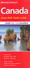


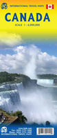
Canada ITMB
Canada at 1:6, 000, 000 from the Vancouver-based ITMB, providing an overview of the country with altitude colouring, provincial boundaries, main roads and railways. Coverage extend north beyond 80° to include the whole of Ellesmere Island.The map is a reproduction of a title published by the Canadian national survey organization, Natural Resources Canada, as part of the National Atlas of Canada Reference Map series. Altitude colouring in supplemented by relief shading, unfortunately so dark that in parts of Rockies or coastal British Columbia other information becomes illegible. Numerous rivers and larger lakes are named and a few of the national parks are marked. The map shows provincial boundaries plus the network of main roads and railways, and is annotated to highlight a
selection of places of interest. A disappointing map, on the other hand if you want to see French territorial waters around Saint-Pierre and Miquelon……….
selection of places of interest. A disappointing map, on the other hand if you want to see French territorial waters around Saint-Pierre and Miquelon……….

Product Description
Reviews/Comments
Add New
Vouchers
No voucher codes found.
Do you know a voucher code for this product or supplier? Add it to Insights for others to use.
Do you know a voucher code for this product or supplier? Add it to Insights for others to use.
 Denmark