More From Contributor

£12.74
Canada Eyewitness travel guide from Dorling Kindersley is a lavishly illustrated book concerned with providing the visitor with detailed background information to sightseeing in the country & a broad cultural introduction. Popular historical buildings & museums are often described with cutaway diagrams allowing you to view ...
Archived Product
£10.99
Large, double-sided, indexed map of Canada, extending northwards to show the whole of the Northwest Passage. Relief shading shows the country’s topography, with plenty of names of mountain ranges, peaks & passes, lakes, rivers & islands. Swamp areas are marked & national or provincial parks, nature reserves & Indian reservations are highlighted. Symbols indicate various places of interest, including historical sites, museums & churches, waterfalls, caves, hot springs, etc. The map shows Canada’s provincial boundaries, main road & rail networks, ferry routes, as well as local airfields in the more remote ares. The country is divided just west of the Great Lakes & coverage extends to beyond 76° north, to include the whole of the Northwest Passage. Latitude & longitude lines are drawn at 2° intervals. The map has an index of place names. Multilingual map legend

Includes::
English.

...
Archived Product
£10.99
Canada Easy-to-Fold at 1:12, 500, 000 from the Canadian Cartographics Corporation; the map is laminated, so waterproof & tear-resistant & can be written on with suitable marker pens, & provides a very basic overview of the country & its road network, plus a list of main places of interest, a distance table & a map of USA. On one side is a general map of Canada showing its division into provinces & time zones. Coverage extends north just beyond Baffin Isl&. Topography is shown by relief shading, with names of main mountain ranges, rivers & lakes. Several national or provincial parks are highlighted. The map is indexed. Accompanying panels provided facts & figures about the country. On the reverse are bilingual lists of main places to visit in each province, a comprehensive distance table, plus an overview map of USA showing the main highways.* Please note:* following a number changes among Canadian cartographic publishers maps previously published by Map Art Publishing may now be available under one of the following imprints: Map Art, Canadian Cartographics Corporation or JDM Géo Inc. Within a series, therefore, some titles may still be published as Map Art whilst others will be available as Canadian Cartographics Corporation or JDM Géo Inc. ...
Archived Product
£13.99
Detailed touring map of southern Canada showing six different kinds of roads, with road names, intermediate driving distances in km an miles, pick high & passes. Railways, ferry lines & airports are also marked alongside national & international boundaries, time zones boundaries, restricted areas, national parks, indian reserves. Also indicated are places/objects of interests, ancient & wells. The map also

Includes::
a special ” Distoguide” incorporated into the map cover, showing at a glance road distances between several Canadian cities. Map index is in a separate booklet attached to the cover. All texts are in eight different languages including English.

...
Archived Product
£10.99
Colourful IGN map of Canada at 1:4, 000, 000 scale with topography shown by countours, elevation colouring, & spot heights. Road network

Includes::
seasonal roads & tracks, indicating petrol stations & intermediate distances on major roads. The map also shows places of interest, forest reserves, post offices, medical facilities, selected accommodation, etc. Extensive index

Includes::
geographical features & places of interest. An inset shows the administrative divisions of the country. Latitude & longitude are marked at 1° intervals. The legend is in French only.


...
Archived Product
£6.99
Insight Guides Travel Map: has a fold up map of the country ideal for planning routes or taking on holiday. This Canada Travel Map is drawn to a scale of 1:4 million & shows the entire country complete with a comprehensive index. This is an ideal on-the-move companion when you`re exploring Canada It

Includes::
detailed street plans of Vancouver, Toronto & Montreal, each with their own separate index Outlines Top Attractions & places of interest Pictorial symbols for instant recognition Shows countries roads, rail networks & ferry routes
Includes: distance indicators Detailed topography Legend shown in eight languages


...
Archived Product
£9.99
Canada at 1:6, 000, 000 from the Vancouver-based ITMB, providing an overview of the country with altitude colouring, provincial boundaries, main roads & railways. Coverage extend north beyond 80° to include the whole of Ellesmere Isl&. The map is a reproduction of a title published by the Canadian national survey organization, Natural Resources Canada, as part of the National Atlas of Canada Reference Map series. Altitude colouring in supplemented by relief shading, unfortunately so dark that in parts of Rockies or coastal British Columbia other information becomes illegible. Numerous rivers & larger lakes are named & a few of the national parks are marked. The map shows provincial boundaries plus the network of main roads & railways, & is annotated to highlight a selection of places of interest. A disappointing map, on the other hand if you want to see French territorial waters around Saint-Pierre & Miquelon………. ...
Archived Product
£15.99
Canada in the Key Guide series from AA Publishing; exploring a range of international destinations & recently been re-launched with full colour pages. Thorough & detailed in style, the guides are targeted at an older audience, exploring the principal sights, walks, activities, restaurants & accommodation of the destination. A detailed introductory section provides comprehensive information about the destination, including the economy, politics, heritage & language. There are also specific sections unique to each destination, covering society, the urban & rural, sports & leisure, art media & culture, history & science & technology. Each title is organised in the same way with destinations grouped by region or district & colour-coded to help readers navigate around the guide. An On the Move section provides details on transport, with important information on arriving, getting around (including distinctive local transport features such as metro & underground networks) & for visitors with a disability. Individual regional sections cover Sights, driving & walking opportunities, what to do, eating & accommodation. Local listings are accompanied by addresses, opening times, prices, directions & local transport options, though options for younger travellers & those with children are more limited. Extensive colour photography accompanies the text, with a range of pictures illustrations the main sites of the city, region or country. An extensive Practicalities chapter at the back of each guide carries essential information on weather, documents & customs, money, health, communication, tourist information, useful websites, finding help, opening times & entrance fees, media & books, films & maps. There is also basic information on entertainment & nightlife, sports & activities, film & music & festivals & events. ...
Archived Product
£4.99
With an easy-fold, easy-to-use format, Lonely Planet Planning Maps are your conveniently sized passport to traveling with ease. Get more from your map & your trip with images & information about top country attractions, itinerary suggestions & themed lists. ...
Archived Product
£12.99
Canada on an A4, 69-page paperback road atlas from the Canadian Cartographics Corporation with map scales varying according to the density of the road network, plus additional city maps for main towns, an index, & a distance table. The southern, more populates parts of Québec & Ontario, plus the Atlantic Provinces are covered at scales of around 1:1, 000, 000. Most of British Columbia, Alberta, Saskatchewan & Manitoba are shown at scales of around 1:2, 000, 000. Scales of the remaining regions are less detailed. The maps provide an overview of the road network on a base prominently highlighting national or provincial parks & other protected areas. Driving distances are shown on main routes. Railway lines are not included. Symbols mark campsites & historic sites. The maps have no geographical coordinates. The index is arranged by province. Main urban areas are also shown in greater detail on enlargements, usually at around 1:250, 000. Also provided is a distance table in miles & kilometres.* Please note:* following a number changes among Canadian cartographic publishers titles previously published by Map Art Publishing may now be available under one of the following imprints: Map Art, Canadian Cartographics Corporation or JDM Géo Inc. ...
Archived Product

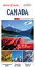
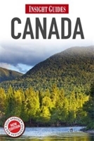
Canada Insight Guide

”Insight Guide Canada” is a comprehensive, full-colour guide to getting the most out of one of the world`s most beautiful countries. Engaging History and Culture chapters explain the tumultuous history of Canada, and the factors influencing Canadian culture and identity; from ancient Inuit settlements, through to the arrival of the British, to the influx of immigrants from all over the world. The burgeoning arts scene, local cuisine and the wild landscape, all contributors to the country`s unique character, are fully explored. To help with planning your trip, the Places chapters encompass all of Canada`s provinces, cover the vibrant cities of Toronto, Vancouver and Montreal in detail, and suggest where to visit and what to do in Canada`s great outdoors, including taking the
train across the majestic Rocky Mountains. Full-colour photographs throughout illustrate the beauty of the Canadian landscape and give a true flavour of life in the country today. Detailed maps plot all major sights, and the Travel Tips offer practical advice plus selective, independent reviews of the best and most authentic places to stay and eat.
RIP - This product is no longer available on our network. It was last seen on 25.09.2019

This page now acts as a permanent archive for this product. Add more information using the comments box below to ensure it can still be found by future generations.

Use our search facility to see if it is available from an alternative contributor.
  • Availability: Out Of Stock
  • Supplier: Stanfords
  • SKU: 9781780051550
Availability: In Stock
£15.99

Product Description

” Insight Guide Canada” is a comprehensive, full-colour guide to getting the most out of one of the world`s most beautiful countries. Engaging History & Culture chapters explain the tumultuous history of Canada, & the factors influencing Canadian culture & identity; from ancient Inuit settlements, through to the arrival of the British, to the influx of immigrants from all over the world. The burgeoning arts scene, local cuisine & the wild landscape, all contributors to the country`s unique character, are fully explored. To help with planning your trip, the Places chapters encompass all of Canada`s provinces, cover the vibrant cities of Toronto, Vancouver & Montreal in detail, & suggest where to visit & what to do in Canada`s great outdoors, including taking the train across the majestic Rocky Mountains. Full-colour photographs throughout illustrate the beauty of the Canadian landscape & give a true flavour of life in the country today. Detailed maps plot all major sights, & the Travel Tips offer practical advice plus selective, independent reviews of the best & most authentic places to stay & eat.

Reviews/Comments

Add New

Intelligent Comparison

Oooops!
We couldn't find anything!
Perhaps this product's unique.... Or perhaps we are still looking for comparisons!
Click to bump this page and we'll hurry up.

Price History

Vouchers

No voucher codes found.
Do you know a voucher code for this product or supplier? Add it to Insights for others to use.

Facebook

Jargon Buster

History - Anything that happens in the past. An acedemic subject.
World - A physical grouping, commonly used to describe earth and everything associated with ti
Colour - The categorised spectrum of light visable to humans
Flavour - The taste of a food product.
Practical - Weather a task is easy to carry out and realistically succeed.

Supplier Information

Stanfords
Stanfords was established in 1853 and opened their iconic Covent Garden flagship store in 1901. They have become the top retailer of maps, travel books and accessories in the UK and arguably offer the largest selection of maps and travel books worldwide. Famous names such as Captain Robert Falcon Scott, Ranulph Fiennes and Michael Palin have purchased from Stanfords. They now have a shop in Bristol and both stores together with other venues operate a calendar of events including talks, book signings and exhibitions. As a specialist map retailer, the map selection is comprehensive and includes road maps, street maps and walking maps from worldwide destinations, as well as a selection of world atlases and wall maps. Books include travel guides and travel literature. Stanfords also stock globes, from miniatures made of blue marble to magnificent floor-standing globes. The website features a selection of interesting articles on travel topics.
Page Updated: 2023-11-12 20:15:36

Community Generated Product Tags

Oh No! The productWIKI community hasn't generated any tags for this product yet!
Menu