
 United Kingdom
 France
 Germany
 Netherlands
 Sweden
 USA
USA
 Italy
Italy
 Spain
Spain
More From Contributor

Canada F&B
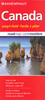
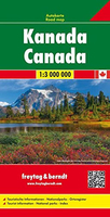
Large, double-sided, indexed map of Canada, extending northwards to show the whole of the Northwest Passage. Relief shading shows the country’s topography, with plenty of names of mountain ranges, peaks and passes, lakes, rivers and islands. Swamp areas are marked and national or provincial parks, nature reserves and Indian reservations are highlighted. Symbols indicate various places of interest, including historical sites, museums and churches, waterfalls, caves, hot springs, etc.The map shows Canada’s provincial boundaries, main road and rail networks, ferry routes, as well as local airfields in the more remote ares. The country is divided just west of the Great Lakes and coverage extends to beyond 76° north, to include the whole of the Northwest Passage. Latitude
and longitude lines are drawn at 2° intervals. The map has an index of place names. Multilingual map legend includes English.
and longitude lines are drawn at 2° intervals. The map has an index of place names. Multilingual map legend includes English.

Product Description
Reviews/Comments
Add New
Vouchers
No voucher codes found.
Do you know a voucher code for this product or supplier? Add it to Insights for others to use.
Do you know a voucher code for this product or supplier? Add it to Insights for others to use.
 Denmark