
 United Kingdom
 France
 Germany
 Netherlands
 Sweden
 USA
USA
 Italy
Italy
 Spain
Spain
More From Contributor
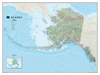


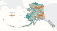
Alaska State Physical Wall Map
Detailed physical wall map of Alaska State at a scale of 1:2, 500, 000. The cartography shows relief through a stunning, highly detailed shading, with different elevations varing in colouring, giving an almost 3-dimensional feel to the map. Peak heights are also clearly marked.The map displays land only within the boundaries of the chosen states - there is no overlap with neigbouring states. Principal physical features such as glaciers, mountain ranges, rivers and lakes are shown clearly. Human features, such as main towns, cities, roads and railways, are shown in a very fine, subtle and elegant cartographic style. State capitals are also clearly marked.This map measures 89x163cm (35”x64”). From glaciated mountain ranges to the tip of the Aleutian Islands, the 49th state is
one of most topographically intriguing areas in the country.*About this series:*Located on the corner of Main and Central in downtown Medford, Oregon since 1986, Raven has become the quintessential small company with a big reputation. Every map is created with attention to accuracy and elegance, from gathering the base information to the final color adjustment on the printing press.
one of most topographically intriguing areas in the country.*About this series:*Located on the corner of Main and Central in downtown Medford, Oregon since 1986, Raven has become the quintessential small company with a big reputation. Every map is created with attention to accuracy and elegance, from gathering the base information to the final color adjustment on the printing press.

Product Description
Reviews/Comments
Add New
Intelligent Comparison
Archived Product
Hawaii State Physical Wall Map Stanfords
£30.00
Archived Product
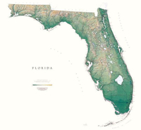
Florida State Physical Wall Map Stanfords
£30.00
Archived Product
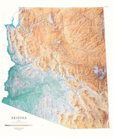
Arizona State Physical Wall Map Stanfords
£30.00
Archived Product
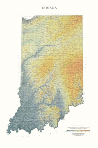
Indiana State Physical Wall Map Stanfords
£30.00
Archived Product
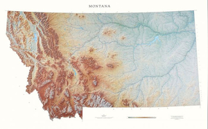
Montana State Physical Wall Map Stanfords
£30.00
Archived Product
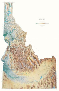
Idaho State Physical Wall Map Stanfords
£30.00
Archived Product
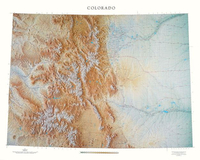
Colorado State Physical Wall Map Stanfords
£30.00
Archived Product
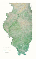
Illinois State Physical Wall Map Stanfords
£30.00
Vouchers
No voucher codes found.
Do you know a voucher code for this product or supplier? Add it to Insights for others to use.
Do you know a voucher code for this product or supplier? Add it to Insights for others to use.
 Denmark