More From Contributor
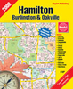
£10.99
This quirky travelogue celebrates the hamburger joints that made America great! No food says ' America' like the hamburger, & documentary maker George Motz has made it his personal mission to preserve the USA's hamburger heritage. He has travelled the length & breadth of the country in search of the best independent burger joints
- those that have survived outside the fast-food mainstream
- & documented the rich histories & local colour behind them all. From roadside stalls to nostalgic diners his book is served up as a quirky 'travelogue', & packaged with the acclaimed DVD of George Motz's ' Hamburger America', which was aired on the Sundance Channel.

...
Archived Product
£14.99
From Victor Garnier & the team at Blend Hamburger, the Parisian restaurant that has taken this humble food to towering new heights, this collection of delicious recipes celebrates the burger. Reflecting the recent trend for burgers of every type & description, Hamburger Gourmet takes you from the beautiful simplicity of a classic beef burger to burgers made from everything from chicken to quinoa, along with blendies, delicious American sweets with a French twist. With separate instructions on buns, sauces & accompaniments, these 58 recipes will give even the biggest burger-lover new ideas for surprising twists on old favourites. ...
Archived Product
£8.99
Hame, n. Scottish form of `home`: a valued place regarded as a refuge or place of origin After her relationship breaks down, Mhairi Mc Phail dismantles her life in New York & moves with her 9-year-old daughter, Agnes, to the remote Scottish island of Fascaray. Mhairi has been commissioned to write the biography of Grigor Mc Watt, the late Bard of Fascaray. But who was the cantankerous Grigor Mc Watt? Despite his international reputation, details of his past are elusive. As Mhairi struggles to adapt to her new life she begins to unearth the astonishing secret history of the poet regarded by many as the custodian of Fascaray`s
- & Scotland`s
- soul.

...
Archived Product
£17.99
The 1:50, 000 topographic map gives a more general picture of the ground features than a basic map. It shows settlements, houses, roads, cultivated areas, waterways, cutting areas, mires, rock exposures, & relief. One map sheet covers an area of 30 x 40 km & one centimetre corresponds to 500 metres on the ground. The 1:50, 000 topographic map is also an ideal complement to nautical charts as it provides useful information about the land areas adjacent to waterways. For example, all Finnish sea areas are covered by 1:50, 000 topographic map sheets. ...
Archived Product
£18.99
Street atlas of Hamilton, Burlington & Oakville area, including Ancaster, Brookville, Burlington, Caledonia, Campbellville, Carlisle, Cayuga, Dundas, Dunnville, Flamborough, Greensville, Hagersville, Hamilton, Jarvis, Killbride, Milton, Nanticoke, Oakville, Stoney Creek, & Waterdown. The atlas is part of an extensive coverage of Canadian cities & towns from the country’s largest map publisher, Map Art. The mapping is usually at 1:25, 000 or 1:31, 250. Colouring distinguishes general build-up areas, shopping centres, public buildings & institutions, historical sites & places of interest, parks, etc. One way streets & pedestrian zones are indicated & a wide range of symbols shows parking facilities, bus terminals, metro and/or railway stations, various public facilities & services, places of interest, recreational centres, etc. Local neighbourhoods are named & municipal & quadrant boundaries are marked. In titles covering more than one city or town, each section is accompanied by overview maps indicating areas covered by the street plans. Each title has a full street index for all localities covered by it. Map legend is either bilingual in English & French or in English only.* Please note:* following a number changes among Canadian cartographic publishers maps previously published by Map Art Publishing may now be available under one of the following imprints: Map Art, Canadian Cartographics Corporation or JDM Géo Inc. Within a series, therefore, some titles may still be published as Map Art whilst others will be available as Canadian Cartographics Corporation or JDM Géo Inc. ...
Archived Product
£8.50
Hamilton City, Cambridge, Te Awamutu region in a series of maps covering various districts of New Zeal&, with each title combining a detailed road map with street plans of local towns, all with road & street indexes. The maps are published in two formats: handy Pocket Maps or Pathfinders with, as the publishers put it “ Larger print so you don’t squint”. The road maps, typically around 1:175, 000
- 1:275, 000, show local roads & 4WD tracks. Main sightseeing routes across the country, such as the Pacific Road Highway or Thermal Explorer Highway, are identified by small icons. Railways, local airports & where appropriate, ferry routes are shown. The maps also include selected local hiking tracks. A range of symbols highlight various places of interest & sport or recreational facilities. Topography is indicated by names of mountain ranges & selected peaks. Colouring shows forested areas, with national parks & reserves highlighted. The maps have no geographical coordinates but each one has an index listing names of local roads. Each title also

Includes::
numerous street plans of the main centres of population in the area covered by the road map. The plans are usually at 1:25, 000 to 1:35, 000, & for larger towns an enlargement of the town centre is also provided. The plans shows one way streets, public buildings & various facilities, including sport & recreational centres &, almost invariably, public toilets. Each plan has a separate street index.* In this title:* street plan of Hamilton at 1:25, 000 with enlargement for the town centre, University of Waikato campus, Waikato Institute of Technology campus & Avalon Centre & Waikato Hospital. Also street plans of Huntly, Cambridge & Te Awamutu
- Kihikihi, all with enlargements for the town centres, plus Ngaruawahia. The road map of the Waikato region is at 1:250.000.


...
Archived Product
£14.99
The stirring untold story of a true Australian hero who opened up the nation. While English-born soldiers, sailors & surveyors have claimed pride of place among the explorers of the young New South Wales colony, the real pathfinder was a genuine native-born Australian. Hamilton Hume, a man with a profound understanding of the Aboriginal people & an almost mystical relationship with the Australian bush, led settlers from the cramped surrounds of Sydney Town to the vast fertile country that would provide the wealth to found & sustain a new nation. Robert Macklin, author of the critically acclaimed DARK PARADISE, tells the heroic tale of this young Australian man who outdid his English `betters` by crossing the Blue Mountains, finding a land route from Sydney to Port Phillip & opening up western New South Wales. His contribution to the development of the colony was immense but downplayed in deference to explorers of British origin. HAMILTON HUME uncovers this brave man`s achievements & paints an intriguing & at times shocking portrait of colonial life, by the author of the bestselling SAS SNIPER. ...
Archived Product
£3.50
Hamilton Low Parks in 1897 in a fascinating series of reproductions of old Ordnance Survey plans in the Alan Godfrey Editions, ideal for anyone interested in the history of their neighbourhood or family. The map covers the northern part of Hamilton & is dominated by Hamilton Low Parks. In the south-western corner are Clyde Colliery, Hamilton Poorhouse & Infantry Barracks. Other features include much of Hamilton Race Course, Great North Avenue, Back Muir Plantation, Barmichael Plantation, Mausoleum, etc. On the reverse is a six inch to the mile map of the area in 1859, covering a wider area including Bothwell, Bothwellhaugh & Kirkfield. About the Alan Godfrey Editions of the 25” OS Series: Selected towns in Great Britain & Ireland are covered by maps showing the extent of urban development in the last decades of the 19th & early 20th century. The plans have been taken from the Ordnance Survey mapping & reprinted at about 15 inches to one mile (1:4, 340). On the reverse most maps have historical notes & many also include extracts from contemporary directories. Most maps cover about one mile (1.6kms) north/south, one & a half miles (2.4kms) across; adjoining sheets can be combined to provide wider coverage.FOR MORE INFORMATION & A COMPLETE LIST OF ALL AVAILABLE TITLES PLEASE CLICK ON THE SERIES LINK. ...
Archived Product
£6.99
Hamilton, Cambridge & district in a series of maps covering various districts of New Zeal&, with each title combining a detailed road map with street plans of local towns, all with road & street indexes. The maps are published in two formats: handy Pocket Maps or Pathfinders with, as the publishers put it “ Larger print so you don’t squint”. The road maps, typically around 1:175, 000
- 1:275, 000, show local roads & 4WD tracks. Main sightseeing routes across the country, such as the Pacific Road Highway or Thermal Explorer Highway, are identified by small icons. Railways, local airports & where appropriate, ferry routes are shown. The maps also include selected local hiking tracks. A range of symbols highlight various places of interest & sport or recreational facilities. Topography is indicated by names of mountain ranges & selected peaks. Colouring shows forested areas, with national parks & reserves highlighted. The maps have no geographical coordinates but each one has an index listing names of local roads. Each title also

Includes::
numerous street plans of the main centres of population in the area covered by the road map. The plans are usually at 1:25, 000 to 1:35, 000, & for larger towns an enlargement of the town centre is also provided. The plans shows one way streets, public buildings & various facilities, including sport & recreational centres &, almost invariably, public toilets. Each plan has a separate street index.* In this title:* street plans of Hamilton & Cambridge at 1:35, 000 approx. with enlargements for the town centres & the University of Waikato campus. Also plans of Huntly, Ngaruawahia, Te Awamutu, Kihikihi & Morrinsville. The road map of the district is at 1:275, 000


...
Archived Product
£30.00
From Tony Award-winning composer-lyricist-star Lin-Manuel Miranda comes a backstage pass to his groundbreaking, hit musical Hamilton. Lin-Manuel Miranda`s groundbreaking musical Hamilton is as revolutionary as its subject, the poor kid from the Caribbean who fought the British, defended the Constitution, & helped to found the United States. Fusing hip-hop, pop, R&B, & the best traditions of theater, this once-in-a-generation show broadens the sound of Broadway, reveals the storytelling power of rap, & claims the origins of the United States for a diverse new generation. HAMILTON: THE REVOLUTION gives readers an unprecedented view of both revolutions, from the only two writers able to provide it. Miranda, along with Jeremy Mc Carter, a cultural critic & theater artist who was involved in the project from its earliest stages
- ”since before this was even a show, ” according to Miranda
- traces its development from an improbable perfor-mance at the White House to its landmark opening night on Broadway six years later. In addition, Miranda has written more than 200 funny, revealing footnotes for his award-winning libretto, the full text of which is published here. Their account features photos by the renowned Frank Ockenfels & veteran Broadway photographer, Joan Marcus; exclusive looks at notebooks & emails; interviews with Questlove, Stephen Sond-heim, leading political commentators, & more than 50 people involved with the production; & multiple appearances by Presi-dent Obama himself. The book does more than tell the surprising story of how a Broadway musical became an international phenomenon: It demonstrates that America has always been renewed by the brash upstarts & brilliant outsiders, the men & women who don`t throw away their shot.

...
Archived Product

Hamilton 1896

Hamilton in 1896 in a fascinating series of reproductions of old Ordnance Survey plans in the Alan Godfrey Editions, ideal for anyone interested in the history of their neighbourhood or family. The map covers the heart of Hamilton, with the Town Hall and Central station near its centre. Coverage stretches from Hamilton West station eastward to Covan Bridge. Features include Barncluth Colliery, Bent Colliery, Allanshaw Colliery, Bent Cemetery, Hamilton NBR station, Hamilton CR West and Central stations, Hamilton Palace, Great Avenue, Quarry Street, Eddlehurst, Union Street, Almada Street, Silverton Colliery, etc. On the reverse are street directories for Almada Street, Cadzow Street, Portland Place, Quarry Street, Townhead Street.About the Alan Godfrey Editions of the
25” OS Series:Selected towns in Great Britain and Ireland are covered by maps showing the extent of urban development in the last decades of the 19th and early 20th century. The plans have been taken from the Ordnance Survey mapping and reprinted at about 15 inches to one mile (1:4, 340). On the reverse most maps have historical notes and many also include extracts from contemporary directories. Most maps cover about one mile (1.6kms) north/south, one and a half miles (2.4kms) across; adjoining sheets can be combined to provide wider coverage.FOR MORE INFORMATION AND A COMPLETE LIST OF ALL AVAILABLE TITLES PLEASE CLICK ON THE SERIES LINK.
RIP - This product is no longer available on our network. It was last seen on 25.09.2019

This page now acts as a permanent archive for this product. Add more information using the comments box below to ensure it can still be found by future generations.

Use our search facility to see if it is available from an alternative contributor.
  • External links may include paid for promotion
  • Availability: Out Of Stock
  • Supplier: Stanfords
  • SKU: 9780850549072
Availability: In Stock
£3.50

Product Description

Hamilton in 1896 in a fascinating series of reproductions of old Ordnance Survey plans in the Alan Godfrey Editions, ideal for anyone interested in the history of their neighbourhood or family. The map covers the heart of Hamilton, with the Town Hall & Central station near its centre. Coverage stretches from Hamilton West station eastward to Covan Bridge. Features include Barncluth Colliery, Bent Colliery, Allanshaw Colliery, Bent Cemetery, Hamilton NBR station, Hamilton CR West & Central stations, Hamilton Palace, Great Avenue, Quarry Street, Eddlehurst, Union Street, Almada Street, Silverton Colliery, etc. On the reverse are street directories for Almada Street, Cadzow Street, Portland Place, Quarry Street, Townhead Street. About the Alan Godfrey Editions of the 25” OS Series: Selected towns in Great Britain & Ireland are covered by maps showing the extent of urban development in the last decades of the 19th & early 20th century. The plans have been taken from the Ordnance Survey mapping & reprinted at about 15 inches to one mile (1:4, 340). On the reverse most maps have historical notes & many also include extracts from contemporary directories. Most maps cover about one mile (1.6kms) north/south, one & a half miles (2.4kms) across; adjoining sheets can be combined to provide wider coverage.FOR MORE INFORMATION & A COMPLETE LIST OF ALL AVAILABLE TITLES PLEASE CLICK ON THE SERIES LINK.

Reviews/Comments

Add New

Price History

Vouchers

No voucher codes found.
Do you know a voucher code for this product or supplier? Add it to Insights for others to use.

Facebook

Jargon Buster

Contemporary - Modern era design
Contemporary - A design reference to indicate post war modern design
History - Anything that happens in the past. An acedemic subject.
Heart - An organ that pumps blood around the body. Usually related to love.
Contemporary - An object that is living in the same time.
Hall - A room at the inside of an entrance of a house.
Ideal - Something that satisfies a perfect criteria.
Family - A group of people that live together made up from parents and children.

Supplier Information

Stanfords
Stanfords was established in 1853 and opened their iconic Covent Garden flagship store in 1901. They have become the top retailer of maps, travel books and accessories in the UK and arguably offer the largest selection of maps and travel books worldwide. Famous names such as Captain Robert Falcon Scott, Ranulph Fiennes and Michael Palin have purchased from Stanfords. They now have a shop in Bristol and both stores together with other venues operate a calendar of events including talks, book signings and exhibitions. As a specialist map retailer, the map selection is comprehensive and includes road maps, street maps and walking maps from worldwide destinations, as well as a selection of world atlases and wall maps. Books include travel guides and travel literature. Stanfords also stock globes, from miniatures made of blue marble to magnificent floor-standing globes. The website features a selection of interesting articles on travel topics.
Page Updated: 2023-11-12 20:15:36

Community Generated Product Tags

Allanshaw colliery hamilton (1 person tagged the product this way)
Menu