
 United Kingdom
 France
 Germany
 Netherlands
 Sweden
 USA
USA
 Italy
Italy
 Spain
Spain
More From Contributor


Helston 1906
Helston in 1906 in a fascinating series of reproductions of old Ordnance Survey plans in the Alan Godfrey Editions, ideal for anyone interested in the history of their neighbourhood or family. The map is double-sided to give maximum coverage. The main map covers the centre of Helston, extending to the south and east. The town centre is in the top left corner and features here include St Michael`s church, Coinagehall Street, Cross Street, Castle Green, Wendron Street, Meneage Street, Market House, Workhouse. Coverage continues south along Meneage Road to Whitehill, with All Saints church, cemetery, and to Nansloe and Nansloe Farm; and eastward to Culdrose, Tresprison, Tregarrick. On the reverse is a strip of the adjacent sheet 76.06 continuing coverage north to show the GWR
Helston Branch with station, and this includes Lower Town, with corn mill and Treworlis tin works. A list of private residents in 1910 is also included.About the Alan Godfrey Editions of the 25” OS SeriesSelected towns in Great Britain and Ireland are covered by maps showing the extent of urban development in the last decades of the 19th and early 20th century. The plans have been taken from the Ordnance Survey mapping and reprinted at about 15 inches to one mile (1:4, 340). On the reverse most maps have historical notes and many also include extracts from contemporary directories. Most maps cover about one mile (1.6kms) north/south, one and a half miles (2.4kms) across; adjoining sheets can be combined to provide wider coverage.FOR MORE INFORMATION AND A COMPLETE LIST OF ALL
AVAILABLE TITLES PLEASE CLICK ON THE SERIES LINK.

Product Description
Reviews/Comments
Add New
Intelligent Comparison
Archived Product

Heston 1894 Stanfords
£3.50
Archived Product
Nelson 1910 Stanfords
£2.95
Archived Product

Nelson 1910 Stanfords
£3.50
Archived Product
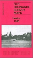
Heston 1935 Stanfords
£3.50
Archived Product

Bilston 1901 Stanfords
£3.50
Archived Product

Folkestone 1906 Stanfords
£3.50
Archived Product
Hamilton 1896 Stanfords
£3.50
Archived Product

Neilston 1895 Stanfords
£3.50
Vouchers
No voucher codes found.
Do you know a voucher code for this product or supplier? Add it to Insights for others to use.
Do you know a voucher code for this product or supplier? Add it to Insights for others to use.
 Denmark