
 United Kingdom
 France
 Germany
 Netherlands
 Sweden
 USA
USA
 Italy
Italy
 Spain
Spain
More From Contributor


Shildon 1896
Shildon in 1896 in a fascinating series of reproductions of old Ordnance Survey plans in the Alan Godfrey Editions, ideal for anyone interested in the history of their neighbourhood or family. Shildon is famous as a railway town; the Stockton & Darlington Railway opened their locomotive works from 1825, and today a major branch of the National Railway Museum is based here. The map is double-sided to give maximum coverage and includes both Shildon, the original settlement, and New Shildon, the railway town. Features on the main map include at Shildon the Main Street, St John`s church, Market Place, Shildon Lodge Colliery, West Durham Wallsend Colliery, Coppy Crook Cottages, Red House, etc. At the foot of the map is New Shildon and here are Shildon station, Shildon Colliery,
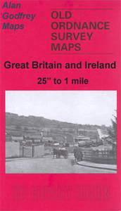
Shildon Wagon Works, and the various streets developed around the railway. The NER Black Boy Branch, and Surtees Railway run through the map. On the reverse is part of the adjacent map 42.15 and this continues coverage south, including the rest of the wagon works, part of the Brusselton Incline railway, and All Saints church.About the Alan Godfrey Editions of the 25” OS Series:Selected towns in Great Britain and Ireland are covered by maps showing the extent of urban development in the last decades of the 19th and early 20th century. The plans have been taken from the Ordnance Survey mapping and reprinted at about 15 inches to one mile (1:4, 340). On the reverse most maps have historical notes and many also include extracts from contemporary directories. Most maps cover about one
mile (1.6kms) north/south, one and a half miles (2.4kms) across; adjoining sheets can be combined to provide wider coverage.FOR MORE INFORMATION AND A COMPLETE LIST OF ALL AVAILABLE TITLES PLEASE CLICK ON THE SERIES LINK.

Product Description
Reviews/Comments
Add New
Intelligent Comparison
Archived Product

Hamilton 1896 Stanfords
£3.50
Archived Product
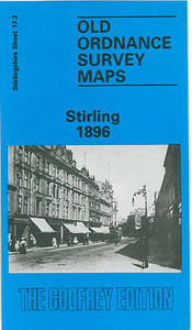
Stirling 1896 Stanfords
£3.50
Vouchers
No voucher codes found.
Do you know a voucher code for this product or supplier? Add it to Insights for others to use.
Do you know a voucher code for this product or supplier? Add it to Insights for others to use.
 Denmark