More From Contributor

£16.99
Venezuela in the Travel Guide series from Bradt; encompassing a comprehensive range of titles to destinations worldwide, with a particular focus on Africa, Central & South America. Bradt are one of the country’s leading independent publishers & have an ethos that focuses on responsible travel, in alliance with a philosophy of sustainability; both in the destinations the guides cover but also in encouraging tourists to limit the impact they have on the local environment. Bradt guides have a reputation for appealing to more independent travelers & often cover destinations that are not available from other publishers. Each guide opens with two comprehensive chapters on Background & Practical Information, covering details of the country’s geography, culture, natural history, government & politics, economy, people, language, religion, education & culture. Important practical advice

Includes::
when to visit, highlights, suggested itineraries, tour operators, red tape, embassies & consulates, getting there & away, health, safety, what to take, money, budgeting, getting around, accommodation, eating & drinking, public holidays, shopping, arts & entertainment, media & communications, business, travel culture & cultural etiquette. Individual sections are organized geographically by region & typically open with information on practicalities & orientation, before focusing on what to see & where to go. Information on what to see, where to stay, where to eat & how to find your way around is provided, with a range of budgets catered for. Simple black & white maps locate key visitor sites & places of accommodation. Bradt Travel Guides include appendices that provide an in-depth introduction to the language of each country, a glossary of terms & a listing of books & internet resources providing further information on the destination.

...
Archived Product
£12.99
Venezuela in Marshall Cavendish's Culture Shock! Series; comprising a range of guides that inform visitors of the finer points & details relating to social etiquette, traditions & customs; bringing visitors to a sensitive yet substantial understanding of the country or city in question. The series targets those who are planning long stays in the destination or extended periods of residence. The guides are written by authors who have experienced the joys & pitfalls of cultural adaptation, & so are ideally placed to provide informative & relevant advice. Each title contains insights into local culture & traditions, guidance on adapting to the local environment, linguistic help & lots of general advice about local culture & idiosyncrasies to help prepare readers for their visit. Each title is structured similarly, beginning with the first impressions a visitor might expect to have. The guides aim to help readers understand the local culture through first appreciating the motivations, beliefs & attitudes of the local people. Practical advice on settling in is provided, with focused sections on accommodation, utilities, health, education & telecommunications. There is also extensive information on the destination ...
Archived Product
£10.99
Detailed, double-sided road map Venezuela, ideal for route-planning. Clearly shows the national road network & selected provincial & local roads, with each class of road clearly indicated & road numbers shown. Intermediate driving distances between locations are shown in kilometres alongside the road, motorway filling stations are shown & motorway junctions are indicated. Topography is shown with relief shading & some spot heights, & colour shading is used to indicate land types. International & provincial boundaries are clearly marked, as are National Parks, nature reserves & restricted military areas. Symbols indicate various sights & locations of tourist interest, such as churches, leisure & sports destinations, panoramas & viewing points, monuments & historic sites. Some hotels & campsites are marked. Railway lines, airports, ports, reefs & marinas are also shown. A grid divides the map at 1° increments, & is also grid-referenced for the map index.* Multilingual map legend

Includes::
English.*

...
Archived Product
£9.99
Venezuela at 1:1, 200, 000 on a double-sided, indexed map from ITMB printed on light, waterproof & tear-resistant plastic paper, with enlargements of the environs of Caracas, Isla de Margarita, plus Roraima & Auyán Tepuí regions. The map divides the country east/west, with Caracas included on both sides. Topography is shown by altitude colouring, with graphics for swamps, mangroves & areas subject to inundation. National parks & other protested areas are highlighted. Road network is classified into six types of roads & selected country tracks or trails are also included. Driving distances are shown on main routes & locations of petrol stations are marked. The map shows railway lines & local airports, & also indicates internal administrative boundaries with names of the provinces.A range of symbols highlight various places of interest. Latitude & longitude lines are drawn at 1° intervals. Each side has a separate index of localities. Also provided are enlargements of the environs of Caracas, Isla de Margarita, plus Roraima & Auyán Tepuí regions. ...
Archived Product
£25.00
We are able to source a wide range of courtesy flags. Flags are available in many sizes & can be sewn or printed on 100% Ministry Of Defence Standard Woven & Knitted Polyester. Flags are supplied with rope & toggle. If you would like more information, have a custom size request or cannot find a desired product, please email us at maritime@stanfords.co.uk. We will be glad to help! ...
Archived Product
£15.99
This is the world's bestselling guide to this adventurer's paradise. It
Includes:: new Outdoors chapter; expanded activities
...
Archived Product
£7.95
Venezuela with Guyana, Suriname & the French Guiana at 1:2, 500, 000 from Nelles Verlag, with a smaller size sheet offering a convenient format for use when travelling. Included are street plans & an enlargement of Isla de Margarita. The map is double-sided, showing all but the very southernmost tip of Venezuela on one size, with the other three countries on the reverse. Large overlap means that the Gran Sabana with the Canaima National Park is included on both sides. Vivid relief shading, numerous spot heights & names of mountain ranges, plus graphics for marshlands present the topography. National parks & other protected area are marked. Road network distinguishes between highways in good & poor condition &

Includes::
partially paved roads & cart tracks, with distances shown on main routes. Railway lines & local airports are included, & the map also shows internal administrative boundaries with names of the provinces. Numerous places of interest are prominently marked. Latitude & longitude margin ticks are at 2° intervals. The map has no index of localities. Map legend

Includes::
English. Street plans highlighting main places of interest cover central areas of Caracas, Maracaibo, Paramaribo & Cayenne. An enlargement at 1:400, 000 shows Isla de Margarita in greater detail.


...
Archived Product
£14.95
Map No. K-27D in the TPC series: military topographic survey mapping covering the world's land masses & significant islands at 1:500, 000. The maps are useful as general topographical coverage where nothing else is available, although they are designed primarily as flying charts for military aircraft. TPC stands for Tactical Pilotage Chart. Relief is portrayed by a combination of contours (basic interval 500ft, intermediate contours shown where appropriate), elevation tinting & relief shading, plus spot heights. Towns, villages, major roads, railways & airports are shown but please note that many of the smaller settlements are not named & the road information is not necessarily up to date, as compilation & revision dates vary. Some air navigation information also appears on the map, such as radio beacons & restricted flying zones. Each TPC chart has both UTM & latitude/longitude grids overprinted on it, with additional margin ticks. IMPORTANT
- PLEASE NOTE: The series is gradually being withdrawn from sale to the general public & some sheets may no longer be available when ordered by us. Due to the nature of the map projection assembling these sheets to make a larger map is not recommended. in addition, colours used for relief are not constant throughout the series. In some areas of central Africa & South America the maps have blank spaces, reflecting localized deficiencies or inconsistencies in the survey data.
...
Archived Product
£9.99
The Romans left a long-lasting legacy & their influence can still be seen all around us
- from our calendar & coins, to our language
...
Archived Product
£8.50
The National Geographic map of Venice at 1:6, 500 is a durable waterproof city map & transport guide designed for tourism. Clear & easy-to-read street mapping has main attractions highlighted & 3D illustrations of top sights. Hotels, churches, theatres & information points are among the tourist features marked on the map. One-way streets & pedestrian areas are indicated. The map covers from the mouth of the Grand Canal & Saint Lucia station in the east to Sant' Elena in the west, & from Cannaregio in the north to Guidecca in the south. An inset map shows Murano, & another inset on the reverse shows the Lido strip at 1:13, 000. The reverse of the map features background information, top sights & activities, basic essential tourist info & city transport network details, including a detailed map of Vaporetto routes. There is also a small map of Marco Polo Airport showing terminals & transport connections. The map is indexed for streets, points of interest & hotels, &

Includes::
regional & national overview maps. This map is printed on a surprisingly strong rip-proof, waterproof paper.

...
Archived Product

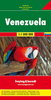
Venezuela Reise-Know-How Map

Indexed road map of Venezuela AT 1:1, 400, 000 with topographic and tourist information, published by Reise Know-How as part of their highly acclaimed World Mapping Project. The map is double-sided to provide the best balance between a good scale and a convenient size sheet. Unlike most of the maps in this series, this title is printed on paper and not waterproof or tear-resistant.The country’s topography is presented by altitude colouring with contours, spot height, mountain passes and names of mountain ranges. Swamps, salt lakes and coral reefs are indicated Road network includes unsurfaced local roads and tracks, and indicates driving distances on main and secondary roads and locations of petrol stations. Border crossings are clearly marked. Railways and local airfields are also
shown and internal administrative boundaries are presented with names of the provinces. National parks and nature reserves are prominently marked. Symbols highlight various places of interest, viewpoints, beaches, surfing and diving sites, etc. Oil wells and pipelines are also shown. The map has a latitude and longitude grid at intervals of at 1°, plus an extensive index of localities. Map legend includes English. *”World Mapping Project”* is an extensive series of maps at varying scales, aiming to provide coverage of countries and regions worldwide using clear, well presented cartography with both topographic and tourist information.
RIP - This product is no longer available on our network. It was last seen on 25.09.2019

This page now acts as a permanent archive for this product. Add more information using the comments box below to ensure it can still be found by future generations.

Use our search facility to see if it is available from an alternative contributor.
  • External links may include paid for promotion
  • Availability: Out Of Stock
  • Supplier: Stanfords
  • SKU: 9783831772216
Availability: In Stock
£10.50

Product Description

Indexed road map of Venezuela AT 1:1, 400, 000 with topographic & tourist information, published by Reise Know-How as part of their highly acclaimed World Mapping Project. The map is double-sided to provide the best balance between a good scale & a convenient size sheet. Unlike most of the maps in this series, this title is printed on paper & not waterproof or tear-resistant. The country’s topography is presented by altitude colouring with contours, spot height, mountain passes & names of mountain ranges. Swamps, salt lakes & coral reefs are indicated Road network

Includes::
unsurfaced local roads & tracks, & indicates driving distances on main & secondary roads & locations of petrol stations. Border crossings are clearly marked. Railways & local airfields are also shown & internal administrative boundaries are presented with names of the provinces. National parks & nature reserves are prominently marked. Symbols highlight various places of interest, viewpoints, beaches, surfing & diving sites, etc. Oil wells & pipelines are also shown. The map has a latitude & longitude grid at intervals of at 1°, plus an extensive index of localities. Map legend

Includes::
English. *” World Mapping Project”* is an extensive series of maps at varying scales, aiming to provide coverage of countries & regions worldwide using clear, well presented cartography with both topographic & tourist information.

Reviews/Comments

Add New

Price History

Vouchers

No voucher codes found.
Do you know a voucher code for this product or supplier? Add it to Insights for others to use.

Facebook

Jargon Buster

Paper - A thin sheet mainly used for writing. Available in a variety of colours. Made mainly from wood pulp.
Venezuela - A tropical country on the north coast of South America
Oil - A hydrophobic liquid with high carbon and hydrogen content. Has many variations including; cooking oils, petrochemical oils, essential oils.
Waterproof - Resistant to water, usualy specified by depth in metres
Railways - A set of tracks that have been laid for the purpose of trains to travel up and down them
World - A physical grouping, commonly used to describe earth and everything associated with ti
Size - is the measurement of how big an object is in space.
Network - A link and communication between things. Often computers or people.
Road - a manmade lane or a path that is used to speed up travel.
Resistant - Something that can repel against something.
Altitude - Something that can be quite high in relation to sea or ground level.
Balance - Something that is evenly weighted to keep something upright.
Convenient - Something that suits and fits well to other activities.

Supplier Information

Stanfords
Stanfords was established in 1853 and opened their iconic Covent Garden flagship store in 1901. They have become the top retailer of maps, travel books and accessories in the UK and arguably offer the largest selection of maps and travel books worldwide. Famous names such as Captain Robert Falcon Scott, Ranulph Fiennes and Michael Palin have purchased from Stanfords. They now have a shop in Bristol and both stores together with other venues operate a calendar of events including talks, book signings and exhibitions. As a specialist map retailer, the map selection is comprehensive and includes road maps, street maps and walking maps from worldwide destinations, as well as a selection of world atlases and wall maps. Books include travel guides and travel literature. Stanfords also stock globes, from miniatures made of blue marble to magnificent floor-standing globes. The website features a selection of interesting articles on travel topics.
Page Updated: 2023-11-12 20:15:36

Community Generated Product Tags

Oh No! The productWIKI community hasn't generated any tags for this product yet!
Menu