
 United Kingdom
 France
 Germany
 Netherlands
 Sweden
 USA
USA
 Italy
Italy
 Spain
Spain
More From Contributor

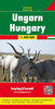


Hungary Reise-Know-How Map
Hungary at 1:380, 000 on an indexed, waterproof and tear-resistant road map with topographic and tourist information, published by Reise Know-How as part of their highly acclaimed World Mapping Project. The map is double-sided to provide the best balance between a good scale and a convenient size sheet.Road and rail networks are easy to see on a clear base which presents topography by altitude colouring with contours, spot heights and names of mountain ranges. Road network includes small local roads, shows driving distances on main and secondary routes and indicates locations of border crossings. Coverage includes Vienna and Bratislava.National parks and protected areas are marked and symbols highlight various places of interest: picturesque towns and villages, UNESCO World Heritage
sites, museums, churches and monasteries, viewpoints, etc. Many towns are shown with their old historical German names (Pécs/Fünfkirchen). The map has a latitude and longitude grid at intervals of 30’ and an index of localities. Map legend includes English. *”World Mapping Project”* is an extensive series of maps at varying scales, aiming to provide coverage of countries and regions worldwide using clear, well presented cartography with both topographic and tourist information.
sites, museums, churches and monasteries, viewpoints, etc. Many towns are shown with their old historical German names (Pécs/Fünfkirchen). The map has a latitude and longitude grid at intervals of 30’ and an index of localities. Map legend includes English. *”World Mapping Project”* is an extensive series of maps at varying scales, aiming to provide coverage of countries and regions worldwide using clear, well presented cartography with both topographic and tourist information.

Product Description
Reviews/Comments
Add New
Intelligent Comparison
Archived Product
Sumatra Reise-Know-How Map Stanfords
£10.50
Archived Product

Antarctica Reise-Know-How Map Stanfords
£10.50
Archived Product

Venezuela Reise-Know-How Map Stanfords
£10.50
Archived Product

Afghanistan Reise-Know-How Map Stanfords
£10.50
Archived Product
Bulgaria Reise Know-How Stanfords
£11.50
Archived Product

Central America Reise-Know-How Map Stanfords
£10.50
Archived Product
Angola Reise Know-How Stanfords
£11.50
Archived Product
Middle East Reise-Know-How Map Stanfords
£10.50
Vouchers
No voucher codes found.
Do you know a voucher code for this product or supplier? Add it to Insights for others to use.
Do you know a voucher code for this product or supplier? Add it to Insights for others to use.
 Denmark