More From Contributor
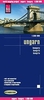
£18.50
Hungary Supertouring Road Atlas from Freytag & Berndt in a glovebox size spiral-bound format, presenting the country at 1:250, 000, with additional pages at 1:1, 000, 000 for route planning. Picturesque towns & other places of interest are highlighted. Detailed presentation of the road network

Includes::
minor local roads & selected cart tracks, with names of motorway junctions, services, toll routes, gradients, seasonal closures, roads not recommended for caravan, etc. Driving distances are shown on most local roads. Scenic roads & special tourist routes are highlighted. Railway lines are shown with stations, local airports are marked, & across Lake Balaton ferry connections are indicated. Picturesque towns & villages are highlighted & symbols indicate other places of interest including campsites & youth hostels, cultural & historical sites, etc. Topography is indicated by relief shading with spot heights. The maps have latitude & longitude grid at intervals of 10’. The index lists locations with their postcodes. Multilingual map legend

Includes::
English. Also provided is mapping of the whole country at 1:1, 000, 000 for route planning.


...
Archived Product
£5.99
The Michelin National road map of Hungary at 1:400, 000 scale is ideal for route planning. The map gives comprehensive coverage of national road networks showing all major motorways, dual carriageways, national & regional main roads & some single-lane roads. [[ Also shows unsurfaced roads & tracks & major footpaths. Distances between major locations are marked along roads, with total distance & several intermediate distances shown. A quick-reference chart of distances & driving times between major locations is also included. The map also

Includes::
a grid-referenced index of principal place names. Clear, easy-to read cartography shows roads in reds, yellows & white with black outlines. [[ Major topography is indicated with relief shading.]] Woodland & forest is marked with green shading. Built-up urban areas are clearly marked in yellow. Airports, ferries, railways are also marked. National & administrative divisions are marked. Tourist sites are marked, such as castles, ruins & national parks; as are sports & recreational facilities. Also

Includes::
a quick reference panel giving national driving regulations, including speed limits, equipment requirements (e.g. bulb kits, warning triangles) & seatbelt rules. Town plans & regional enlargements:- central Budapest street plan at 1:25, 000 scale- greater Budapest road map at 1:125, 000 scale


...
Archived Product
£7.50
Pocket spiral-bound Road Atlas of Hungary from the Budapest based Cartographia, presenting the country at 1:330, 000, with enlargements for the environs of the capital & for Lake Balaton, a distance table & diagrams of motorway interchanges. The atlas shows Hungary at a scale slightly better than used in most folded maps of the country. The number of place names, presentation of the topography & of the road & rail networks is the same as in the publishers’ road atlas at 1:250, 000 in an A5 format, but simply reduce in print size. This pocket version does not, however, indicate locations of petrol & LPG stations. Picturesque locations are prominently highlighted & symbols indicate campsites, youth hostels & various interesting sites. The maps have no geographical coordinates. The index

Includes::
names of geographical features & places of interest. Map legend

Includes::
English. The atlas also contains enlargements showing in greater clarity at 1:250, 000 the environs of Budapest & Lake Balaton, a comprehensive distance table, plus over 50 diagrams of motorway junctions.


...
Archived Product
£10.50
Hungary at 1:380, 000 on an indexed, waterproof & tear-resistant road map with topographic & tourist information, published by Reise Know-How as part of their highly acclaimed World Mapping Project. The map is double-sided to provide the best balance between a good scale & a convenient size sheet. Road & rail networks are easy to see on a clear base which presents topography by altitude colouring with contours, spot heights & names of mountain ranges. Road network

Includes::
small local roads, shows driving distances on main & secondary routes & indicates locations of border crossings. Coverage

Includes::
Vienna & Bratislava. National parks & protected areas are marked & symbols highlight various places of interest: picturesque towns & villages, UNESCO World Heritage sites, museums, churches & monasteries, viewpoints, etc. Many towns are shown with their old historical German names (Pécs/Fünfkirchen). The map has a latitude & longitude grid at intervals of 30’ & an index of localities. Map legend

Includes::
English. *” World Mapping Project”* is an extensive series of maps at varying scales, aiming to provide coverage of countries & regions worldwide using clear, well presented cartography with both topographic & tourist information.


...
Archived Product
£12.95
Hungary Road Atlas at 1:200, 000 from Cartographia, the country’s leading map publisher, in a large format, with detailed presentation of the road network, convenient coverage of Lake Balaton & the environs of Budapest, etc. The atlas provides detailed classification of the roads network &

Includes::
cart tracks & selected local footpaths. The maps show toll roads, scenic routes, sections closed to motorized traffic, gradients, locations of LPG fuel supplies, & driving distances on most local roads. Railway lines are shown with stations & stops. Narrow gauge lines, funiculars & ski lifts are included & on Lake Balaton ferry routes are marked. Picturesque towns or villages & other places of interest, including national parks & protected areas, are highlighted. Symbols mark locations of campsites & youth hostels, castles & churches, folk museums, spas, swimming pools, etc. The maps have no geographical coordinates. The atlas has an extensive index of towns & villages plus a separate section listing main geographical features & places of interest. Where appropriate, locations outside Hungary also indicate their historical Hungarian names. Map legend & index explanations include English. Special pages, also at 1:200, 000, show Lake Balaton & the environs of Budapest, including Visegrad & Esztergom, to provide a more convenient coverage of these areas. Also included is an administrative map of the country, plus a map & a table with road distances.

...
Archived Product
£25.00
How has Hungary, a country once in the vanguard of political & economic reform under Communism, become a chilling example of the new threats confronting democracy in Central Europe? The return of Hungary`s demons of the past
- nationalism, ethnic hatred, deeply-rooted corruption & authoritarian tendencies
- has engendered international concern. Since winning a two-thirds majority in parliament in the spring of 2010, the dynamic right-wing populist Prime Minister Viktor Orban has embarked on a sweeping & ruthless concentration of power & has sought to reshape the state in his own image. A new constitution & a sweeping series of laws & decrees
- radical changes in the judicial & electoral system & the dismantling of constitutional safeguards ensuring the autonomy of the executive branch & the freedom of the media
- seem destined to ensure a long-term hegemony of the far right. Meanwhile a campaign of vituperative nationalist rhetoric & the granting of voting rights to 2.5 million ethnic Hungarians living in neighbouring countries are bound to increase tensions in this volatile corner of Europe. Lendvai offers readers an unsparing & dispassionate account, based on his intimate personal knowledge of Hungary`s major political figures & its political culture, of the turbulent events since the collapse of the Communist regime which affect not only Hungary, but also the political & economic stability of the Danube basin.


...
Archived Product
£8.99
Hiking guides from Hungary’s leading cartographic publisher Cartographia with detailed, contoured maps highlighting walking routes, including Hungarian sections of the European long-distance footpaths. The text is in Hungarian only but map legends include English (unless indicated to the contrary in the individual description). The guides have detailed topographic maps at scales from 1:25, 000 & 1:60, 000 with contours at 10m intervals enhanced by relief shading, plus colouring & graphics for different types of vegetation & land use, e.g. vineyards, orchards, meadows, woodlands, etc. An overprint highlights local and/or long-distance hiking trails, indicating their waymarking signage. Most guides also show recommended cycling routes. Local roads indicate bus routes & stops, & railway lines are shown with stations. Symbols mark various facilities & places of interests including campsites, hostels & other tourist accommodation, restaurants & cafes, etc. GPS coordinates are as indicated in the individual description of each guide. Extensive text, illustrated with colour photos, is in Hungarian only – a challenge indeed! – but a lot of useful information, including telephone numbers for tourist offices, can be deciphered with help from a pocket dictionary. ...
Archived Product
£6.99
Hungary’s best hiking & recreational areas on a series of contoured maps from the Budapest based Cartographia, with hiking routes & other tourist information, including in many titles street plans, cycling trails, etc. The maps have contours at 10m intervals with relief shading & spot heights, plus colouring and/or graphics to indicate different types of vegetation. An overprint highlights local hiking paths, with cycling routes also included is some titles. Symbols mark various places of interest, sport & recreational facilities, including campsites & other tourist accommodation, locations of petrol stations, etc. The maps show 1km lines of the country’s national grid. Map legends are in Hungarian & German only. On the reverse many titles include street plans of holiday centres & further information on the area, in Hungarian only. ...
Archived Product
£9.99
Nineteenth-century Kristiania is an unforgiving place, & work is thin on the ground. Roaming the streets of Norway`s capital, a penniless young writer searches for inspiration whilst trying desperately to make ends meet. Driven to extraordinary lengths, sleeping under the stars with his stomach growling, the writer`s behaviour becomes increasingly irrational & his world spirals into chaos. Hunger was Knut Hamsun`s first novel & earned him the Nobel Prize for Literature in 1920. A disturbing & darkly humorous masterpiece of existential fiction, Hunger anticipated & influenced some of the twentieth century`s most acclaimed writers including Camus, Kafka & Fante. ...
Archived Product
£14.99
Before Carrie Brownstein became a music icon, she was a young girl growing up in the Pacific Northwest just as it was becoming the setting for one the most important movements in rock history. Seeking a sense of home & identity, she would discover both while moving from spectator to creator in experiencing the power & mystery of a live performance. With Sleater-Kinney, Brownstein & her bandmates rose to prominence in the burgeoning underground feminist punk-rock movement that would define music & pop culture in the 1990s. They would be cited as ” America`s best rock band” by legendary music critic Greil Marcus for their defiant, exuberant brand of punk that resisted labels & limitations, & redefined notions of gender in rock. Hunger Makes Me a Modern Girl is an intimate & revealing narrative of her escape from a turbulent family life into a world where music was the means toward self-invention, community, & rescue. Along the way, Brownstein chronicles the excitement & contradictions within the era`s flourishing & fiercely independent music subculture, including experiences that sowed the seeds for the observational satire of the popular television series Portlandia years later. With deft, lucid prose Brownstein proves herself as formidable on the page as on the stage. Accessibly raw, honest & heartfelt, this book captures the experience of being a young woman, a born performer & an outsider, & ultimately finding one`s true calling through hard work, courage & the intoxicating power of rock & roll. ...
Archived Product

Hungary Walking

Walking in Hungary by Tom Chrystal and Beata Dosa is a Cicerone walking guide to one of central Europe’s most accessible and ideal walking countries. Hungary’s Great Plain often dominates walkers’ image of the country and as a result many visitors are unaware of the ridges of the Matra and Borzsony or the limestone outcrops of the Bukk which dispel the myth that Hungary is flat. Hundreds of tracks and trails which were once used by the Roman legions, medieval miners, Turkish janissaries, pillaging Hussites, herders, beekeepers, charcoal burners and foundry workers zigzag across the highlands. These ancient trails now form a network of walking path which the guide explores extensively. Valuable information on accommodation in rural Hungary, public transport and the intriguing
‘little forest trains’ are all included. The author also gives an insight into the history and geology which have shaped the landscape and supplies tips on how to survive the countryside. Useful Hungarian words and phrases as well as a glossary of Hungarian topographical terms are also featured to aid map interpretation. Detailed route descriptions are accompanied by line drawings mapping the routes as well as colour photographs illustrating the highlights of the route.
RIP - This product is no longer available on our network. It was last seen on 25.09.2019

This page now acts as a permanent archive for this product. Add more information using the comments box below to ensure it can still be found by future generations.

Use our search facility to see if it is available from an alternative contributor.
  • External links may include paid for promotion
  • Availability: Out Of Stock
  • Supplier: Stanfords
  • SKU: 9781852843526
Availability: In Stock
£14.00

Product Description

Walking in Hungary by Tom Chrystal & Beata Dosa is a Cicerone walking guide to one of central Europe’s most accessible & ideal walking countries. Hungary’s Great Plain often dominates walkers’ image of the country & as a result many visitors are unaware of the ridges of the Matra & Borzsony or the limestone outcrops of the Bukk which dispel the myth that Hungary is flat. Hundreds of tracks & trails which were once used by the Roman legions, medieval miners, Turkish janissaries, pillaging Hussites, herders, beekeepers, charcoal burners & foundry workers zigzag across the highlands. These ancient trails now form a network of walking path which the guide explores extensively. Valuable information on accommodation in rural Hungary, public transport & the intriguing ‘little forest trains’ are all included. The author also gives an insight into the history & geology which have shaped the landscape & supplies tips on how to survive the countryside. Useful Hungarian words & phrases as well as a glossary of Hungarian topographical terms are also featured to aid map interpretation. Detailed route descriptions are accompanied by line drawings mapping the routes as well as colour photographs illustrating the highlights of the route.

Reviews/Comments

Add New

Intelligent Comparison

Oooops!
We couldn't find anything!
Perhaps this product's unique.... Or perhaps we are still looking for comparisons!
Click to bump this page and we'll hurry up.

Price History

Vouchers

No voucher codes found.
Do you know a voucher code for this product or supplier? Add it to Insights for others to use.

Facebook

Jargon Buster

Forest - A area with a high density of trees
History - Anything that happens in the past. An acedemic subject.
Colour - The categorised spectrum of light visable to humans
Network - A link and communication between things. Often computers or people.
Accommodation - A room in which someone can live in, for example in a hotel
Ideal - Something that satisfies a perfect criteria.
Transport - Something that carries people or goods.

Supplier Information

Stanfords
Stanfords was established in 1853 and opened their iconic Covent Garden flagship store in 1901. They have become the top retailer of maps, travel books and accessories in the UK and arguably offer the largest selection of maps and travel books worldwide. Famous names such as Captain Robert Falcon Scott, Ranulph Fiennes and Michael Palin have purchased from Stanfords. They now have a shop in Bristol and both stores together with other venues operate a calendar of events including talks, book signings and exhibitions. As a specialist map retailer, the map selection is comprehensive and includes road maps, street maps and walking maps from worldwide destinations, as well as a selection of world atlases and wall maps. Books include travel guides and travel literature. Stanfords also stock globes, from miniatures made of blue marble to magnificent floor-standing globes. The website features a selection of interesting articles on travel topics.
Page Updated: 2023-11-12 20:15:36

Community Generated Product Tags

Oh No! The productWIKI community hasn't generated any tags for this product yet!
Menu