
 United Kingdom
 France
 Germany
 Netherlands
 Sweden
 USA
USA
 Italy
Italy
 Spain
Spain
More From Contributor

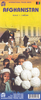

Afghanistan Reise-Know-How Map
Afghanistan at 1:1, 000, 000 on an indexed, waterproof and tear-resistant road map with topographic and tourist information, published by Reise Know-How as part of their highly acclaimed World Mapping Project. The map is double-sided to provide the best balance between a good scale and a convenient size sheet, with a very generous overlap between the two sides.Road network is easy to see on a clear base which shows the area’s topography by altitude colouring with contours, spot heights, and names of mountain ranges. Internal administrative boundaries are shown with names of the provinces. Road network includes unsurfaced roads and tracks. Symbols highlight various places of interest, including archaeological remains, viewpoints, nature reserves, wells, etc. The map has a
latitude and longitude grid at intervals of 1° and an index of place names. Map legend includes English.*”World Mapping Project”* is an extensive series of maps at varying scales, aiming to provide coverage of countries and regions worldwide using clear, well presented cartography with both topographic and tourist information.
latitude and longitude grid at intervals of 1° and an index of place names. Map legend includes English.*”World Mapping Project”* is an extensive series of maps at varying scales, aiming to provide coverage of countries and regions worldwide using clear, well presented cartography with both topographic and tourist information.

Product Description
Reviews/Comments
Add New
Intelligent Comparison
Archived Product
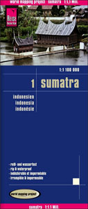
Sumatra Reise-Know-How Map Stanfords
£10.50
Archived Product

Antarctica Reise-Know-How Map Stanfords
£10.50
Archived Product
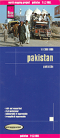
Pakistan Reise Know-How Stanfords
£10.50
Archived Product
Hungary Reise-Know-How Map Stanfords
£10.50
Archived Product
Middle East Reise-Know-How Map Stanfords
£10.50
Archived Product
Albania Reise Know-How Stanfords
£11.50
Archived Product

Thailand Reise Know-How Stanfords
£11.50
Archived Product

Lebanon & Beirut Reise-Know-How Map Stanfords
£7.50
Vouchers
No voucher codes found.
Do you know a voucher code for this product or supplier? Add it to Insights for others to use.
Do you know a voucher code for this product or supplier? Add it to Insights for others to use.
 Denmark