More From Contributor

£8.95
Laminated waterproof plan designed to provide tourist information for visitors to the city itself & the sites of northern Tunisia. The plan shows the Medina & the surrounding area with just the main streets named, but with an overprint highlighting hotels, markets, mosques & churches, museums, etc. Street index

Includes::
hotels & various places of interest. On the reverse, a series of maps & plans provide more information for tourists. A general road map showing the coast from Bizerte to Sousse is accompanied by small street plans of these two towns. There is also a regional map of the environs of Tunis, a plan of the city

...
Archived Product
£9.99
Colourful & informative map for visitors showing railways, metro lines, parks & districts. Indexed for streets, administrative buildings, mosques, squares, hotels, hospitals, & places of interest. Large symbols depict such features as railway stations, cemeteries, places of worship, police & fire stations, schools, hospitals, embassies, & post offices. Colours distinguish the town`s districts. A small inset map shows the metro system beyond the confines of the main map. Map legend is in English & French. Also included is a glossary of terms used in place names. ...
Archived Product
£10.99
Large indexed street plan, with a detailed enlargement for the central area & a general map of the city’s environs. The main map at 1:10, 000 covers the main section of the city from the port & the El Jallaz cemetery in the south-east to Le Bardo district in the west & El Menzah district in the north. Markets, notable buildings & hotels are highlighted, & the metro lines & stations are included. Symbols depict mosques, museums, monuments, hostels, car parks, hospitals, post offices, etc. On the reverse are three more maps: a larger scale plan at 1:5, 000 concentrating on the old city centre & the surrounding streets, a plan of the metro system, & a general map at 1:100, 000 showing the main districts & roads of the whole city. All the maps are indexed. Map legend

Includes::
English.

...
Archived Product
£11.99
One of the titles in a series of topographic maps covering much of north-west Africa, produced as part of the IMW* project in 1960’s. Each map covers an area spanning 6° in longitude & 4° in latitude. There is some variation in colouring & the depiction of terrain, but hill-shading, spot heights & contours are used to show the general relief. Additional graphics show features such as dunes, rock outcrops, cliffs, sand areas, escarpments, marshes, seasonal lakes & watercourses, & areas liable to flooding. Bathymetric contours are also included. Communications detail

Includes::
roads, major trails & railways, although there is some inconsistency in colouring & the extent of classification, e.g. not all maps distinguish seasonal roads. On most maps intermediate road distances are indicated on main routes. Symbols show airports, mosques, mines, oil & gas fields, lighthouses, ruins & significant isolated buildings. Administrative boundaries are marked & latitude & longitude lines are drawn at 1° intervals, with further margin ticks at 1’ intervals. The map legend is in French only on some sheets, & in English & French on others.* The International Map of the World was a project conceived in the early 20th century to compile a world map series at 1:1, 000, 000 through the efforts of participating nations. The value of the program has declined since 1970 & the IMW is no longer regarded as an active international series.

...
Archived Product
£10.99
General road maps with street plans of Tunis, Kairouan, & Sousse, & an enlargement for Jerba Isl&. Topography is indicated by relief shading & spot heights. The map shows railways & road network with secondary & minor roads. Places of interest are highlighted. The prohibited zone in the southern tip of the country is clearly marked. The map

Includes::
a large part of north-eastern Algeria, up to approx. 6º30’, with the same information as for Tunisia. Latitude/longitude grid is at 30’ intervals. Multilingual legend

Includes::
English. The map also

Includes::
a street plan of substantial part of Tunis, with the historic centre & the surrounding areas, plus plans of Kairouan & Sousse. An enlargement shows Ile de Jerba at 1:250, 000.


...
Archived Product
£9.50
Tunisia on an indexed, waterproof & tear-resistant road map with topographic & tourist information, published by Reise Know-How as part of their highly acclaimed World Mapping Project. The map is double-sided to provide the best balance between a good scale & a convenient size sheet. Road & rail networks are easy to see on a clear base which shows the area ...
Archived Product
£11.99
Tunisia in the Countries & Regions series from Lonely Planet, market-leading comprehensive guides aimed at independent travellers & serving a large range of international destinations. Frank & informal in style, the guides explore an extensive range of sights, activities, accommodation, restaurants & nightlife & are designed for practical use while travelling on the road. Written & researched by a team of experts, each book is independent in its recommendations & suggestions, often offering individual takes on individual destinations. Widely recognised for their reliability, each Lonely Planet country & region guide has the same layout. Introductory sections profile the destination with individual chapters on particular highlights, getting started, (including when to go) itineraries, history, culture, arts, food & drink & the environment. Each guide is organised geographically by region, with individual sections detailing an extensive range of sights, places of interest, attractions, restaurants, nightlife, accommodation & any local activities. The guides have detailed explanations of historical context where relevant. There is also practical guidance on ...
Archived Product
£11.99
Tunisia in the Countries, Regions & Cities series from Rough Guides; comprehensively detailed guidebooks specifically designed for independent travellers & serving a range of worldwide destinations. Widely recognised for their free editorial style, Rough Guide authors are allowed to express their personal opinions on a range of subjects. Although sometimes controversial, this editorial stance allows readers to experience more detailed & personal takes on each destination, a feature often more limited in other guidebooks. Cultural & historical nuances are explored in significant depth throughout the text & descriptions on the ambience of individual settings alongside personal recommendations, particularly in cities, are notably prevalent. Each Rough Guide in the Countries, Regions & Cities series has a similar layout. A ...
Archived Product
£6.95
Tunisia in the Culture Smart range of pocket-sized guide books; providing detailed information on local customs, culture, etiquette & manners & ensuring that visitors are prepared for a diverse range of social environments. The series covers an extensive number of countries worldwide & are designed both for those working & living abroad, as well as for visitors who do not want to offend, either intentionally or inadvertently. Their aim is to prevent readers from making embarrassing mistakes & feel confident in unfamiliar situations, while preparing them before arrival on what to expect & how to behave. Each guide is arranged thematically, with dedicated individual chapters on land & people, values & attitudes, customs & traditions, making friends, people at home, ‘time-out’, travelling & communicating. There is also a separate chapter for business travelers, with important information on subjects such as business culture, meetings & making appointments. A Further Reading section also offers a list of recommended other history, travel literature & language titles available on the country. ...
Archived Product
£5.99
Tunisia in the Essential Guide Series from the AA exploring the best places to see & things to do in a range of popular destinations. Each illustrated, pocket-sized guide is divided into five sections
- the essence of the area, planning your trip, the best places to see, best things to do & an exploration of notable highlights, organised by area. An introductory chapter profiles each destination &

Includes::
notes on local cuisine & recommendations for short breaks. A planning section advises on pre-trip preparations & getting there & around as well as outlining useful language tips & what


...
Archived Product

Tunisia

The Michelin National road map of Tunisia at 1:800, 000 scale is ideal for trip & route planning. The map gives comprehensive coverage of national road networks showing all major motorways, dual carriageways, national & regional main roads and some local roads. Also shows unsurfaced roads & tracks and major footpaths. Road obstacles & dangers including steep slopes, seasonally impassable routes, height restrictions, one-way roads, tolls, narrow bridges & high passes are indicated.Clear, easy-to read cartography shows roads in reds, yellows and white with black outlines. Major topography is indicated with relief shading. Woodland & forest is marked with green shading, desert in yellow & some indication of salt flats & marshland. Towns and cities are marked with symbols only on the
main map, but regional enlargements (see below) show built-up urban areas in salmon pink highlighting. Airports, ferries, railways, bridges & level crossings are also marked. National and administrative divisions are shown, as are administrative seats & state capitals. Plenty of detailed tourist information is given: Accommodation & practical facilities (hotels, resorts, fuel & repair services where attached to a hotel), sport & leisure facilities (e.g. golf courses, winder sports & spas) and sights. Sights include kasbahs, rural markets, towns & places of particular tourist interest, scenic driving routes, viewpoints & panoramas, forts, ruins and other historical locations. Includes markings for other features including palm groves, national parks, pipelines & natural
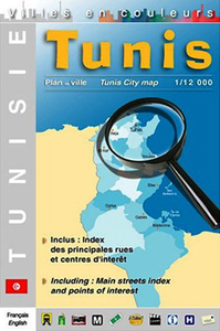
resource extraction.Town plans & regional enlargements:- Tunis city centre plan at 1:35, 000
RIP - This product is no longer available on our network. It was last seen on 25.09.2019

This page now acts as a permanent archive for this product. Add more information using the comments box below to ensure it can still be found by future generations.

Use our search facility to see if it is available from an alternative contributor.
  • External links may include paid for promotion
  • Availability: Out Of Stock
  • Supplier: Stanfords
  • SKU: 9782067118973
Availability: In Stock
£5.99

Product Description

The Michelin National road map of Tunisia at 1:800, 000 scale is ideal for trip & route planning. The map gives comprehensive coverage of national road networks showing all major motorways, dual carriageways, national & regional main roads & some local roads. Also shows unsurfaced roads & tracks & major footpaths. Road obstacles & dangers including steep slopes, seasonally impassable routes, height restrictions, one-way roads, tolls, narrow bridges & high passes are indicated. Clear, easy-to read cartography shows roads in reds, yellows & white with black outlines. Major topography is indicated with relief shading. Woodland & forest is marked with green shading, desert in yellow & some indication of salt flats & marshl&. Towns & cities are marked with symbols only on the main map, but regional enlargements (see below) show built-up urban areas in salmon pink highlighting. Airports, ferries, railways, bridges & level crossings are also marked. National & administrative divisions are shown, as are administrative seats & state capitals. Plenty of detailed tourist information is given: Accommodation & practical facilities (hotels, resorts, fuel & repair services where attached to a hotel), sport & leisure facilities (e.g. golf courses, winder sports & spas) & sights. Sights include kasbahs, rural markets, towns & places of particular tourist interest, scenic driving routes, viewpoints & panoramas, forts, ruins & other historical locations.

Includes::
markings for other features including palm groves, national parks, pipelines & natural resource extraction. Town plans & regional enlargements:- Tunis city centre plan at 1:35, 000

Reviews/Comments

Add New

Price History

Vouchers

No voucher codes found.
Do you know a voucher code for this product or supplier? Add it to Insights for others to use.

Facebook

Jargon Buster

Black - A colour which does not emit any colour of the spectrum. Black absorbs all frequencies of the spectrum.
Forest - A area with a high density of trees
White - A colour combining all colours
Hotel - An establishment which provides lodging for a fee
Pink - A colour made by combining red and white
Yellow - A primary colour. The sun is often described as yellow
Palm - The centre of a hand when facing upwards
Palm - A hardware manufacturer of smart phones and personal digital assistants
fuel - A material used to generate energy.
Railways - A set of tracks that have been laid for the purpose of trains to travel up and down them
Natural - not manmade
Road - a manmade lane or a path that is used to speed up travel.
Golf - A sport played on a large outside grass course, the aim to hit a small ball with a club into small holes.
Accommodation - A room in which someone can live in, for example in a hotel
Practical - Weather a task is easy to carry out and realistically succeed.
Regional - An adjective to describe a set geographic area.
Ideal - Something that satisfies a perfect criteria.

Supplier Information

Stanfords
Stanfords was established in 1853 and opened their iconic Covent Garden flagship store in 1901. They have become the top retailer of maps, travel books and accessories in the UK and arguably offer the largest selection of maps and travel books worldwide. Famous names such as Captain Robert Falcon Scott, Ranulph Fiennes and Michael Palin have purchased from Stanfords. They now have a shop in Bristol and both stores together with other venues operate a calendar of events including talks, book signings and exhibitions. As a specialist map retailer, the map selection is comprehensive and includes road maps, street maps and walking maps from worldwide destinations, as well as a selection of world atlases and wall maps. Books include travel guides and travel literature. Stanfords also stock globes, from miniatures made of blue marble to magnificent floor-standing globes. The website features a selection of interesting articles on travel topics.
Page Updated: 2023-11-12 20:15:36

Community Generated Product Tags

Oh No! The productWIKI community hasn't generated any tags for this product yet!
Menu