
 United Kingdom
 France
 Germany
 Netherlands
 Sweden
 USA
USA
 Italy
Italy
 Spain
Spain
More From Contributor


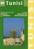

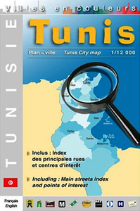
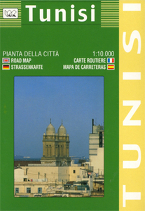
Tunis
Laminated waterproof plan designed to provide tourist information for visitors to the city itself and the sites of northern Tunisia. The plan shows the Medina and the surrounding area with just the main streets named, but with an overprint highlighting hotels, markets, mosques and churches, museums, etc. Street index includes hotels and various places of interest.On the reverse, a series of maps and plans provide more information for tourists. A general road map showing the coast from Bizerte to Sousse is accompanied by small street plans of these two towns. There is also a regional map of the environs of Tunis, a plan of the city
Product Description
Reviews/Comments
Add New
Intelligent Comparison
Archived Product
Tunis Stanfords
£9.99
Archived Product
Tunis Stanfords
£10.99
Archived Product

Tunisia Stanfords
£10.99
Archived Product
Tunisia Stanfords
£5.99
Archived Product
Tunisia Stanfords
£9.50
Archived Product
Tunisia Stanfords
£11.99
Archived Product
Tunisia Stanfords
£11.99
Archived Product
Tuntsa Stanfords
£17.99
Vouchers
No voucher codes found.
Do you know a voucher code for this product or supplier? Add it to Insights for others to use.
Do you know a voucher code for this product or supplier? Add it to Insights for others to use.
 Denmark