
 United Kingdom
 France
 Germany
 Netherlands
 Sweden
 USA
USA
 Italy
Italy
 Spain
Spain
More From Contributor


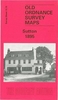

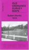
Sutton Coldfield 1913
Sutton Coldfield in 1913 in a fascinating series of reproductions of old Ordnance Survey plans in the Alan Godfrey Editions, ideal for anyone interested in the history of their neighbourhood or family. Selected towns in Great Britain and Ireland are covered by maps showing the extent of urban development in the last decades of the 19th and early 20th century.In this title: the map covers most of Sutton Coldfield, a few miles north of Birmingham but distinctly a town in its own right. Coverage stretches from Park House and Clifton Road eastward to Reddicap Hill and Boot Hill and from Upper Holland Road northward to Barker Road. Features include Holy Trinity church, Town Hall, King Edward's Square, Tudor Laundry, Cottage Hospital, cemetery, Royal Hotel, Holy Trinity RC church, LNWR
railway with station, Midland Railway with Sutton Town and Sutton Park stations, Crystal Palace, site of Manor, Tudor Hill, Grammar School, etc. On the reverse is the commercial entry from a 1912 directory. About the Alan Godfrey Editions of the 25
railway with station, Midland Railway with Sutton Town and Sutton Park stations, Crystal Palace, site of Manor, Tudor Hill, Grammar School, etc. On the reverse is the commercial entry from a 1912 directory. About the Alan Godfrey Editions of the 25
Product Description
Reviews/Comments
Add New
Vouchers
No voucher codes found.
Do you know a voucher code for this product or supplier? Add it to Insights for others to use.
Do you know a voucher code for this product or supplier? Add it to Insights for others to use.
 Denmark