
 United Kingdom
 France
 Germany
 Netherlands
 Sweden
 USA
USA
 Italy
Italy
 Spain
Spain
More From Contributor

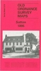


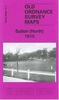
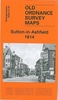

Sutton North 1910
Sutton North in 1910 in a fascinating series of reproductions of old Ordnance Survey plans in the Alan Godfrey Editions, ideal for anyone interested in the history of their neighbourhood or family. Selected towns in Great Britain and Ireland are covered by maps showing the extent of urban development in the last decades of the 19th and early 20th century.In this title: the map covers the north of Sutton, including Benhilton, from Clensham Lane to Manor Lane and eastward to Benhill Road. Features include St Barnabas church, Newtown area, tramway, Benfleet Hall, Benhilton area, The Green, All Saints church, Hallmead Farm, fireworks manufactory, Gandergreen Lane, etc.About the Alan Godfrey Editions of the 25
Product Description
Reviews/Comments
Add New
Vouchers
No voucher codes found.
Do you know a voucher code for this product or supplier? Add it to Insights for others to use.
Do you know a voucher code for this product or supplier? Add it to Insights for others to use.
 Denmark