
 United Kingdom
 France
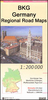
 Germany
 Netherlands
 Sweden
 USA
USA
 Italy
Italy
 Spain
Spain
More From Contributor


Stuttgart Region Street Atlas
One of the titles in a series of regional street atlases providing detailed mapping of the main urban conurbations in Germany. The plans name all the individual streets and indicate all the main landmarks and public buildings. All public transport facilities are shown: buses, trams, underground and overland rail lines. One way streets and car parks are indicated.Each atlas also includes enlargements showing town centres at a more detailed scale, a general road map of the area, and diagrams of motorways with exits and service areas. The plans also show the postal divisions and have an extensive street index which, where appropriate, shows individual postal codes for each street. Map legend includes English.In this atlas: the area around Stuttgart, including Heilbronn, Pforzheim,
Schw
Schw
Product Description
Reviews/Comments
Add New
Intelligent Comparison
Archived Product
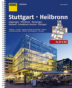
Stuttgart - Heilbronn Region Street Atlas Stanfords
£25.99
Archived Product

Saarland Region Street Atlas Stanfords
£19.95
Archived Product
Hamburg Region Street Atlas Stanfords
£25.99
Archived Product

Hannover Region Street Atlas Stanfords
£19.95
Archived Product
Thuringia Regional Street Atlas Stanfords
£17.95
Archived Product
Munich Region Street Atlas Stanfords
£19.95
Archived Product
Bremen Region Street Atlas Stanfords
£19.95
Archived Product
Kassel Region Street Atlas Stanfords
£19.95
Vouchers
No voucher codes found.
Do you know a voucher code for this product or supplier? Add it to Insights for others to use.
Do you know a voucher code for this product or supplier? Add it to Insights for others to use.
 Denmark