
 United Kingdom
 France
 Germany
 Netherlands
 Sweden
 USA
USA
 Italy
Italy
 Spain
Spain
More From Contributor

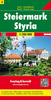
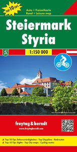
Styria F&B Top 10 Tips
Styria Province ”Top 10 Tips” indexed, double-sided road map at 1:150, 000 from Freytag & Berndt, with highlighting for cycle routes, scenic roads and tourist routes, places of interest, etc, plus descriptions of sights and routes and 17 street plans.An index booklet attached to the map cover provides brief multilingual descriptions of the region’s 10 main sights, plus of descriptions of 12 cycling trails including the Wine Route. City centre street plans cover 17 towns: Graz, Bad Radkersburg, Bruck an der Mur, Deutschlandsberg, Eisenerz, Feldbach, Fürstenfeld, Hartberg, Judenburg, Knittelfeld, Leibnitz, Leoben, Lienzen, Mürzzuschlag, Murau, Voitsberg and Weitz. Map legend and all the text include English.Maps in F&B’s “Top 10 Tops” series have relief
portrayed by hill-shading without distracting from other detail, and plenty of names of topographic features: mountain chains, valley, peaks, etc. National Parks and other protected areas are prominently highlighted. Road network includes minor local roads and selected cart tracks, shows driving distances are main and selected local, and indicates toll routes, steep gradients, caravan traffic restrictions, seasonal closures on mountain roads, etc. Scenic roads are highlighted, as are cycle routes and special tourist routes. Also marked are the country’s long-distance hiking trails. Railway lines are shown with stations. Picturesque towns and other locations are highlighted and in each title 10 selected main sights are prominently marked and are briefly described in a booklet
attached to the map cover. Symbols depict various landmarks, places of interest and facilities, including campsites, youth hostels, viewpoints, historical buildings, etc. Latitude and longitude lines are drawn at 10` intervals. In addition to the descriptions, accompanying booklets also provide an index listing all locations with their postcodes and street plans main towns in each region – please see individual descriptions for more details. To see the list of titles in this series please click on the series link.

Product Description
Reviews/Comments
Add New
Vouchers
No voucher codes found.
Do you know a voucher code for this product or supplier? Add it to Insights for others to use.
Do you know a voucher code for this product or supplier? Add it to Insights for others to use.
 Denmark