
 United Kingdom
 France
 Germany
 Netherlands
 Sweden
 USA
USA
 Italy
Italy
 Spain
Spain
More From Contributor

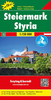
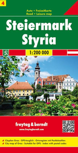
Styria F&B
Styria at 1:200, 000 in a series of road maps of Austria from Freytag & Berndt, the country’s leading publishers, with a separate index attached to the cover. Information includes sightseeing routes and long-distance hiking trails.The maps have clear, effective relief shading to show the topography and indicate steep roads with gradient marks, show traffic restrictions and seasonal closures on mountain roads, etc. Tourist information includes scenic roads and special tourist sightseeing routes, places of interest, campsites and youth hostels, etc. An overprint highlights the national network of the long-distance footpaths indicating, where appropriate, their European numbers. A grid in steps of 10` indicates latitude and longitude. *Map legend includes English.* A separate
index attached to the cover gives the postcode for each locality.
index attached to the cover gives the postcode for each locality.

Product Description
Reviews/Comments
Add New
Vouchers
No voucher codes found.
Do you know a voucher code for this product or supplier? Add it to Insights for others to use.
Do you know a voucher code for this product or supplier? Add it to Insights for others to use.
 Denmark