
 United Kingdom
 France
 Germany
 Netherlands
 Sweden
 USA
USA
 Italy
Italy
 Spain
Spain
More From Contributor


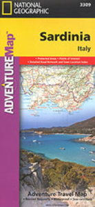
Sardinia Adventure Map
Sardinia at 1:200, 000 in a series of Adventure maps from the National Geographic Society with cartography provided by Reise Know-How. The map is double-sided and printed on light waterproof and tear-resistant synthetic paper.Cartographic information provided by Reise Know-How has been adjusted to follow the house style of the NGS Adventure series with greater emphasis on the country’s topography. Altitude colouring in broader bands has been replaced here by contours at 100m intervals and relief shading. National parks and other protected areas are highlighted.The map divides the island north/south with a generous overlap between the sides. Road information includes local tracks, indicates driving distances on main and secondary roads, and highlights scenic routes. Railways and ferry
connections are also shown.Extensive overprint indicates locations of numerous nuraghi/nuraghes, the main type of megalithic edifices found in Sardinia, dating back before 1000 BC and today a symbol of the island’s distinctive culture. Also marked are other prehistoric monuments, campsites and mountain refuges, viewpoints, churches and castles, beaches, golf courses, etc. The map has a latitude and longitude grid at 10’ intervals.Overall, the NGS map presents a more vivid picture of the country’s topography, whilst the original RK-H version provides clearer information for touring the island by car.PLEASE NOTE: to ensure faster delivery to our customers we keep this title in regular stock in the Reise Know-How version. The NGS versions can be ordered on request.
connections are also shown.Extensive overprint indicates locations of numerous nuraghi/nuraghes, the main type of megalithic edifices found in Sardinia, dating back before 1000 BC and today a symbol of the island’s distinctive culture. Also marked are other prehistoric monuments, campsites and mountain refuges, viewpoints, churches and castles, beaches, golf courses, etc. The map has a latitude and longitude grid at 10’ intervals.Overall, the NGS map presents a more vivid picture of the country’s topography, whilst the original RK-H version provides clearer information for touring the island by car.PLEASE NOTE: to ensure faster delivery to our customers we keep this title in regular stock in the Reise Know-How version. The NGS versions can be ordered on request.

Product Description
Reviews/Comments
Add New
Intelligent Comparison
Archived Product

China Adventure Map Stanfords
£9.99
Archived Product
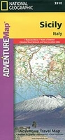
Sicily Adventure Map Stanfords
£9.99
Archived Product
Argentina Adventure Map Stanfords
£9.99
Archived Product

Annapurna Adventure Map Stanfords
£9.99
Archived Product

Mayan Adventure Map Stanfords
£9.95
Archived Product
Langtang Adventure Map Stanfords
£9.99
Archived Product
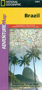
Brazil Adventure Map Stanfords
£9.99
Archived Product

Australia Adventure Map Stanfords
£9.99
Vouchers
No voucher codes found.
Do you know a voucher code for this product or supplier? Add it to Insights for others to use.
Do you know a voucher code for this product or supplier? Add it to Insights for others to use.
 Denmark