More From Contributor

£4.99
Hotspots Sardinia highlights all you need to know about a country with miles of sandy beaches & turquoise seas. This book delivers: summaries of the best beaches & resorts, including the exclusive resorts & beaches of the Costa Smeralda or the picturesque medieval village of Castelsardo; an excursions section that lists the many activities on offer, including places to visit such as La Maddalena, an archipelago of seven islands; advice on the wide range of water sports & leisure activities; lists of local restaurants, bars, nightclubs & places of interest; maps of the local area showing the location of restaurants & places of interest; & a lifestyle section, including a summary of the types of food available, a menu decoder, festivals, sports & activities on offer. These vibrant guides focus on the popular sun destinations worldwide. Highlighting the best nightlife, shopping, beaches & activities, they enable travellers to become familiar with their chosen resort, while providing details for them to get out & about to see local attractions too. It is presented in a handy pocket size
- ideal for travelling light. It has full-colour maps & photographs. It
Includes:: a menu decoder, sports & activities; fun excursions & scenic trips; & colourful descriptions of local cuisine, fiestas, & markets.

...
Archived Product
£12.99
Sardinia in the Cadogan guide series; covering a range of destinations – primarily in Europe
- & combining solid research, detailed,
...
Archived Product
£13.99
Sardinia in the Countries, Regions & Cities series from Rough Guides; comprehensively detailed guidebooks specifically designed for independent travellers & serving a range of worldwide destinations. Widely recognised for their free editorial style, Rough Guide authors are allowed to express their personal opinions on a range of subjects. Although sometimes controversial, this editorial stance allows readers to experience more detailed & personal takes on each destination, a feature often more limited in other guidebooks. Cultural & historical nuances are explored in significant depth throughout the text & descriptions on the ambience of individual settings alongside personal recommendations, particularly in cities, are notably prevalent. Each Rough Guide in the Countries, Regions & Cities series has a similar layout. A ...
Archived Product
£18.95
A clear sea, coral beaches, & reefs: all around Europe, Sardinia is known above all for its sea. However its coast is only one of the many interesting aspects of the island: Sardinia boasts a landscape of limestone & granite mountains, forests of cork & Holm oaks together with tiny gulfs with crystal waters. Sardinia means also Nuraghic sites, medieval churches & sanctuaries, historical centres, festivities & traditions, these man made spectacles complement the islands natural wonders. The aerial photography depicts the best of Sardinia in a single volume, concentrating on the three main areas: coast, countryside & towns, offering the reader a brand new insight into this magnificent isl&, quite different from the images used on postcards. ...
Archived Product
£11.99
Sardinia at 1:200, 000 from Kümmerly & Frey with cartography from the Italian publishers de Agostini. Each title in this series has a separate index booklet attached to the map cover providing enlargements with access to main cities plus several very clear street plans of other towns & smaller but important tourist destinations. The colouring of the road network clearly distinguishes between motorways, main or secondary routes & smaller local roads. Driving information

Includes::
full or partial motorway interchanges & services, toll roads, entry restrictions & possible seasonal closures, steep gradients, etc. Scenic roads are highlighted. Driving distances are marked on main & secondary roads. Railway lines are shown with stations & ferry route indicates approximate crossing time. Locations worth visiting are prominently highlighted & symbols mark various other places of interest including mountain shelters, Blue Flag beaches, etc. Topography is very well presented by relief shading with plenty of names of mountain ranges, peaks with heights, etc. The maps also indicate main long-distance hiking trails such as the GTA (Grande Traversata delle Apli) or the GEA (Grande Escursione Appenninnica). Latitude & longitude lines are drawn at 10’ intervals. Map legend

Includes::
English. The index is in a separate booklet attached to the map cover. The booklet also

Includes::
enlargements of the environs of main cities plus city centre street plans of other towns. Also provided is a small overview map of Italy for route planning plus main driving regulations. To see other titles in this series please click on the series link.


...
Archived Product
£9.99
Sardinia at 1:200, 000 in a series of Adventure maps from the National Geographic Society with cartography provided by Reise Know-How. The map is double-sided & printed on light waterproof & tear-resistant synthetic paper. Cartographic information provided by Reise Know-How has been adjusted to follow the house style of the NGS Adventure series with greater emphasis on the country’s topography. Altitude colouring in broader bands has been replaced here by contours at 100m intervals & relief shading. National parks & other protected areas are highlighted. The map divides the island north/south with a generous overlap between the sides. Road information

Includes::
local tracks, indicates driving distances on main & secondary roads, & highlights scenic routes. Railways & ferry connections are also shown. Extensive overprint indicates locations of numerous nuraghi/nuraghes, the main type of megalithic edifices found in Sardinia, dating back before 1000 BC & today a symbol of the island’s distinctive culture. Also marked are other prehistoric monuments, campsites & mountain refuges, viewpoints, churches & castles, beaches, golf courses, etc. The map has a latitude & longitude grid at 10’ intervals. Overall, the NGS map presents a more vivid picture of the country’s topography, whilst the original RK-H version provides clearer information for touring the island by car.PLEASE NOTE: to ensure faster delivery to our customers we keep this title in regular stock in the Reise Know-How version. The NGS versions can be ordered on request.

...
Archived Product
£17.99
The central part of Sardinia on a set of four double-sided, contoured & GPS compatible recreational maps at 1:50, 000 from Kompass. Extensive overprint highlights hiking trails, cycle & selected mountain bike routes, & horse riding paths. Symbols indicate various types of accommodation including campsites, youth hostels, “ Friends of Nature” house, refuges, etc, plus numerous places of interest. The map has contours at 40m intervals & a 2km UTM grid. PLEASE NOTE: unlike most recreational maps from Kompass, maps in this set are printed on paper. KOMPASS HIKING MAPS OF ITALY – TO SEE THE OTHER TITLES IN THIS SERIES PLEASE CLICK ON THE SERIES LINK. The series covers the northern part of the Italian Alps, the lake region of Lombardy, the Dolomites, selected parts of Tuscany & Umbria, the Sorrento Peninsula, central Sardinia & the islands of the Tyrrhenian Sea. Coverage of the Dolomites by Kompass at more detailed scales (mainly 1:25, 000) is listed on our website in a separate series.CARTOGRAPHY: Contour interval varies according to the terrain from 20m to 10om. Colouring and/or graphics show different types of the terrain, including woodlands, vineyards, heath, exposed rock, etc. All the maps highlight local hiking paths indicating, where appropriate, long-distance routes or via ferrata trails. Symbols show various types of accommodation such as selected inns & hotels, campsites, mountain huts & refuges, etc. Most titles also include cycle or mountain bike trails and/or ski routes. GPS COMPATIBILITY & MAP LEGEND: All the titles are GPS compatible with a UTM grid, unless indicated to the contrary in the individual description. Map legend

Includes::
English.DURABILITY: Most new editions are now published on sturdy, waterproof & tear-resistant synthetic paper, as indicated in the individual description.BOOKLETS: PLEASE NOTE BEFORE ORDERING!
- Many titles come with a booklet describing the area and/or various hiking routes. Unless indicated in the individual description that the booklet

Includes::
English, these booklets are in Italian & German only. The booklets are not necessary to use the maps since, as stated above, full English language map legend is provided. Kompass are Europe’s largest publishers of walking maps, with extensive coverage of hiking areas in other countries, all listed on our website.


...
Archived Product
£13.95
Five cycle routes in Sardinia which can be combined into one larger tour of the island: a 440km route from Cagliari in the south; a 401km tour in the west; a 362km tour northern loop; a 455 km tour of the north-east; & a 477km tour in the east. Detailed maps show the route & its variants & extensive information is conveyed by symbols, indicating road surface, campsites & other accommodation, repair workshops, recreational facilities, places of interest, etc. A list of various types of accommodation facilities is included.IMPORTANT
- PLEASE NOTE: ALL THE TEXT IN THIS TITLE IS GERMAN ONLY. MAP LEGEND

Includes::
ENGLISH, please see our sample image, & the information provided on the maps is sufficient to use this title without any knowledge of German, particularly in the absence of a similar product in English from other publishers. There is currently no English edition this title available in this series. About the series: All the titles have been meticulously researched & are highly regarded in their native Germany. Most titles, as indicated in their individual descriptions, also include a separate section listing selected accommodation, from hotels to campsites, youth hostels & rooms in private houses, all with addresses, telephone numbers & price range. Information on towns along each route

Includes::
a list of places of interest, with opening hours, etc. Several of the guides also have street plans.


...
Archived Product
£13.99
Sardinia Eyewitness travel guide from Dorling Kindersley is a lavishly illustrated book concerned with providing the visitor with detailed background information to sightseeing in the country & a broad cultural introduction. Popular historical buildings & museums are often described with cutaway diagrams allowing you to view ...
Archived Product
£10.99
Sardinia at a detailed scale of 1:150, 000 on a large, double-sided map in Freytag & Berndt’s very popular “ Top 10 Tips” series. A booklet attached to the map cover provides descriptions of the region’s 10 best sights. Street plans, presented on the map itself rather than in the booklet, show the centres of Cagliari, Sassari, Nuoro, Alghero, Oristano & Olbia. Many place names are in large print to make navigating easier. PLEASE NOTE: the same mapping but with route highlighting & additional information for cycling is also available in the publishers’ set covering Sardinia on two more handy size, double-sided maps – please click on the series link to see the set & other titles in this series. Maps in this “ Top 10 Tips” F&B series for Italy have topography well presented by subtle hill-shading with spot heights, plus colouring for woodlands; national & regional parks are highlighted. Road network emphasizes motorways & regional roads, but also

Includes::
small local roads & selected country tracks, most annotated with driving distances. Scenic routes are highlighted & the maps show roads closed to motor vehicles and/or not recommended for caravans, winter closures, toll routes, etc. Names of larger local towns are in bold print, making navigating in unfamiliar terrain much easier. Railway lines & ferry routes are included & local airports are marked. Picturesque locations are highlighted & in each title 10 best places of interest are prominently marked & briefly described in a booklet attached to the map cover. Symbols indicate various landmarks & facilities, e.g. archaeological sites, churches & castles, campsites, hostels, etc. Latitude & longitude lines are drawn at 10` intervals. The index, listing all the localities with their postcodes, is in the booklet attached to the map cover. The booklet also provides street plan (s) of the region’s main town (s). Map legend & the descriptions include English.

...
Archived Product

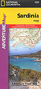
Sardinia 3in1 Flash Guide

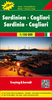
Sardinia on a large, waterproof and tear-resistant map at 1:200, 000 from the Swiss Hallwag/Kümmerly + Frey cartographic house, highlighting the island’s 77 best sights, each with a brief description, plus street plans of central Cagliari and Sassari. The map is double-sided with a small overlap between the sides.Road network, including small local roads and selected country tracks, is clearly laid out on a base showing the island’s topography by relief shading with names of mountain ranges, peaks, valleys, etc. Scenic routes are highlighted. 77 best sights are cross-referenced to the surrounding panels of brief descriptions, many illustrated with photos. The map has no geographical coordinates. The index lists a selection of locations.Also included are small street plans of
central Cagliari and Sassari annotated with main sights and recommendations for hotels, restaurants, shopping, etc. Map legend and all the text include English.
RIP - This product is no longer available on our network. It was last seen on 25.09.2019

This page now acts as a permanent archive for this product. Add more information using the comments box below to ensure it can still be found by future generations.

Use our search facility to see if it is available from an alternative contributor.
  • Availability: Out Of Stock
  • Supplier: Stanfords
  • SKU: 9783828308121
Availability: In Stock
£13.99

Product Description

Sardinia on a large, waterproof & tear-resistant map at 1:200, 000 from the Swiss Hallwag/Kümmerly + Frey cartographic house, highlighting the island’s 77 best sights, each with a brief description, plus street plans of central Cagliari & Sassari. The map is double-sided with a small overlap between the sides. Road network, including small local roads & selected country tracks, is clearly laid out on a base showing the island’s topography by relief shading with names of mountain ranges, peaks, valleys, etc. Scenic routes are highlighted. 77 best sights are cross-referenced to the surrounding panels of brief descriptions, many illustrated with photos. The map has no geographical coordinates. The index lists a selection of locations. Also included are small street plans of central Cagliari & Sassari annotated with main sights & recommendations for hotels, restaurants, shopping, etc. Map legend & all the text include English.

Reviews/Comments

Add New

Intelligent Comparison

Oooops!
We couldn't find anything!
Perhaps this product's unique.... Or perhaps we are still looking for comparisons!
Click to bump this page and we'll hurry up.

Price History

Vouchers

No voucher codes found.
Do you know a voucher code for this product or supplier? Add it to Insights for others to use.

Facebook

Jargon Buster

swiss - Short for Switzerland, one of the richest countries in the world
Waterproof - Resistant to water, usualy specified by depth in metres
Network - A link and communication between things. Often computers or people.
Large - something that takes up more space than normal.
Small - something that takes up less space than normal.
Road - a manmade lane or a path that is used to speed up travel.
Resistant - Something that can repel against something.

Supplier Information

Stanfords
Stanfords was established in 1853 and opened their iconic Covent Garden flagship store in 1901. They have become the top retailer of maps, travel books and accessories in the UK and arguably offer the largest selection of maps and travel books worldwide. Famous names such as Captain Robert Falcon Scott, Ranulph Fiennes and Michael Palin have purchased from Stanfords. They now have a shop in Bristol and both stores together with other venues operate a calendar of events including talks, book signings and exhibitions. As a specialist map retailer, the map selection is comprehensive and includes road maps, street maps and walking maps from worldwide destinations, as well as a selection of world atlases and wall maps. Books include travel guides and travel literature. Stanfords also stock globes, from miniatures made of blue marble to magnificent floor-standing globes. The website features a selection of interesting articles on travel topics.
Page Updated: 2023-11-12 20:15:36

Community Generated Product Tags

Oh No! The productWIKI community hasn't generated any tags for this product yet!
Menu