More From Contributor

£7.50
Orléans & its Environs in a series of detailed road maps at 1:80, 000 from the IGN, designed to highlight places of interest & recreational possibilities, with a city centre street plan & an enlargement of a selected hiking area. Cartography is an enlargement from 1:100, 000 to 1:80, 000 of the publisher’s highly popular TOP100 series, with very detailed presentation of the road network, including classification of local roads according to lanes, rest areas, access restrictions, etc. Railway lines are shown with stations. Topography is shown by relief shading, with spot heights & colouring for woodlands, vineyards, orchards, etc. Cycle tracks & long-distance GR routes are marked. A wide range of symbols indicate various places of interest & recreational facilities, historical & cultural sites, golf courses, rock climbing, nature reserves, etc. Refuges & gîtes d’etape are marked, but no campsites. The maps have no geographical coordinates for GPS. Each title has an index of communes. Map legend

Includes::
English.A special feature of this series is the inclusion of a large city centre street plan & an enlargement of a particularly interesting recreational area. Presentation of these features varies, so please check the individual descriptions for more information.* IN THIS TITLE: a large street plan of Orléans’ city centre highlighting main traffic arteries & indicating one way streets. An additional panel presents an extract from IGN’s topographic coverage of the area of Cour Dieu around Ingrannes in their TOP25 series but shown here at 1:30, 000. The extract highlights local hiking routes. The map also indicates how its whole area is covered by IGN’s topographic survey at 1:25, 000.

...
Archived Product
£6.95
Map No. 116, Orlicke hory
- Gory Stolowe, in a series of GPS compatible topographic maps of the Czech Republic at 1:75.000 from
...
Archived Product
£6.95
Map No. 129, Orlickoustecko, in a series of GPS compatible topographic maps of the Czech Republic at 1:75.000 from Shocart highlighting both signposted cycling routes & other local cycling paths, with route profiles & additional tourist information. Relief is shown by contour lines, spot heights, & subtle hill-shading. The maps show roads, tracks, railways, cable cars, chairlifts, & a range of natural landscape features & landmarks. Coloured symbols depict plenty of additional tourist features e.g. information centres, places of interest, antiquities, shelters, campsites, accommodation, bicycle services etc. An overprint highlights both signposted routes & other recommended routes which have no terrain markers. For all bike routes intermediate distances are shown. Hiking paths are also highlighted. Latitude & longitude margin ticks are at 5' intervals. Each map is accompanied by a booklet containing general information on the Czech cycle route network, elevation profile diagram for selected routes, plus an index for locations of historical & geographical interest, bicycle service workshops, information centres, & tourist attractions. Map legend & text are in English, German & Czech. ...
Archived Product
£2.95
Ormskirk North in 1907 in a fascinating series of reproductions of old Ordnance Survey plans in the Alan Godfrey Editions, ideal for anyone interested in the history of their neighbourhood or family. Selected towns in Great Britain & Ireland are covered by maps showing the extent of urban development in the last decades of the 19th & early 20th century. In this title: the map covers the northern half of Ormskirk, stretching from Derby Street northward to Brooklands, along High Lane to Sycamore House, & eastward to Dark Lane. Features include railways with station, engine shed & junction with the Skelmersdale Branch; parish church, Cottage Hospital, The Quarry, Isolation Hospital, Burscough Street, Bath Wood, Charlesbye. On the reverse is a list of private residents from a 1918 directory, plus railway timetables for the Ormskirk-St Helens & Liverpool-Ormskirk-Southport lines in 1914. About the Alan Godfrey Editions of the 25 ...
Archived Product
£3.50
Ormskirk North in 1907 in a fascinating series of reproductions of old Ordnance Survey plans in the Alan Godfrey Editions, ideal for anyone interested in the history of their neighbourhood or family. The map covers the northern half of Ormskirk, stretching from Derby Street northward to Brooklands, along High Lane to Sycamore House, & eastward to Dark Lane. Features include railways with station, engine shed & junction with the Skelmersdale Branch; parish church, Cottage Hospital, The Quarry, Isolation Hospital, Burscough Street, Bath Wood, Charlesbye, etc. On the reverse is a list of private residents from a 1918 directory, plus railway timetables for the Ormskirk-St Helens & Liverpool-Ormskirk-Southport lines in 1914. About the Alan Godfrey Editions of the 25” OS Series: Selected towns in Great Britain & Ireland are covered by maps showing the extent of urban development in the last decades of the 19th & early 20th century. The plans have been taken from the Ordnance Survey mapping & reprinted at about 15 inches to one mile (1:4, 340). On the reverse most maps have historical notes & many also include extracts from contemporary directories. Most maps cover about one mile (1.6kms) north/south, one & a half miles (2.4kms) across; adjoining sheets can be combined to provide wider coverage.FOR MORE INFORMATION & A COMPLETE LIST OF ALL AVAILABLE TITLES PLEASE CLICK ON THE SERIES LINK. ...
Archived Product
£3.50
Ormskirk South in 1907 in a fascinating series of reproductions of old Ordnance Survey plans in the Alan Godfrey Editions, ideal for anyone interested in the history of their neighbourhood or family. The map covers the southern half of Ormskirk, extending south-eastward to The Ruff. Features include Aughton Street, Moor Street, Brook Lane, Wigan Road, Industrial School, Grammar School, Woodlands Farm, Ruff Lane, etc. On the reverse is a commercial directory for 1918. About the Alan Godfrey Editions of the 25” OS Series: Selected towns in Great Britain & Ireland are covered by maps showing the extent of urban development in the last decades of the 19th & early 20th century. The plans have been taken from the Ordnance Survey mapping & reprinted at about 15 inches to one mile (1:4, 340). On the reverse most maps have historical notes & many also include extracts from contemporary directories. Most maps cover about one mile (1.6kms) north/south, one & a half miles (2.4kms) across; adjoining sheets can be combined to provide wider coverage.FOR MORE INFORMATION & A COMPLETE LIST OF ALL AVAILABLE TITLES PLEASE CLICK ON THE SERIES LINK. ...
Archived Product
£29.95
Surface decoration has always played a fundamental role in Islamic architecture. As human representation is forbidden in Islamic religious monuments, designers employed mosaics, stucco, brickwork & ceramics, & the vigorous use of brilliant colour to reach unparalleled heights of expression. It is this ornamental dimension of Islamic architecture that is explored in this magnificent volume. Rather than limiting itself to an exclusively historical or chronological perspective, Ornament & Decoration in Islamic Architecture presents four successive approaches to its subject. The first part offers an overview of Islamic architecture, discussing the great diversity it contains. Dealing exclusively with techniques, the second part considers the materials most often used as well as the expertise of the builders & Muslim decorative artists, & the third part explores themes in Islamic ornamentation. Section four discusses aesthetics, & studies the relationship between the buildings
- the structures or their architectonic components
- & their ornamental coverings. Each of these topics is presented through a number of outstanding examples & then through comparable monuments from all over the Islamic world. For anyone in thrall to such great wonders as the Taj Mahal & the Alhambra, & for everyone interested in the world of Islam, this lavish publication will be indispensable.

...
Archived Product
£12.99
Topographic survey of France at 1:25, 000 in IGN`s excellent TOP25 / Série Bleue series. All the maps are GPS compatible, with a 1km UTM grid plus latitude & longitude lines at 5’ intervals. Contours are at 5m intervals except for mountainous areas where the maps have contours at 10m intervals, vividly enhanced by hill shading & graphics for rocky terrain. Colouring with graphics indicates different types of vegetation or land use (deciduous or coniferous forests, moors, orchards, vineyards, etc). PLEASE NOTE: coverage of France at this scale is currently being revised – the format & the presentation of each title are indicated by the letters at the end of its Sheet Reference number (e.g. 0416ET, 3531ETR, 1923SB, etc.)MAPS WITH FULL TOURIST OVERPRINT & AN ENGLISH MAP LEGEND: all TOP25 maps & the SB editions of Série Bleue have an overprint highlighting waymarked walking trails including long-distance GR routes &, where appropriate, ski routes. Symbols indicate campsites, gîtes d’etape, refuges, equestrian centres & other recreational facilities or sites, tourist information centres, cultural heritage, etc. Towns & locations of particular interest are highlighted.- ET or OT = single-sided TOP25 map covering approx. 29x 21 km / 18x 13 miles.- ETR or OTR = waterproof & tear resistant TOP25 map covering the same area as the corresponding ET or OT number, but double-sided, printed on a smaller size sheet with a good overlap between the sides.- SB = Série Bleue map with full tourist overprint; these maps, first introduced in summer 2014, each cover approx. 29x 24km / 18x 15 miles.SÉRIE BLEUE maps with numbers ending in E (Est) or O (Ouest): most editions now indicate the GR routes, but do not show any other tourist information. Map legend is in French only. Each map covers approx. 14x 20km / 9x 12 miles. ...
Archived Product
£16.99
Sverigeserien is an outdoor map series consisting of 116 sheets with coverage of southern & central Sweden & the northern coastline. The map is suitable for outdoor activities such as hiking, excursions, trail running, hunting, fishing, riding, cycling, mountain biking, paddling, skating & much more. Every sheet covers an area of 45x 68km. These topographical maps in scale 1:50 000 contain all the information needed for outdoor activities: Terrain information, hiking trails, illuminated tracks, camping, shelters, golf courses, leisure baths, historical remains, roads in different categories, railway lines & much more. Easy to read topography with contour lines, vertical interval 5 m. Sverigeserien is a high-quality map series & is durable for frequent use! Updated content with map data from Lantmäteriet (National Land Survey of Sweden) & printed on Polyart which is water & tear resistant. This means that the map can be folded repeatedly without breaking & can withstand the challenging weather in Sweden during both winter & summer. Legend is in Swedish, English & German. ...
Archived Product
£9.99
Sardinia’s eastern coast around the town of Orosei on a detailed, contoured, GPS compatible map at 1:35, 000 from Abies Edizioni, with on the reverse notes on the area’s history, heritage & beaches. Contours are at 20m intervals with colouring for different types of vegetation. The map shows local footpaths & hiking trails, as well as recommended mountain bike routes. Symbols highlight various places of interest including campsites, beaches, diving & surfing sites, viewpoints, climbing sites, nuraghi, churches, etc. The map has a 1-km UTM grid. On the reverse are multilingual notes about the area & its heritage. Map legend & the notes include English. ...
Archived Product

Ormskirk South 1907

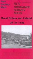
Ormskirk South in 1907 in a fascinating series of reproductions of old Ordnance Survey plans in the Alan Godfrey Editions, ideal for anyone interested in the history of their neighbourhood or family. Selected towns in Great Britain and Ireland are covered by maps showing the extent of urban development in the last decades of the 19th and early 20th century.In this title: the map covers the southern half of Ormskirk, extending south-eastward to The Ruff. Features include Aughton Street, Moor Street, Brook Lane, Wigan Road, Industrial School, Grammar School, Woodlands Farm, Ruff Lane. On the reverse is a commercial directory for 1918.About the Alan Godfrey Editions of the 25
RIP - This product is no longer available on our network. It was last seen on 25.09.2019

This page now acts as a permanent archive for this product. Add more information using the comments box below to ensure it can still be found by future generations.

Use our search facility to see if it is available from an alternative contributor.
  • Availability: Out Of Stock
  • Supplier: Stanfords
  • SKU: 9786000007225
Availability: In Stock
£2.95

Product Description

Ormskirk South in 1907 in a fascinating series of reproductions of old Ordnance Survey plans in the Alan Godfrey Editions, ideal for anyone interested in the history of their neighbourhood or family. Selected towns in Great Britain & Ireland are covered by maps showing the extent of urban development in the last decades of the 19th & early 20th century. In this title: the map covers the southern half of Ormskirk, extending south-eastward to The Ruff. Features include Aughton Street, Moor Street, Brook Lane, Wigan Road, Industrial School, Grammar School, Woodlands Farm, Ruff Lane. On the reverse is a commercial directory for 1918. About the Alan Godfrey Editions of the 25

Reviews/Comments

Add New

Price History

Vouchers

No voucher codes found.
Do you know a voucher code for this product or supplier? Add it to Insights for others to use.

Facebook

Jargon Buster

History - Anything that happens in the past. An acedemic subject.
Road - a manmade lane or a path that is used to speed up travel.
Ideal - Something that satisfies a perfect criteria.
Family - A group of people that live together made up from parents and children.

Supplier Information

Stanfords
Stanfords was established in 1853 and opened their iconic Covent Garden flagship store in 1901. They have become the top retailer of maps, travel books and accessories in the UK and arguably offer the largest selection of maps and travel books worldwide. Famous names such as Captain Robert Falcon Scott, Ranulph Fiennes and Michael Palin have purchased from Stanfords. They now have a shop in Bristol and both stores together with other venues operate a calendar of events including talks, book signings and exhibitions. As a specialist map retailer, the map selection is comprehensive and includes road maps, street maps and walking maps from worldwide destinations, as well as a selection of world atlases and wall maps. Books include travel guides and travel literature. Stanfords also stock globes, from miniatures made of blue marble to magnificent floor-standing globes. The website features a selection of interesting articles on travel topics.
Page Updated: 2023-11-12 20:15:36

Community Generated Product Tags

Oh No! The productWIKI community hasn't generated any tags for this product yet!
Menu