
 United Kingdom
 France
 Germany
 Netherlands
 Sweden
 USA
USA
 Italy
Italy
 Spain
Spain
More From Contributor


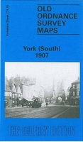
York South 1907
York South in 1907 in a fascinating series of reproductions of old Ordnance Survey plans in the Alan Godfrey Editions, ideal for anyone interested in the history of their neighbourhood or family. The map covers the southern part of York, stretching from Micklegate southward to Campleshon Lane, and from Fawcetts Street westward to New Lane and Murray Street. Features include the southern tip of the station and its railway approaches with carriage works and engine shed, Holgate Junction, River Ouse, Nunthorpe Hall, Mount Vale, Holgate Road, South Bank, Nunthorpe Court, Blossom Street, City Wall, Nunnery Lane, Scarcroft Road, Skeldergate Bridge, York Castle, Court House, Clementhorpe, Bishopthorpe Road, Fishergate, glass works, River Foss Navigation with locks, Ebor
Flour Mills, tramways, etc. On the reverse are street directory entries for Acomb Road, Bishophill, Bishopthorpe Road, Fishergate, The Mount, Mount Ephraim and Nunnery Lane.About the Alan Godfrey Editions of the 25” OS Series:Selected towns in Great Britain and Ireland are covered by maps showing the extent of urban development in the last decades of the 19th and early 20th century. The plans have been taken from the Ordnance Survey mapping and reprinted at about 15 inches to one mile (1:4, 340). On the reverse most maps have historical notes and many also include extracts from contemporary directories. Most maps cover about one mile (1.6kms) north/south, one and a half miles (2.4kms) across; adjoining sheets can be combined to provide wider coverage.FOR MORE INFORMATION AND A
COMPLETE LIST OF ALL AVAILABLE TITLES PLEASE CLICK ON THE SERIES LINK.

Product Description
Reviews/Comments
Add New
Intelligent Comparison
Archived Product
Bury South 1907 Stanfords
£2.95
Archived Product
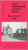
Bury South 1907 Stanfords
£3.50
Archived Product

Dover South 1897 Stanfords
£3.50
Archived Product
Ormskirk South 1907 Stanfords
£2.95
Archived Product
Ormskirk South 1907 Stanfords
£3.50
Archived Product
Stockport South 1907 Stanfords
£2.95
Archived Product
Stockport South 1907 Stanfords
£3.50
Archived Product
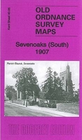
Sevenoaks South 1907 Stanfords
£3.50
Vouchers
No voucher codes found.
Do you know a voucher code for this product or supplier? Add it to Insights for others to use.
Do you know a voucher code for this product or supplier? Add it to Insights for others to use.
 Denmark