
 United Kingdom
 France
 Germany
 Netherlands
 Sweden
 USA
USA
 Italy
Italy
 Spain
Spain
More From Contributor


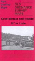
Grimsby South 1906
Grimsby South in 1906 in a fascinating series of reproductions of old Ordnance Survey plans in the Alan Godfrey Editions, ideal for anyone interested in the history of their neighbourhood or family. The map covers much of central Grimsby, stretching from West Haven and East Gate southward to Weelsby Road, and from Convamore Road westward to Cromwell Road. Points of interest include Peoples Park, the Bull Ring, Holme Hill Brick & Tile Works and the Town Hall. Railway information includes stretches of the Great Central and Great Northern Railways, including Town Station, junctions, Weelsby Road Motor Halt, Weelholme Road Halt, Garden St Crossing. Other features include cemetery, St James church, St James College, The Abbey, River Head, etc. On the reverse are street directory
entries for Clayton Street, Dudley Street, Edward Street, Flottergate, Garden Street, Osborne Street, Town Hall Street, Welholme Road and Welllowgate. About the Alan Godfrey Editions of the 25” OS Series:Selected towns in Great Britain and Ireland are covered by maps showing the extent of urban development in the last decades of the 19th and early 20th century. The plans have been taken from the Ordnance Survey mapping and reprinted at about 15 inches to one mile (1:4, 340). On the reverse most maps have historical notes and many also include extracts from contemporary directories. Most maps cover about one mile (1.6kms) north/south, one and a half miles (2.4kms) across; adjoining sheets can be combined to provide wider coverage.FOR MORE INFORMATION AND A COMPLETE LIST OF ALL
AVAILABLE TITLES PLEASE CLICK ON THE SERIES LINK.

Product Description
Reviews/Comments
Add New
Vouchers
No voucher codes found.
Do you know a voucher code for this product or supplier? Add it to Insights for others to use.
Do you know a voucher code for this product or supplier? Add it to Insights for others to use.
 Denmark