
 United Kingdom
 France
 Germany
 Netherlands
 Sweden
 USA
USA
 Italy
Italy
 Spain
Spain
More From Contributor


Grimsby North 1906
Grimsby North in 1906 in a fascinating series of reproductions of old Ordnance Survey plans in the Alan Godfrey Editions, ideal for anyone interested in the history of their neighbourhood or family. Selected towns in Great Britain and Ireland are covered by maps showing the extent of urban development in the last decades of the 19th and early 20th century.In this title: the map of Grimsby North is dominated by the Alexandra Dock which is in the centre, with residential areas to both sides. Corporation Bridge, which opened in 1873 and was replaced by the present structure in 1928, provides the walkway over the dock. Areas of interest include West Marsh Paper Mills, the Royal Dock, Pyewipe Brick & Tile Works, GCR railway lines with Docks Station, malthouses, Brickpit Coal Sidings.
Coverage stretches from South Parade and East Marsh Street northward, and from Albion Street westward to Werst Marsh. The River Freshney runs across the bottom left of the map, travelling past Grimsby & District Hospital. Going north through the map is the GCR's Great Coates Branch Railway line. On the reverse are street directory entries for Annesley Street, Ayscough Street, Church Street, Corporation Street, Freeman Street, Garibaldi Street and Wellington Street. About the Alan Godfrey Editions of the 25
Coverage stretches from South Parade and East Marsh Street northward, and from Albion Street westward to Werst Marsh. The River Freshney runs across the bottom left of the map, travelling past Grimsby & District Hospital. Going north through the map is the GCR's Great Coates Branch Railway line. On the reverse are street directory entries for Annesley Street, Ayscough Street, Church Street, Corporation Street, Freeman Street, Garibaldi Street and Wellington Street. About the Alan Godfrey Editions of the 25
Product Description
Reviews/Comments
Add New
Intelligent Comparison
Archived Product

Grimsby North 1906 Stanfords
£3.50
Archived Product
Grimsby South 1906 Stanfords
£2.95
Archived Product

Grimsby South 1906 Stanfords
£3.50
Archived Product
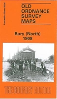
Bury North 1908 Stanfords
£3.50
Archived Product
Shrewsbury North 1900 Stanfords
£3.50
Archived Product
Grimsby New Clee 1906 Stanfords
£2.95
Archived Product
Grimsby New Clee 1906 Stanfords
£3.50
Archived Product

Whitstable North 1906 Stanfords
£3.50
Vouchers
No voucher codes found.
Do you know a voucher code for this product or supplier? Add it to Insights for others to use.
Do you know a voucher code for this product or supplier? Add it to Insights for others to use.
 Denmark