-
Home
-
Contributors
-
International
-
Account
-
Information
More From Contributor
Includes:: notes on the development of Ordnance Survey & the various series produced by them. For those interested in maps & cartography in general, the Cassini series also provides a fascinating insight into how Ordnance Survey cartographic style has developed over a period of over 100 years. Coverage
Includes:: present day Market Rasen, Louth, Manby, Saltfleetby St Peter, Alvingham, Saltfleet, Fotherby, Ludford, Walesby, Clacby, Binbrook, Ludborough, Fulstow, North Somercotes, Ashby cum Fenby, Tetney, Waltham, Beelsby, Caistor, Swallow, Great Limber, Keelby, Laceby, Heeling, Immingham, Ulceby, Easy Halton, Goxhill, Cleethorpes, Kilnsea, Easington, Welwick, Holmpton, Partington, Sunk Islands & Keyingham, with the Wolds, Covenham Reservoir, Spurn Head & the Mouth of the Humber.* PLEASE NOTE: Stanfords can also print on request mapping from all four series *centring the map on a location of your choice.* For more information please click on the link below. ...
Includes:: notes on the development of Ordnance Survey & the various series produced by them. For those interested in maps & cartography in general, the Cassini series also provides a fascinating insight into how Ordnance Survey cartographic style has developed over a period of over 100 years. Coverage
Includes:: present day Market Rasen, Louth, Manby, Saltfleetby St Peter, Alvingham, Saltfleet, Fotherby, Ludford, Walesby, Clacby, Binbrook, Ludborough, Fulstow, North Somercotes, Ashby cum Fenby, Tetney, Waltham, Beelsby, Caistor, Swallow, Great Limber, Keelby, Laceby, Heeling, Immingham, Ulceby, Easy Halton, Goxhill, Cleethorpes, Kilnsea, Easington, Welwick, Holmpton, Partington, Sunk Islands & Keyingham, with the Wolds, Covenham Reservoir, Spurn Head & the Mouth of the Humber. PLEASE NOTE: Stanfords can also print on request mapping from all four series centring the map on a location of your choice. For more information please click on the link below. ...
Includes:: notes on the development of Ordnance Survey & the various series produced by them. For those interested in maps & cartography in general, the Cassini series also provides a fascinating insight into how Ordnance Survey cartographic style has developed over a period of over 100 years. Coverage
Includes:: present day Market Rasen, Louth, Manby, Saltfleetby St Peter, Alvingham, Saltfleet, Fotherby, Ludford, Walesby, Clacby, Binbrook, Ludborough, Fulstow, North Somercotes, Ashby cum Fenby, Tetney, Waltham, Beelsby, Caistor, Swallow, Great Limber, Keelby, Laceby, Heeling, Immingham, Ulceby, Easy Halton, Goxhill, Cleethorpes, Kilnsea, Easington, Welwick, Holmpton, Partington, Sunk Islands & Keyingham, with the Wolds, Covenham Reservoir, Spurn Head & the Mouth of the Humber.* PLEASE NOTE: Stanfords can also print on request mapping from all four series *centring the map on a location of your choice.* For more information please click on the link below. ...
Includes:: notes on the development of Ordnance Survey & the various series produced by them. For those interested in maps & cartography in general, the Cassini series also provides a fascinating insight into how Ordnance Survey cartographic style has developed over a period of over 100 years. Coverage
Includes:: present day Market Rasen, Louth, Manby, Saltfleetby St Peter, Alvingham, Saltfleet, Fotherby, Ludford, Walesby, Clacby, Binbrook, Ludborough, Fulstow, North Somercotes, Ashby cum Fenby, Tetney, Waltham, Beelsby, Caistor, Swallow, Great Limber, Keelby, Laceby, Heeling, Immingham, Ulceby, Easy Halton, Goxhill, Cleethorpes, Kilnsea, Easington, Welwick, Holmpton, Partington, Sunk Islands & Keyingham, with the Wolds, Covenham Reservoir, Spurn Head & the Mouth of the Humber.* PLEASE NOTE: Stanfords can also print on request mapping from all four series *centring the map on a location of your choice.* For more information please click on the link below. ...
Includes:: stretches of the Great Central & Great Northern Railways, including Town Station, junctions, Weelsby Road Motor Halt, Weelholme Road Halt, Garden St Crossing. Other features include cemetery, St James church, St James College, The Abbey, River Head. On the reverse are street directory entries for Clayton Street, Dudley Street, Edward Street, Flottergate, Garden Street, Osborne Street, Town Hall Street, Welholme Road & Welllowgate. About the Alan Godfrey Editions of the 25 ...

Grimsby New Clee 1906
Sheets 22.03 and 22.04, which show the dock entrances, are included as an insert. On the reverse are street directory entries for Barcroft Street, Guildford Street, Harrington Street, Hilda Street, Stirling Street, Victor Street and Weelsby Street. About the Alan Godfrey Editions of the 25
This page now acts as a permanent archive for this product. Add more information using the comments box below to ensure it can still be found by future generations.
Use our search facility to see if it is available from an alternative contributor.
- External links may include paid for promotion
- Availability: Out Of Stock
- Supplier: Stanfords
- SKU: 9786000007539
Product Description
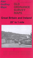
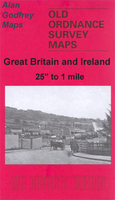
Grimsby New Clee in 1906 in a fascinating series of reproductions of old Ordnance Survey plans in the Alan Godfrey Editions, ideal for anyone interested in the history of their neighbourhood or family. Selected towns in Great Britain & Ireland are covered by maps showing the extent of urban development in the last decades of the 19th & early 20th century. In this title: the map covers the eastern part of Grimsby with the western part of Cleethorpes. Coverage stretches from Victor Street eastward to Suggits Lane, & from Harold Streeet northward to the docks. A major feature on the map is the Fish Docks, which appear in the top left corner. Other points of interest include New Clee Station & Blundell Park Football Ground, which was the original home of Grimsby Town FC from 1889. Sheets 22.03 & 22.04, which show the dock entrances, are included as an insert. On the reverse are street directory entries for Barcroft Street, Guildford Street, Harrington Street, Hilda Street, Stirling Street, Victor Street & Weelsby Street. About the Alan Godfrey Editions of the 25
Reviews/Comments
Add New
Intelligent Comparison
Price History
Vouchers
Do you know a voucher code for this product or supplier? Add it to Insights for others to use.


 United Kingdom
 France
 Germany
 Netherlands
 Sweden
 USA
USA
 Italy
Italy
 Spain
Spain


 Denmark