
 United Kingdom
 France
 Germany
 Netherlands
 Sweden
 USA
USA
 Italy
Italy
 Spain
Spain
More From Contributor


Shrewsbury North 1900
Shrewsbury North in 1900 in a fascinating series of reproductions of old Ordnance Survey plans in the Alan Godfrey Editions, ideal for anyone interested in the history of their neighbourhood or family. The map is double-sided. The main map covers the area around Ditherington, Greenfields, Castlefields and Spring Gardens. Coverage stretches east to include Monkmoor. Features show His Majesty`s Prison, Gas Works, Isolation Hospital, Newpark Farm, and St Michaels Church. The railway line runs north to south through the left hand side with the station at the bottom of the map. On the reverse is a section of map 34.06 which includes Coton Hill and the area around Mountfields. The railway line also features here, along with the Vicarage, Shropshire & West Midlands Agricultural Show
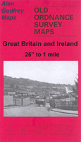
Ground, Infantry Barracks and Cotonhill Farm.About the Alan Godfrey Editions of the 25” OS Series:Selected towns in Great Britain and Ireland are covered by maps showing the extent of urban development in the last decades of the 19th and early 20th century. The plans have been taken from the Ordnance Survey mapping and reprinted at about 15 inches to one mile (1:4, 340). On the reverse most maps have historical notes and many also include extracts from contemporary directories. Most maps cover about one mile (1.6kms) north/south, one and a half miles (2.4kms) across; adjoining sheets can be combined to provide wider coverage.FOR MORE INFORMATION AND A COMPLETE LIST OF ALL AVAILABLE TITLES PLEASE CLICK ON THE SERIES LINK.
Ground, Infantry Barracks and Cotonhill Farm.About the Alan Godfrey Editions of the 25” OS Series:Selected towns in Great Britain and Ireland are covered by maps showing the extent of urban development in the last decades of the 19th and early 20th century. The plans have been taken from the Ordnance Survey mapping and reprinted at about 15 inches to one mile (1:4, 340). On the reverse most maps have historical notes and many also include extracts from contemporary directories. Most maps cover about one mile (1.6kms) north/south, one and a half miles (2.4kms) across; adjoining sheets can be combined to provide wider coverage.FOR MORE INFORMATION AND A COMPLETE LIST OF ALL AVAILABLE TITLES PLEASE CLICK ON THE SERIES LINK.
Product Description
Reviews/Comments
Add New
Intelligent Comparison
Archived Product
Shrewsbury West 1900 Stanfords
£3.50
Archived Product
Shrewsbury East 1900 Stanfords
£3.50
Archived Product
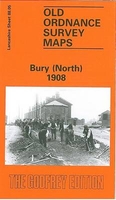
Bury North 1908 Stanfords
£3.50
Archived Product

Chorley North 1909 Stanfords
£3.50
Archived Product
Chorley North 1909 Stanfords
£2.95
Archived Product
Grimsby North 1906 Stanfords
£2.95
Archived Product
Grimsby North 1906 Stanfords
£3.50
Archived Product

Shaftesbury 1900 Stanfords
£3.50
Vouchers
No voucher codes found.
Do you know a voucher code for this product or supplier? Add it to Insights for others to use.
Do you know a voucher code for this product or supplier? Add it to Insights for others to use.
 Denmark