
 United Kingdom
 France
 Germany
 Netherlands
 Sweden
 USA
USA
 Italy
Italy
 Spain
Spain
More From Contributor

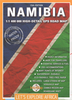

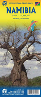
Namibia ITMB
Indexed map of Namibia with a plan of central Windhoek. Altitude colouring shows the country’s topography, with spot heights given in feet. Swamps, salt pans and desert areas are marked, as well as locations of numerous wells.The map shows the country’s road and rail networks, including selected local and seasonal tracks. Intermediate distances are marked on main routes and locations of petrol stations are shown. National parks are prominently marked and symbols highlight various places of interest, including selected accommodation, hot springs and caves, etc.The map has latitude and longitude grid at intervals of 1º and an index of localities. Caprivi Strip is shown as an inset. Also included are two street plans, central Windhoek and Walvis Bay, wrongly identified as
Windhoek! Both plans indicate selected accommodation and various facilities and places of interest.
Windhoek! Both plans indicate selected accommodation and various facilities and places of interest.

Product Description
Reviews/Comments
Add New
Vouchers
No voucher codes found.
Do you know a voucher code for this product or supplier? Add it to Insights for others to use.
Do you know a voucher code for this product or supplier? Add it to Insights for others to use.
 Denmark