More From Contributor

£10.99
Namibia at 1:1, 000, 000 from Freytag & Berndt with a separate booklet attached to the map cover also providing a street plan of central Windhoek. The map is double-sided with a very generous overlap between the sides. Caprivi Strip is shown as a separate inset at 1:1, 200, 000 Topography is shown by relief shading with spot heights plus graphics and/or colouring indicating sandy or rocky deserts, salt lakes or flats, wells & hot springs, etc. Many seasonal rivers & lakes are included. National parks & other protected areas are prominently highlighted. Road network

Includes::
country tracks, with road numbers very clearly presented & distances shown on many smaller routes. Locations of petrol stations & border crossings are marked. Railway lines are included & local airports are marked. Also shown are internal administrative boundaries with names of the provinces. Symbols highlight various places of interest including UNESCO World Heritage sites. The map has latitude & longitude lines at 1° intervals. Most place names are in larger print than found on other maps. Multilingual map legend

Includes::
English. The index is in a separate booklet attached to the map cover &

Includes::
a street plan of central Windhoek. Also provided is a showing time zones within Africa & Europe.


...
Archived Product
£9.99
Namibia at 1:1, 400, 000 on light, waterproof at tear-resistant map published by Freytag & Berndt in their “ World Compact” series which combines a country map with street plans & extensive tourist information: descriptions of places of interest, a fact-box, etc. The map is double-sided, with an overlap between the sides; the Caprivi Strip is shown as an inset. Topography is shown by very effective relief shading with spot heights, graphics for salt lakes, swamps, deserts, oasis, water wells, etc, & plenty of names of geographical features. National parks & other protected areas are highlighted. Road network

Includes::
main & selected local tracks, gives distances on most routes & shows locations of filling stations. Railway lines are included & local airports are marked. Also shown are internal administrative boundaries with names of the provinces. Icons indicate various places of tourist interest such as campsites, archaeological sites, hot springs, beaches & snorkeling sites, etc. The map is indexed & has latitude & longitude lines drawn at 1° intervals.A special feature of Freytag & Berndt’s World Compact series are additional street plans & information panels, illustrated with colour photos, with descriptions of main tourist destinations, important natural features, facts & figures about the country, a phrase book, tourist tips, etc. The map of Namibia

Includes::
a street plan of central Windhoek. Map legend & all the text in the information panels is bilingual English – German.


...
Archived Product
£9.99
Namibia in New Holland’s Globetrotter Travel Guide series, comprising a range of practical & accessible guides to a number of cities, regions & countries worldwide. Globetrotter guides incorporate essential information in an easy-to-carry & easy-to-reference format. They provide visitors with an introduction highlighting the country’s ‘must see’ areas, allowing readers to make the most of their time away. Presented in a paperback PVC format, each guide in the series provides vital tips for visitors &

Includes::
information on the best places to stay, eat & shop, star-rated top attractions, detailed regional profiles & recommendations of the best tours & excursions. Individual titles also have a separate, pull-out overview map in the rear pocket of the guide that serves as a companion to the book itself. An introductory section profiles the destination with details of the l&, a brief history, government & economy & the people. Every chapter is summarised in the ‘ At-a-Glance’ sections at the end of each chapter. There is also a Travel Tips section at the back of each guide providing practical guidance & information on tourist information services, entry requirements, customs, health requirements, getting there, what to pack, money matters, accommodation, transport, business hours, time difference, electricity, health precautions, useful phrases, personal safety, emergencies, etiquette & tipping.

...
Archived Product
£15.99
Namibia in the Handbooks series from Footprint; comprehensive & leading guides designed & written for independent travellers who enjoy exploring off the beaten track. Footprint guides have an established reputation, built up since 1921, for catering for more adventurous & individual travellers. An unrestrictive editorial style also gives authors the freedom to capture & explore local cultures, sights & areas that are often not covered in other guides. Widely recognised for their reliability & independent writing style, Footprint guides all have the same layout. Introductory sections introduce the reader to the destination, with chapters on planning on your trip & essentials, including practical information & guidance on subjects such as when & where to go, itineraries, sport & activities, arts, getting there & around, eating & drinks, sleeping & a dedicated section on the anticipated carbon footprint involved in travelling to the destination. Each guide is organised geographically by region or country, with individual sections having a particular focus on an extensive range of sights & places of interest. Further, there are also details of accommodation, nightlife, restaurants & any notable local activities. Information boxes throughout the text give readers an insight into local customs, stories & sights of particular interest.A ...
Archived Product
£14.99
Namibia in the Handbooks series from Footprint; comprehensive & leading guides designed & written for independent travellers who enjoy exploring off the beaten track. Footprint guides have an established reputation, built up since 1921, for catering for more adventurous & individual travellers. An unrestrictive editorial style also gives authors the freedom to capture & explore local cultures, sights & areas that are often not covered in other guides. Widely recognised for their reliability & independent writing style, Footprint guides all have the same layout. Introductory sections introduce the reader to the destination, with chapters on planning on your trip & essentials, including practical information & guidance on subjects such as when & where to go, itineraries, sport & activities, arts, getting there & around, eating & drinks, sleeping & a dedicated section on the anticipated carbon footprint involved in travelling to the destination. Each guide is organised geographically by region or country, with individual sections having a particular focus on an extensive range of sights & places of interest. Further, there are also details of accommodation, nightlife, restaurants & any notable local activities. Information boxes throughout the text give readers an insight into local customs, stories & sights of particular interest.A ‘ Background’ section explores the history, economy, government, education, culture, people, land & environment of the destination in significant depth. There is also a ‘ Footnotes’ chapter with a basic language guide for travellers & information about the author. A useful distance chart tailored to the destination is also included in the inside back cover. * Please note:* the series is gradually being revised, reverting to its previous style of ” Handbooks”, published in a hardback format. ...
Archived Product
£13.99
Namibia at 1:1, 400, 000 on a double-sided, waterproof & tear-resistant road map from South African publishers International Motoring Productions with GPS waypoints for selected road junctions, small towns or settlements, places of interest & recommended accommodation, plus enlargements showing in greater detail Etosha National Park, the Zambezi Region, & the area around the Twyfelfontein Rock Engravings UNESCO World Heritage site. Road network indicates tar or gravel roads & 4WD tracks; locations of fuel stations are marked & driving distances are shown on all routes. Many road junctions & other points such as park entry gates, etc, are annotated with GPS waypoints. Border crossings to neighbouring countries show their opening times. The map also shows locations accessible by air transport. Symbols mark recommended accommodation (shown with names of camps, etc) & various places of interest. Towns are annotated to indicate what services are provided there (shops, ATMs, car repairs, medical, etc). The map, one of a series of similar maps covering countries & selected regions of southern Africa, has rather simple cartography with somewhat basic elevation tinting & occasional spot heights. Perennial or seasonal rivers & dry pan are marked & main mountain ranges are named; main protected areas are highlighted. The areas outside the country’s borders show only main road connections. In addition to the waypoints, latitude & longitude are drawn at 1º intervals. Each side of the map has a panel listing accommodation facilities with phone numbers, star rating & GPS waypoints. ...
Archived Product
£15.99
Namibia Insight Guide is dedicated to exploring the destination in detail with a selection of glossy illustrations. Extensive introductory sections explore the region’s history & culture & there are also short articles written by locals about distinctive local issues, whilst selective photo-features illustrate the variety of the place. The ‘ Places’ section is grouped geographically & provides details of the area including places to visit, suggestions for tours & other activities. Each section has its own listings of the best restaurants, bars & cafes. Essential practical information is provided in the Travel Tips chapter on accommodation, shopping & local activities. A useful location finder & travel tip index with relevant page numbers are given on the inside covers. Overview street plans are also provided for the main cities in the region or country. ...
Archived Product
£15.99
From deciding when to go, to choosing what to see when you arrive, this is all you need to plan your trip & experience the best of Namibia, with in-depth insider information on must-see, top attractions like The Etosha National Park, Fish River Canyon & the haunting Skeleton Coast, & hidden cultural gems like the petrified forests of Northwest Namibia.· Insight Guide Namibia is ideal for travellers seeking immersive cultural experiences, from exploring the haunting Skeleton Coast to discovering the fascinating wildlife of the Etosha National Park · In-depth on history & culture: enjoy special features on Namibia`s fascinating people, safaris & the Arts, all written by local experts·

Includes::
innovative, unique extras to keep you up-to-date when you`re on the move
- this guide comes with a free e Book, & an app that highlights top attractions & regional information & is regularly updated with new hotel, bar, restaurant, shop & local event listings· Invaluable maps, travel tips & practical information ensure effortless planning, & encourage venturing off the beaten track· Inspirational colour photography throughout
- Insight Guides is a pioneer of full-colour guide books· Inventive design makes for an engaging, easy reading experience


...
Archived Product
£9.99
Indexed map of Namibia with a plan of central Windhoek. Altitude colouring shows the country’s topography, with spot heights given in feet. Swamps, salt pans & desert areas are marked, as well as locations of numerous wells. The map shows the country’s road & rail networks, including selected local & seasonal tracks. Intermediate distances are marked on main routes & locations of petrol stations are shown. National parks are prominently marked & symbols highlight various places of interest, including selected accommodation, hot springs & caves, etc. The map has latitude & longitude grid at intervals of 1º & an index of localities. Caprivi Strip is shown as an inset. Also included are two street plans, central Windhoek & Walvis Bay, wrongly identified as Windhoek! Both plans indicate selected accommodation & various facilities & places of interest. ...
Archived Product
£10.99
Namibia on an indexed map from the South African publishers Map Studio annotated numerous places of interest & GPS waypoints for important road junctions, plus a street plan of central Windhoek. The map covers whole country at 1:1, 650, 000, with the Zambezi Region (the new name of the Caprivi Strip) shown as an inset. Road network highlights main routes & clearly shows road numbers for secondary roads & many cross-country tracks. Important road junctions are annotated with GPS waypoints & locations of filling stations & border crossings are marked. Driving distances are shown on main & selected secondary routes. Railway lines are included & local airports are marked. The map also indicates places with tourist accommodation (hotels/motels, caravan & campsites, etc), medical facilities, & various places of interest. Topography is presented by relief shading. The map shows the boundaries of national parks & game reserves, as well as administrative borders of Namibia’s provinces. Latitude & longitude lines are drawn at 1° intervals. The index is next to the map. Also provided is a street plan of central Windhoek annotated with various places of interest & facilities. ...
Archived Product

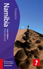
Namibia Handbook SUPERCEDED

Namibia is one of the world's last true wildernesses, home to the highest sand dunes, the oldest desert and the only place you might catch a glimpse of the rare black rhino, or desert-dwelling elephants. With a wealth of animals and birds to get twitchy about, this diverse landscape is perfect for the environmentally conscious traveller with a sense of adventure. Footprint's fully revised 5th edition helps you stay ahead of the game in Namibia's national parks and provides thorough listings on where to sleep and eat, and how to get around.It provides fantastic coverage of all the national parks and their incredible wildlife, including a 32-page wildlife guide. It includes detailed maps and listings to help you explore and get around, from the Skeleton Coast to Naukluft Park and the
world's largest sand dunes. It provides accommodation listings for those with a sense of adventure - from bush camps to B&Bs. It offers great coverage on all the diverse activities on offer, including sandboarding and safaris, ballooning and bush hiking. It features a new lightweight, durable format.
RIP - This product is no longer available on our network. It was last seen on 25.09.2019

This page now acts as a permanent archive for this product. Add more information using the comments box below to ensure it can still be found by future generations.

Use our search facility to see if it is available from an alternative contributor.
  • Availability: Out Of Stock
  • Supplier: Stanfords
  • SKU: 9781906098339
Availability: In Stock
£14.99

Product Description

Namibia is one of the world's last true wildernesses, home to the highest sand dunes, the oldest desert & the only place you might catch a glimpse of the rare black rhino, or desert-dwelling elephants. With a wealth of animals & birds to get twitchy about, this diverse landscape is perfect for the environmentally conscious traveller with a sense of adventure. Footprint's fully revised 5th edition helps you stay ahead of the game in Namibia's national parks & provides thorough listings on where to sleep & eat, & how to get around. It provides fantastic coverage of all the national parks & their incredible wildlife, including a 32-page wildlife guide. It

Includes::
detailed maps & listings to help you explore & get around, from the Skeleton Coast to Naukluft Park & the world's largest sand dunes. It provides accommodation listings for those with a sense of adventure
- from bush camps to B& Bs. It offers great coverage on all the diverse activities on offer, including sandboarding & safaris, ballooning & bush hiking. It features a new lightweight, durable format.

Reviews/Comments

Add New

Intelligent Comparison

Oooops!
We couldn't find anything!
Perhaps this product's unique.... Or perhaps we are still looking for comparisons!
Click to bump this page and we'll hurry up.

Price History

Vouchers

No voucher codes found.
Do you know a voucher code for this product or supplier? Add it to Insights for others to use.

Facebook

Jargon Buster

Black - A colour which does not emit any colour of the spectrum. Black absorbs all frequencies of the spectrum.
Hiking - An outdoor activity envolving walking in nature
World - A physical grouping, commonly used to describe earth and everything associated with ti
Adventure - an undertaking of an exciting challenge or experience.
Skeleton - A bodies internal frame constructed from bones.
Accommodation - A room in which someone can live in, for example in a hotel
Home - A place of permanent residence for families.

Supplier Information

Stanfords
Stanfords was established in 1853 and opened their iconic Covent Garden flagship store in 1901. They have become the top retailer of maps, travel books and accessories in the UK and arguably offer the largest selection of maps and travel books worldwide. Famous names such as Captain Robert Falcon Scott, Ranulph Fiennes and Michael Palin have purchased from Stanfords. They now have a shop in Bristol and both stores together with other venues operate a calendar of events including talks, book signings and exhibitions. As a specialist map retailer, the map selection is comprehensive and includes road maps, street maps and walking maps from worldwide destinations, as well as a selection of world atlases and wall maps. Books include travel guides and travel literature. Stanfords also stock globes, from miniatures made of blue marble to magnificent floor-standing globes. The website features a selection of interesting articles on travel topics.
Page Updated: 2023-11-12 20:15:36

Community Generated Product Tags

Oh No! The productWIKI community hasn't generated any tags for this product yet!
Menu