
 United Kingdom
 France
 Germany
 Netherlands
 Sweden
 USA
USA
 Italy
Italy
 Spain
Spain
More From Contributor


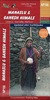


Manaslu & Tsum Valley
Manaslu and Tsum Valley High Route circuit at 1:125, 000, covering the region between the Annapurna Conservation Area and the Langtang National Park, in the Nepa Maps series which provides extensive coverage of trekking areas of Nepal on detailed contoured maps with trekking routes and hiking trails, huts and camp sites, local places of interest and other tourist information.The map covers the western route to the Manaslu massif from Bhulbhule along the Marsyangdi River, the great Himalaya and Manaslu Trek leading eastwards from Larkya La to the routes from Gorkha and Arughat Bazar along the Buddhi Gandaki, plus the Tsum Valley Trek in the north-eastern part of this area. Also highlighted are several connecting alternative routes. Contours are at 125m intervals, with relief shading
and vegetation colouring. Index lists places, peaks, lakes and passes. Margin ticks show latitude and longitude at intervals of 2’30”. Additional information includes a table showing the Manaslu Circuit in stages with altitudes in metres and feet and trekking times.Titles in this series have cartography is based on the country’s topographic survey, with contours usually at 40m or 50m intervals, enhanced by relief shading, colouring and graphics to show various features of the terrain, including glaciers, forested or cultivated areas, etc. Numerous peaks, with additional spot heights, plus names of glaciers and mountain ranges are prominently shown. The network of rivers, streams and lakes is shown in great detail, with many smaller rivers and lakes named. Overprint
highlights main trekking routes and numerous local trails, with symbols indicating various places of interest and tourist facilities. Most maps are indexed and include additional information such as route profiles, glossaries, etc. All the information is in English and heights are given in metres.

Product Description
Reviews/Comments
Add New
Vouchers
No voucher codes found.
Do you know a voucher code for this product or supplier? Add it to Insights for others to use.
Do you know a voucher code for this product or supplier? Add it to Insights for others to use.
 Denmark