More From Contributor

£8.99
Manama on a GPS-compatible street plan from the Dubai-based Explorer Publishing, presenting on one side the city at 1:15, 000, plus on the reverse a wider area including the Bahrain International Airport at 1:32, 000. All place names are in the Latin alphabet only. On one side is a plan of the city at 1:15, 000 highlighting its network of main traffic arteries. The plan shows names of neighbourhoods, plus of main & selected connecting streets. Various facilities & places of interest are named and/or marked by symbols, including hotels & restaurants, banks, embassies & consulates, etc. Coverage

Includes::
access to the Bahrain International Airport. Accompanying index lists neighbourhoods, shopping, hotels, etc. The plan has a 1km UTM grid. On the reverse a wider area of Manama, including the Bahrain International Airport & the Amwaj Isl&, is presented at 1:32, 000 with a 2-km UTM grid. Also provided is a small overview road map of Bahrain. Map legend & names of facilities are in English.

...
Archived Product
£8.99
Having battled & succumbed to the manana pace of rural Mallorca, spring sees Peter Kerr & family relaxing into a supposedly simpler way of life, growing oranges on their little valley farm, Ca`s Mayoral. However, even after the trials, tribulations & triumphs of their initiation, Spain has not yet finished with them. Embarrassing subtleties of the language, brushes with the local police, the unfortunate outcome of a drinking session.. .surprises are aplenty to test the resolve, stamina &, perhaps more importantly, the sense of humour of this venturesome (some would say foolhardy) emigre family. Their eccentric & colourful new friends are always on hand to help out
- for better or worse
- & add spice to this engaging account of tranquilo life from the author of Snowball Oranges. All the charm of Mallorca: where you seldom do today what can be more judiciously put off till manana! Follow Peter on Twitter
- @ Author Peter Kerr


...
Archived Product
£19.99
Manaslu Himal & Ganesh Himal, map no. 106, at 1:125, 000 on a waterproof & tear-resistant trekking map from the Himalayan Map House in their series covering the whole of northern Nepal. The map shows the northern part of the Tsum Valley & the surrounding mountains including Ganesh (Yangra) as an inset & highlights treks north of Arughat Bazar & Besisahar, including the Manaslu Circuit, Ganesh Himal & Tsum Valley treks, Himal Chuli Base Camp Trek & Rupina La Trek. Also highlighted are the relevant sections of the GHT Cultural Trail & the GHT High Route. Contours are at 80m intervals. Route profile shows the Manaslu & Ganesh section of the GHT High Route between Dharapani & Tipling. Cartography in these waterproof editions, first published in 2011, is identical to what Himalayan Map House use in most maps in their other series, published under the Nepa Maps imprint. Contours are at intervals of 80m or 40m (please check individual descriptions), with relief shading plus colouring to show different types of terrain or vegetation. The maps show names of numerous chains, peaks glaciers, valleys, rivers, lakes, etc. Main trekking routes are prominently highlighted, as are selected settlements along them, indicating where tourist accommodation & other services are provided. Also clearly marked are campsites or base camps & various places of interest. The maps also show other local trekking paths, often providing variants or shortcuts to the main routes. The maps are not indexed. Latitude & longitude coordinates are given as margin ticks at 5’ intervals. Unless indicated to the contrary in its individual description, each map also

Includes::
a profile of the main trekking route (s) across its area & provides on the inside cover other relevant information, including stage-by-stage distances & timings. The maps are published on thick, sturdy, waterproof & tear-resistant plastic.* For maps not currently in stock please check availability of corresponding titles in the publishers’ other series under the Nepa Maps imprint. Although printed on paper, most titles are indexed & some are at larger scales and/or include enlargements.

...
Archived Product
£17.99
Manaslu & Tsum Valley High Route circuit at 1:125, 000, covering the region between the Annapurna Conservation Area & the Langtang National Park, in the Nepa Maps series which provides extensive coverage of trekking areas of Nepal on detailed contoured maps with trekking routes & hiking trails, huts & camp sites, local places of interest & other tourist information. The map covers the western route to the Manaslu massif from Bhulbhule along the Marsyangdi River, the great Himalaya & Manaslu Trek leading eastwards from Larkya La to the routes from Gorkha & Arughat Bazar along the Buddhi Gandaki, plus the Tsum Valley Trek in the north-eastern part of this area. Also highlighted are several connecting alternative routes. Contours are at 125m intervals, with relief shading & vegetation colouring. Index lists places, peaks, lakes & passes. Margin ticks show latitude & longitude at intervals of 2’30”. Additional information

Includes::
a table showing the Manaslu Circuit in stages with altitudes in metres & feet & trekking times. Titles in this series have cartography is based on the country’s topographic survey, with contours usually at 40m or 50m intervals, enhanced by relief shading, colouring & graphics to show various features of the terrain, including glaciers, forested or cultivated areas, etc. Numerous peaks, with additional spot heights, plus names of glaciers & mountain ranges are prominently shown. The network of rivers, streams & lakes is shown in great detail, with many smaller rivers & lakes named. Overprint highlights main trekking routes & numerous local trails, with symbols indicating various places of interest & tourist facilities. Most maps are indexed & include additional information such as route profiles, glossaries, etc. All the information is in English & heights are given in metres.

...
Archived Product
£19.95
Manaslu & Ganesh Himals, map no. 106, at 1:125, 000 on a waterproof & tear-resistant trekking map from the Himalayan Map House in their series covering the whole of northern Nepal. The map shows the northern part of the Tsum Valley & the surrounding mountains including Ganesh (Yangra) as an inset & highlights treks north of Arughat Bazar & Besisahar, including the Manaslu Circuit, Ganesh Himal & Tsum Valley treks, Himal Chuli Base Camp Trek & Rupina La Trek. Also highlighted are the relevant sections of the GHT Cultural Trail & the GHT High Route. Contours are at 80m intervals. Route profile shows the Manaslu & Ganesh section of the GHT High Route between Dharapani & Tipling. Cartography in these waterproof editions, first published in 2011, is identical to what Himalayan Map House use in most maps in their other series, published under the Nepa Maps imprint. Contours are at intervals of 80m or 40m (please check individual descriptions), with relief shading plus colouring to show different types of terrain or vegetation. The maps show names of numerous chains, peaks glaciers, valleys, rivers, lakes, etc. Main trekking routes are prominently highlighted, as are selected settlements along them, indicating where tourist accommodation & other services are provided. Also clearly marked are campsites or base camps & various places of interest. The maps also show other local trekking paths, often providing variants or shortcuts to the main routes. The maps are not indexed. Latitude & longitude coordinates are given as margin ticks at 5 ...
Archived Product
£5.59
Map No. 109, Manchester, in the Ordnance Survey Landranger series at 1:50, 000, including Bolton, Warrington, Appleton Thorn, Mere, Wilmslow, Bramhall, Poynton, New Mills, Cheadle, Lymm, Altrincham, Stockport, Romiley, Sel, Irlam, Clucheth, Golborne, Leigh, Platt Bridge, Salford, Ashton-under-Lyne, Stalybridge, Mossley, Oldham, Walkden, Middleton, Westhoughton, Bury, Denshaw, Rochdale, Tottington, Horwich, Egerton & Ramsbottom, with a section of the Pennine Way & a small part of the Peak District National Park. Edition D3; Revised for selected changes 2009; Copyright date 2009 This title is also available on our website in a waterproof & tear-resistant version. Maps in this series are only published folded. Stanfords can also print flat versions of Ordnance Survey maps through the OS Select system, centring the map on a location of your choice & with a picture provided by you on the cover. For more information please click on the link at the bottom of this description. About Ordnance Survey ...
Archived Product
£6.39
A detailed topographic map of Manchester & Salford from the Ordnance Survey Explorer series, covering Oldham, Rochdale & Stockport. Edition A3; Publication date September 2010 About this series: These highly detailed maps show all the administrative boundaries, settlements as small as isolated farms, the road network down to unfenced roads & country tracks, & field boundaries (hedges & drystone walls) which make navigation across the countryside much easier. Steep gradients on roads are indicated. Various landmarks, e.g. powerlines, archaeological sites, windmills, churches & lighthouses are shown & additional graphics indicate natural terrain features such as cliffs, scree, mud & vegetation variations. The contour interval is 5 metres in the lower parts of the country & 10 metres in the uplands, & spot heights are marked. Each map covers an area of 30 x 20km (i.e. approx. 19 x 12 miles), with some double-sided maps covering more, as indicated in the individual descriptions. The maps are fully GPS compatible, with the National Grid shown at 1km intervals & latitude & longitude indicated by margin ticks at 1'. The Explorer series has replaced the earlier, green-cover Pathfinder maps. The Explorer series is now complete & covers all of Engl&, Wales & Scotl&. Some sheets for popular areas like the National Parks are still branded as Outdoor Leisure (OL) maps, but are now included in this series as the cartography is the same as that in the Explorer Maps. The Explorer maps offer a substantial improvement on the Pathfinder series, with greater use of colour, larger area per map, & stronger emphasis on information for ramblers & tourists. This series is ideal for walking & other outdoor pursuits & each map shows a large amount of information for ramblers & tourists. Public rights of way are shown (except in Scotland), together with other routes with public access: National Trails & Recreational Paths, permitted paths & bridleways, & selected cycle routes. Open access land created under the Countryside & Rights of Way Act 2000 is marked. Tourist information

Includes::
caravan & camp sites, Park & Ride locations, recreation/leisure/sport centres, museums, historic buildings, English Heritage & National Trust sites, rural pubs, etc. The map legend is in English only, except for the tourist information content which is also in French & German.

...
Archived Product
£14.99
Manchester, Salford, Oldham, Rochdale & Stockport area on a detailed topographic & GPS compatible map No. 277, waterproof version, from the Ordnance Survey’s 1:25, 000 Explorer series. MOBILE DOWNLOADS: this title & all the other OS Explorer maps include a code for downloading after purchase the digital version onto your smartphone or tablet for viewing on the OS smartphone app.OS EXPLORER SERIES: to see the list of all the titles in the OS Explorer series, both paper & waterproof versions, please click on the series link. The Explorer series, Ordnance Survey’s most detailed maps recommended for anyone enjoying outdoor activities, provides topographic coverage of Great Britain at 1:25, 000 on GPS compatible maps with hiking trails, cycling routes & extensive tourist information. Each printed map is available either on paper or as a waterproof & tear-resistant OS Active Map, as indicated in its title. Britain’s National Parks & other areas of particular tourist interest are presented on often double-sided OL (Outdoor Leisure) maps, whilst most standard format Explorers cover an area of 30 x 20km (approx. 19 x 12 miles). All three versions (paper, waterproof & digital) are the same & provide plenty of recreational & tourist information, indicating the traditional public right of way paths (except in Scotland where different laws apply), including bridleways & byways. National Trails & other long-distance paths are marked, as well as permissive footpaths or bridleways & on-road or traffic-free cycle routes with, where appropriate, their National/ Regional Cycle Network numbers. Boundaries of access land are clearly marked. A wide range of symbols provides additional tourist information, highlighting camping & caravanning sites, information offices & visitors’ centres, parking & picnicking places, country pubs, sport & recreational facilities including cycle hire locations & mountain biking trails, historic buildings & museums, etc. Exceptionally clear presentation of the landscape is provided by contours at 5m or in the uplands at 10m intervals, with additional spot heights plus colouring and/or graphics for different types of woodlands, orchards, heath, marshl&, scree or boulders, & other topographic features. For GPS users the maps have British National Grid lines at 1km intervals, with latitude & longitude given by margin ticks at 1`. Clearly laid out map legend

Includes::
French & German translations for the tourist information symbols.

...
Archived Product
£8.99
Manchester, Salford, Oldham, Rochdale & Stockport area on a detailed topographic & GPS compatible map No. 277, paper version, from the Ordnance Survey’s 1:25, 000 Explorer series.MOBILE DOWNLOADS: this title & all the other OS Explorer maps include a code for downloading after purchase the digital version onto your smartphone or tablet for viewing on the OS smartphone app.OS EXPLORER SERIES: to see the list of all the titles in the OS Explorer series, both paper & waterproof versions, please click on the series link. The Explorer series, Ordnance Survey’s most detailed maps recommended for anyone enjoying outdoor activities, provides topographic coverage of Great Britain at 1:25, 000 on GPS compatible maps with hiking trails, cycling routes & extensive tourist information. Each printed map is available either on paper or as a waterproof & tear-resistant OS Active Map, as indicated in its title. Britain’s National Parks & other areas of particular tourist interest are presented on often double-sided OL (Outdoor Leisure) maps, whilst most standard format Explorers cover an area of 30 x 20km (approx. 19 x 12 miles). All three versions (paper, waterproof & digital) are the same & provide plenty of recreational & tourist information, indicating the traditional public right of way paths (except in Scotland where different laws apply), including bridleways & byways. National Trails & other long-distance paths are marked, as well as permissive footpaths or bridleways & on-road or traffic-free cycle routes with, where appropriate, their National/ Regional Cycle Network numbers. Boundaries of access land are clearly marked. A wide range of symbols provides additional tourist information, highlighting camping & caravanning sites, information offices & visitors’ centres, parking & picnicking places, country pubs, sport & recreational facilities including cycle hire locations & mountain biking trails, historic buildings & museums, etc. Exceptionally clear presentation of the landscape is provided by contours at 5m or in the uplands at 10m intervals, with additional spot heights plus colouring and/or graphics for different types of woodlands, orchards, heath, marshl&, scree or boulders, & other topographic features. For GPS users the maps have British National Grid lines at 1km intervals, with latitude & longitude given by margin ticks at 1`. Clearly laid out map legend

Includes::
French & German translations for the tourist information symbols.

...
Archived Product
£11.19
Laminated waterproof edition of a detailed topographic map of Manchester & Salford from the Ordnance Survey Explorer series, covering Oldham, Rochdale & Stockport. Edition A3; Publication date March 2011 About this series: These highly detailed maps show all the administrative boundaries, settlements as small as isolated farms, the road network down to unfenced roads & country tracks, & field boundaries (hedges & drystone walls) which make navigation across the countryside much easier. Steep gradients on roads are indicated. Various landmarks, e.g. powerlines, archaeological sites, windmills, churches & lighthouses are shown & additional graphics indicate natural terrain features such as cliffs, scree, mud & vegetation variations. The contour interval is 5 metres in the lower parts of the country & 10 metres in the uplands, & spot heights are marked. Each map covers an area of 30 x 20km (i.e. approx. 19 x 12 miles), with some double-sided maps covering more, as indicated in the individual descriptions. The maps are fully GPS compatible, with the National Grid shown at 1km intervals & latitude & longitude indicated by margin ticks at 1'. The Explorer series has replaced the earlier, green-cover Pathfinder maps. The Explorer series is now complete & covers all of Engl&, Wales & Scotl&. Some sheets for popular areas like the National Parks are still branded as Outdoor Leisure (OL) maps, but are now included in this series as the cartography is the same as that in the Explorer Maps. The Explorer maps offer a substantial improvement on the Pathfinder series, with greater use of colour, larger area per map, & stronger emphasis on information for ramblers & tourists. This series is ideal for walking & other outdoor pursuits & each map shows a large amount of information for ramblers & tourists. Public rights of way are shown (except in Scotland), together with other routes with public access: National Trails & Recreational Paths, permitted paths & bridleways, & selected cycle routes. Open access land created under the Countryside & Rights of Way Act 2000 is marked. Tourist information

Includes::
caravan & camp sites, Park & Ride locations, recreation/leisure/sport centres, museums, historic buildings, English Heritage & National Trust sites, rural pubs, etc. The map legend is in English only, except for the tourist information content which is also in French & German.

...
Archived Product

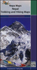
Manaslu And Tsum Valley

Manaslu and Tsum Valley High Route circuit at 1:125, 000, covering the region between the Annapurna Conservation Area and the Langtang National Park, in the Nepa Maps series which provides extensive coverage of trekking areas of Nepal on detailed contoured maps with trekking routes and hiking trails, huts and camp sites, local places of interest and other tourist information.The map covers the western route to the Manaslu massif from Bhulbhule along the Marsyangdi River, the great Himalaya and Manaslu Trek leading eastwards from Larkya La to the routes from Gorkha and Arughat Bazar along the Buddhi Gandaki, plus the Tsum Valley Trek in the north-eastern part of this area. Also highlighted are several connecting alternative routes.Contours are at 125m intervals, with relief shading
and vegetation colouring. Index lists places, peaks, lakes and passes. Margin ticks show latitude and longitude at intervals of 15
RIP - This product is no longer available on our network. It was last seen on 25.09.2019

This page now acts as a permanent archive for this product. Add more information using the comments box below to ensure it can still be found by future generations.

Use our search facility to see if it is available from an alternative contributor.
  • Availability: Out Of Stock
  • Supplier: Stanfords
  • SKU: 9799993323104
Availability: In Stock
£17.95

Product Description

Manaslu & Tsum Valley High Route circuit at 1:125, 000, covering the region between the Annapurna Conservation Area & the Langtang National Park, in the Nepa Maps series which provides extensive coverage of trekking areas of Nepal on detailed contoured maps with trekking routes & hiking trails, huts & camp sites, local places of interest & other tourist information. The map covers the western route to the Manaslu massif from Bhulbhule along the Marsyangdi River, the great Himalaya & Manaslu Trek leading eastwards from Larkya La to the routes from Gorkha & Arughat Bazar along the Buddhi Gandaki, plus the Tsum Valley Trek in the north-eastern part of this area. Also highlighted are several connecting alternative routes. Contours are at 125m intervals, with relief shading & vegetation colouring. Index lists places, peaks, lakes & passes. Margin ticks show latitude & longitude at intervals of 15

Reviews/Comments

Add New

Intelligent Comparison

Oooops!
We couldn't find anything!
Perhaps this product's unique.... Or perhaps we are still looking for comparisons!
Click to bump this page and we'll hurry up.

Price History

Vouchers

No voucher codes found.
Do you know a voucher code for this product or supplier? Add it to Insights for others to use.

Facebook

Jargon Buster

Hiking - An outdoor activity envolving walking in nature
Alternative - Another available choice or possibility

Supplier Information

Stanfords
Stanfords was established in 1853 and opened their iconic Covent Garden flagship store in 1901. They have become the top retailer of maps, travel books and accessories in the UK and arguably offer the largest selection of maps and travel books worldwide. Famous names such as Captain Robert Falcon Scott, Ranulph Fiennes and Michael Palin have purchased from Stanfords. They now have a shop in Bristol and both stores together with other venues operate a calendar of events including talks, book signings and exhibitions. As a specialist map retailer, the map selection is comprehensive and includes road maps, street maps and walking maps from worldwide destinations, as well as a selection of world atlases and wall maps. Books include travel guides and travel literature. Stanfords also stock globes, from miniatures made of blue marble to magnificent floor-standing globes. The website features a selection of interesting articles on travel topics.
Page Updated: 2023-11-12 20:15:36

Community Generated Product Tags

Oh No! The productWIKI community hasn't generated any tags for this product yet!
Menu