More From Contributor
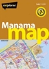
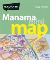
£9.99
It`s an extraordinary tale of yeast-obsessed monks & teetotal prime ministers; of how pale ale fuelled an Empire & weak bitter won a world war; &, of exploding breweries, a bear in a yellow nylon jacket & a Canadian bloke who changed the drinking habits of a nation. It`s also the story of the rise of the pub from humble origins through an epic, thous&-year struggle to survive misunderstanding, bad government & misguided commerce. The history of beer in Britain is a social history of the nation itself, full of catastrophe, heroism & an awful lot of hangovers. `a pleasant antidote to more pro-faced histories of beer`
- ” Guardian”. ` Like a good drinking companion, Brown tells a remarkable story: a stream of fascinating facts, etymologies & pub-related urban phenomena`
- ”TLS”. ` Packed with bar-room bet-winning facts & entertaining digressions, this is a book into which every pub-goer will want to dip`
- ” Express”.


...
Archived Product
£11.50
One of the titles in the topographic survey of the coastal part of French Guiana, published as an extension of IGN’s survey of France to its overseas departments. Contours are at 5m intervals & the maps indicate 13 different types of vegetation & land use, including rain forest, brushwood, savanna, high & low mangrove, rice fields, orchards & plantations, etc. The extent of changes in the coastline in the recent decades is indicated. The maps have a UTM grid & latitude/longitude lines at intervals of 5’. Map legend

Includes::
English.

...
Archived Product
£6.50
Topographic coverage of the Balearic Islands at 1:25, 000 published by the Instituto Geográfico Nacional – Centro Nacional de Información Geografica, the country’s civilian survey organization. The maps have contours at 10m intervals & colouring and/or graphics to show different types of vegetation or land use. Boundaries of national parks & other protected areas are marked. In addition to all the usual information shown on topographic mapping at this scale: detailed presentation of the road & rail networks, rural tracks & paths, etc, the maps also show campsites. The maps have a 1-km UTM grid, plus margin ticks for latitude & longitude at 1` intervals. The majority of the titles have been published since late 1990s. Map legend is in Spanish only.COVERAGE: each 25K map covers one quarter of the corresponding 1:50, 000 map, with the numbering system: I = NW quarter, II = NE quarter, III = SW quarter, & IV = SE quarter. To see other titles in this series please click on the series link. ...
Archived Product
£70.00
Collision avoidance as a vital element of ship safety should be recognised in company instructions & Masters’ standing orders. Safe strategies are outlined with case studies to help improve collision avoidance practice at sea by examining the ways watchkeeping officers make decisions.

Includes::
managing navigational risk, collision avoidance measures for effective control, applying the COLREGS, ship manoeuvring & collision avoidance.

...
Archived Product
£15.00
Produced in partnership with Human Rights at Sea & psychological health consultancy March on Stress, this booklet provides toplevel guidance for senior management to help improve the mental health of seafarers. It will be of particular value to ship managers/operators, HR departments & all involved with seafarers’ welfare around the world. Untreated post-traumatic stress disorder can lead to poor decision-making & may have legal & financial consequences for a maritime organisation. This concise guidance, which stresses the importance of early detection & prevention of mental health issues at sea, is essential reading for all responsible maritime organisations in supporting their most important asset – their people. ...
Archived Product
£8.99
Manama on a GPS-compatible street plan from the Dubai-based Explorer Publishing, presenting on one side the city at 1:15, 000, plus on the reverse a wider area including the Bahrain International Airport at 1:32, 000. All place names are in the Latin alphabet only. On one side is a plan of the city at 1:15, 000 highlighting its network of main traffic arteries. The plan shows names of neighbourhoods, plus of main & selected connecting streets. Various facilities & places of interest are named and/or marked by symbols, including hotels & restaurants, banks, embassies & consulates, etc. Coverage

Includes::
access to the Bahrain International Airport. Accompanying index lists neighbourhoods, shopping, hotels, etc. The plan has a 1km UTM grid. On the reverse a wider area of Manama, including the Bahrain International Airport & the Amwaj Isl&, is presented at 1:32, 000 with a 2-km UTM grid. Also provided is a small overview road map of Bahrain. Map legend & names of facilities are in English.

...
Archived Product
£8.99
Having battled & succumbed to the manana pace of rural Mallorca, spring sees Peter Kerr & family relaxing into a supposedly simpler way of life, growing oranges on their little valley farm, Ca`s Mayoral. However, even after the trials, tribulations & triumphs of their initiation, Spain has not yet finished with them. Embarrassing subtleties of the language, brushes with the local police, the unfortunate outcome of a drinking session.. .surprises are aplenty to test the resolve, stamina &, perhaps more importantly, the sense of humour of this venturesome (some would say foolhardy) emigre family. Their eccentric & colourful new friends are always on hand to help out
- for better or worse
- & add spice to this engaging account of tranquilo life from the author of Snowball Oranges. All the charm of Mallorca: where you seldom do today what can be more judiciously put off till manana! Follow Peter on Twitter
- @ Author Peter Kerr


...
Archived Product
£19.99
Manaslu Himal & Ganesh Himal, map no. 106, at 1:125, 000 on a waterproof & tear-resistant trekking map from the Himalayan Map House in their series covering the whole of northern Nepal. The map shows the northern part of the Tsum Valley & the surrounding mountains including Ganesh (Yangra) as an inset & highlights treks north of Arughat Bazar & Besisahar, including the Manaslu Circuit, Ganesh Himal & Tsum Valley treks, Himal Chuli Base Camp Trek & Rupina La Trek. Also highlighted are the relevant sections of the GHT Cultural Trail & the GHT High Route. Contours are at 80m intervals. Route profile shows the Manaslu & Ganesh section of the GHT High Route between Dharapani & Tipling. Cartography in these waterproof editions, first published in 2011, is identical to what Himalayan Map House use in most maps in their other series, published under the Nepa Maps imprint. Contours are at intervals of 80m or 40m (please check individual descriptions), with relief shading plus colouring to show different types of terrain or vegetation. The maps show names of numerous chains, peaks glaciers, valleys, rivers, lakes, etc. Main trekking routes are prominently highlighted, as are selected settlements along them, indicating where tourist accommodation & other services are provided. Also clearly marked are campsites or base camps & various places of interest. The maps also show other local trekking paths, often providing variants or shortcuts to the main routes. The maps are not indexed. Latitude & longitude coordinates are given as margin ticks at 5’ intervals. Unless indicated to the contrary in its individual description, each map also

Includes::
a profile of the main trekking route (s) across its area & provides on the inside cover other relevant information, including stage-by-stage distances & timings. The maps are published on thick, sturdy, waterproof & tear-resistant plastic.* For maps not currently in stock please check availability of corresponding titles in the publishers’ other series under the Nepa Maps imprint. Although printed on paper, most titles are indexed & some are at larger scales and/or include enlargements.

...
Archived Product
£17.99
Manaslu & Tsum Valley High Route circuit at 1:125, 000, covering the region between the Annapurna Conservation Area & the Langtang National Park, in the Nepa Maps series which provides extensive coverage of trekking areas of Nepal on detailed contoured maps with trekking routes & hiking trails, huts & camp sites, local places of interest & other tourist information. The map covers the western route to the Manaslu massif from Bhulbhule along the Marsyangdi River, the great Himalaya & Manaslu Trek leading eastwards from Larkya La to the routes from Gorkha & Arughat Bazar along the Buddhi Gandaki, plus the Tsum Valley Trek in the north-eastern part of this area. Also highlighted are several connecting alternative routes. Contours are at 125m intervals, with relief shading & vegetation colouring. Index lists places, peaks, lakes & passes. Margin ticks show latitude & longitude at intervals of 2’30”. Additional information

Includes::
a table showing the Manaslu Circuit in stages with altitudes in metres & feet & trekking times. Titles in this series have cartography is based on the country’s topographic survey, with contours usually at 40m or 50m intervals, enhanced by relief shading, colouring & graphics to show various features of the terrain, including glaciers, forested or cultivated areas, etc. Numerous peaks, with additional spot heights, plus names of glaciers & mountain ranges are prominently shown. The network of rivers, streams & lakes is shown in great detail, with many smaller rivers & lakes named. Overprint highlights main trekking routes & numerous local trails, with symbols indicating various places of interest & tourist facilities. Most maps are indexed & include additional information such as route profiles, glossaries, etc. All the information is in English & heights are given in metres.

...
Archived Product
£19.95
Manaslu & Ganesh Himals, map no. 106, at 1:125, 000 on a waterproof & tear-resistant trekking map from the Himalayan Map House in their series covering the whole of northern Nepal. The map shows the northern part of the Tsum Valley & the surrounding mountains including Ganesh (Yangra) as an inset & highlights treks north of Arughat Bazar & Besisahar, including the Manaslu Circuit, Ganesh Himal & Tsum Valley treks, Himal Chuli Base Camp Trek & Rupina La Trek. Also highlighted are the relevant sections of the GHT Cultural Trail & the GHT High Route. Contours are at 80m intervals. Route profile shows the Manaslu & Ganesh section of the GHT High Route between Dharapani & Tipling. Cartography in these waterproof editions, first published in 2011, is identical to what Himalayan Map House use in most maps in their other series, published under the Nepa Maps imprint. Contours are at intervals of 80m or 40m (please check individual descriptions), with relief shading plus colouring to show different types of terrain or vegetation. The maps show names of numerous chains, peaks glaciers, valleys, rivers, lakes, etc. Main trekking routes are prominently highlighted, as are selected settlements along them, indicating where tourist accommodation & other services are provided. Also clearly marked are campsites or base camps & various places of interest. The maps also show other local trekking paths, often providing variants or shortcuts to the main routes. The maps are not indexed. Latitude & longitude coordinates are given as margin ticks at 5 ...
Archived Product

Manama Mini Map

Manama on a handy size Mini Map from the Dubai-base Explorer Publishing, presenting on one side the city’s central districts at 1:15, 000, with on the reverse a wider area including access to the Bahrain International Airport at 1:32, 000. All place names are in the Latin alphabet only, with names of facilities and places of interest in English. Both plans have UTM grids and one combined index listing districts, hotels, museums, etc.
RIP - This product is no longer available on our network. It was last seen on 25.09.2019

This page now acts as a permanent archive for this product. Add more information using the comments box below to ensure it can still be found by future generations.

Use our search facility to see if it is available from an alternative contributor.
  • Availability: Out Of Stock
  • Supplier: Stanfords
  • SKU: 9789948450894
Availability: In Stock
£3.99

Product Description

Manama on a handy size Mini Map from the Dubai-base Explorer Publishing, presenting on one side the city’s central districts at 1:15, 000, with on the reverse a wider area including access to the Bahrain International Airport at 1:32, 000. All place names are in the Latin alphabet only, with names of facilities & places of interest in English. Both plans have UTM grids & one combined index listing districts, hotels, museums, etc.

Reviews/Comments

Add New

Intelligent Comparison

Oooops!
We couldn't find anything!
Perhaps this product's unique.... Or perhaps we are still looking for comparisons!
Click to bump this page and we'll hurry up.

Price History

Vouchers

No voucher codes found.
Do you know a voucher code for this product or supplier? Add it to Insights for others to use.

Facebook

Jargon Buster

Size - is the measurement of how big an object is in space.

Supplier Information

Stanfords
Stanfords was established in 1853 and opened their iconic Covent Garden flagship store in 1901. They have become the top retailer of maps, travel books and accessories in the UK and arguably offer the largest selection of maps and travel books worldwide. Famous names such as Captain Robert Falcon Scott, Ranulph Fiennes and Michael Palin have purchased from Stanfords. They now have a shop in Bristol and both stores together with other venues operate a calendar of events including talks, book signings and exhibitions. As a specialist map retailer, the map selection is comprehensive and includes road maps, street maps and walking maps from worldwide destinations, as well as a selection of world atlases and wall maps. Books include travel guides and travel literature. Stanfords also stock globes, from miniatures made of blue marble to magnificent floor-standing globes. The website features a selection of interesting articles on travel topics.
Page Updated: 2023-11-12 20:15:36

Community Generated Product Tags

Oh No! The productWIKI community hasn't generated any tags for this product yet!
Menu