More From Contributor
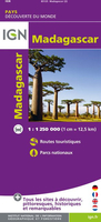
£9.95
Indexed road map, showing relief & annotated with geographical notes. Elevation colouring & spot heights show the general relief. Road detail

Includes::
some tracks, & locations with petrol supplies are marked. Railways, ports, sea ferries, airports & airfields are also shown. Wetland areas, reserves & national parks are indicated, & symbols depict various features e.g. historic sites, places of interest, antiquities, waterfalls, campsites, lodgings, beaches, hospitals & post offices. Latitude & longitude lines are drawn at 2

...
Archived Product
£4.99
Madagascar at 1:800, 000 is an indexed map with additional street plans & enlargements of popular regions on the reverse. The publisher has chosen to concentrate on creating a map which will primarily be of use for a tourist navigating between main points of interest as opposed to stressing more detailed cartography. Tarred & untarred national & main roads & minor roads are clearly marked, as are airports & ferry routes. Provincial boundaries are demarcated. In keeping with the publisher ...
Archived Product
£10.95
Madagascar at 1:1, 250, 000 from the IGN with cartography from Mair Dumont, with more smaller settlements than on other maps of the whole country. Very effective relief shading, altitude colouring & spot heights present the topography, with colouring and/or graphics for seasonal lakes & swamps, mangrove, sand dunes, rice fields, waterfalls, etc. National parks & other protected areas are highlighted. The map indicates unpaved roads &

Includes::
local tracks, showing routes closed to motorized traffic. No intermediate distances are marked. Railway lines & local airports or aerodromes are included. Symbols show various places of interest including campsites, beaches, diving & windsurfing sites, shipwrecks, etc. Latitude & longitude lines are drawn at 1

...
Archived Product
£9.95
Madagascar on a large, double-sided, indexed road map with tourist information, a plan of central Antananarivo & an inset showing the Comoros Islands. National parks & other protected areas are highlighted on a base map with topography shown by bold relief shading with spot heights. Road network

Includes::
seasonal tracks & shows locations of petrol stations & driving distances on main routes. Railways, local airports & ferry routes are marked & the map shows the country

...
Archived Product
£9.50
Indexed, waterproof & tear-resistant road map Madagascar with topographic & tourist information, published by Reise Know-How as part of their highly acclaimed World Mapping Project. The map is double-sided to provide the best balance between a good scale & a convenient size sheet. Coverage

Includes::
the Comoros Islands & Mayotte. Topography is indicated by altitude colouring with spot heights & mountain passes, names of mountain ranges & plateaux, seasonal rivers & lakes, mangroves & coral reefs. Road information

Includes::
seasonal tracks & indicates intermediate driving distances on main & secondary roads & locations of petrol stations. Railways, local airfields & coastal ferry connections are also shown, as well as internal administrative boundaries. National parks & protected areas are marked & symbols highlight various places of interest: selected accommodation including campsites, UNESCO world heritage sites, rovas (former royal palaces), beaches, surfing & diving locations, viewpoints, wells, medical facilities, etc. The map has a latitude/longitude grid at intervals of 1


...
Archived Product
£17.99
Two thousand years ago, Madagascar was probably uninhabited. An island twice the size of Great Britain, it was home to unique species of flora & fauna that were undisturbed by humanity until the first navigators landed on its shores. Since then, the changes imposed by humans on the wide range of environments to be found in this mini-continent have formed one of the threads of Madagascar`s history. No one knows where the island`s first inhabitants came from, but there was a strong connection from the earliest period to the islands of South East Asia
- today`s Indonesia. Austronesians, Arabs, Portuguese, & Dutch sailors & traders successively dominated the sea-lanes around Madagascar, some of the world`s oldest long-distance shipping routes. Over the centuries, Madagascar developed its own distinctive language & cultural systems, absorbing migrants from every shore of the Indian Ocean. In the nineteenth century, Britain & France projected a new type of global power that had a major effect on the isl&, which became a French colony from 1896 to 1960. Throughout this colourful & often turbulent history, the tension between the formation of a highly original culture & the absorption of immigrants, the development of strong social hierarchies, a long experience of slavery & the slave trade, have all had effects that are still felt today. Now home to 17 million people, Madagascar is one of the world`s most fascinating & least-known societies.
...
Archived Product
£12.79
Madagascar & Comoros in the Countries & Regions series from Lonely Planet, market-leading comprehensive guides aimed at independent travellers & serving a large range of international destinations. Frank & informal in style, the guides explore an extensive range of sights, activities, accommodation, restaurants & nightlife & are designed for practical use while travelling on the road. Written & researched by a team of experts, each book is independent in its recommendations & suggestions, often offering individual takes on individual destinations. Widely recognised for their reliability, each Lonely Planet country & region guide has the same layout. Introductory sections profile the destination with individual chapters on particular highlights, getting started, (including when to go) itineraries, history, culture, arts, food & drink & the environment. Each guide is organised geographically by region, with individual sections detailing an extensive range of sights, places of interest, attractions, restaurants, nightlife, accommodation & any local activities. The guides have detailed explanations of historical context where relevant. There is also practical guidance on ...
Archived Product
£9.99
The highly successful Globetrotter Travel Series, which

Includes::
Travel Guides, Travel Maps, Road Atlases,

...
Archived Product
£11.99
Madagascar – The Eighth Continent – Life, Death & Discovery in a Lost World by Peter Tyson takes the reader on a journey & offers comprehensive observations that new & familiar people with the island will love. Combining personal adventures with scientific facts & historical narrative, the author recalls his experience during four trips to the isl&, in the 1990s. Tyson joined a group of scientists
- a herpetologist, a paleoecologist, an archaeologist & a primatologist. The expeditions took them around the isl&, living in the rainforest of Nosy Be as well as the desert of the southwest, searching for species never recorded before. The conclusions of their findings make up much of this book that explores where plants & animals particular to the island come from, what caused the extinction of some species, the origins of the population as well as the environmental crisis, & how its natural & human treasures can be saved. The rich material, supplemented with an introduction which provides an historical context & 16 pages of colour photographs, is blended with personal accounts which make this read entertaining. An Epilogue at the end of the book, first published in 2000, brings this edition up to date on the scientists, political, demographic, scientific & conservationist changes in the country. Madagascar – The Eighth Continent is a must- read for anyone interested in this isl&, its people & finding out the reasons why it is so unique & extraordinary.
...
Archived Product
£12.79
Madagascar & Comoros in the Countries & Regions series from Lonely Planet, market-leading comprehensive guides aimed at independent travellers & serving a large range of international destinations. Frank & informal in style, the guides explore an extensive range of sights, activities, accommodation, restaurants & nightlife & are designed for practical use while travelling on the road. Written & researched by a team of experts, each book is independent in its recommendations & suggestions, often offering individual takes on individual destinations. Widely recognised for their reliability, each Lonely Planet country & region guide has the same layout. Introductory sections profile the destination with individual chapters on particular highlights, getting started, (including when to go) itineraries, history, culture, arts, food & drink & the environment. Each guide is organised geographically by region, with individual sections detailing an extensive range of sights, places of interest, attractions, restaurants, nightlife, accommodation & any local activities. The guides have detailed explanations of historical context where relevant. There is also practical guidance on ...
Archived Product

Madagascar

Clear and detailed road map with a plan of Antananarivo. Hill shading and selected spot heights show the topography. National parks and natural protected areas, waterfalls, reservoirs, mangroves and coral reefs are indicated, as wells as places of interest, viewpoints, various kinds of accommodation including campsites, restaurants, monuments and museums, mosques and churches, interesting buildings, caves, beaches, spas and campsites. The map shows seven different types of roads with intermediate driving distances, plus tracks and trails. Also marked are administrative boundaries, airports, railways, shipping routes and ports. Longitude and latitude lines are drawn at 2
RIP - This product is no longer available on our network. It was last seen on 25.09.2019

This page now acts as a permanent archive for this product. Add more information using the comments box below to ensure it can still be found by future generations.

Use our search facility to see if it is available from an alternative contributor.
  • External links may include paid for promotion
  • Availability: Out Of Stock
  • Supplier: Stanfords
  • SKU: 9789633529645
Availability: In Stock
£8.50

Product Description

Clear & detailed road map with a plan of Antananarivo. Hill shading & selected spot heights show the topography. National parks & natural protected areas, waterfalls, reservoirs, mangroves & coral reefs are indicated, as wells as places of interest, viewpoints, various kinds of accommodation including campsites, restaurants, monuments & museums, mosques & churches, interesting buildings, caves, beaches, spas & campsites. The map shows seven different types of roads with intermediate driving distances, plus tracks & trails. Also marked are administrative boundaries, airports, railways, shipping routes & ports. Longitude & latitude lines are drawn at 2

Reviews/Comments

Add New

Price History

Vouchers

No voucher codes found.
Do you know a voucher code for this product or supplier? Add it to Insights for others to use.

Facebook

Jargon Buster

Madagascar - An Island nation in the Indian Ocean
Railways - A set of tracks that have been laid for the purpose of trains to travel up and down them
Natural - not manmade
Road - a manmade lane or a path that is used to speed up travel.
Accommodation - A room in which someone can live in, for example in a hotel

Supplier Information

Stanfords
Stanfords was established in 1853 and opened their iconic Covent Garden flagship store in 1901. They have become the top retailer of maps, travel books and accessories in the UK and arguably offer the largest selection of maps and travel books worldwide. Famous names such as Captain Robert Falcon Scott, Ranulph Fiennes and Michael Palin have purchased from Stanfords. They now have a shop in Bristol and both stores together with other venues operate a calendar of events including talks, book signings and exhibitions. As a specialist map retailer, the map selection is comprehensive and includes road maps, street maps and walking maps from worldwide destinations, as well as a selection of world atlases and wall maps. Books include travel guides and travel literature. Stanfords also stock globes, from miniatures made of blue marble to magnificent floor-standing globes. The website features a selection of interesting articles on travel topics.
Page Updated: 2023-11-12 20:15:36

Community Generated Product Tags

Oh No! The productWIKI community hasn't generated any tags for this product yet!
Menu