
 United Kingdom
 France
 Germany
 Netherlands
 Sweden
 USA
USA
 Italy
Italy
 Spain
Spain
More From Contributor


Helsinki City Map
Helsinki City Map at a scale of 1:15, 000, from Finnish survey publishers Karttakeskus, is an indexed, easy to read street plan of the capital, with an enlargement of the area surrounding the railway station and central Mannerheimintie given at a scale of 1:5000. The rail station, metro stations, tramway lines and stops, bus stations and bus terminals, official taxi ranks and car parks, as well as petrol stations are detailed and one way roads are indicated. Ferry ports with route destination are also marked.Main points of visitor interest, e.g. the botanical garden, the Finnish National Gallery, or the Mannerheim house museum, are illustrated by numbered pink circles (numbers relate to a list of place names on the legend) and named pink stars on both the map proper and the
and enlargement. Other legend symbols detail the locations of tourist information points, hotels, youth hostels and camping sites, and where to go for medical treatment.A tram route plan and an overview road map of the main routes into Helsinki, at a scale of 1:100, 000, are included. English is one of seven languages on the map legend.
and enlargement. Other legend symbols detail the locations of tourist information points, hotels, youth hostels and camping sites, and where to go for medical treatment.A tram route plan and an overview road map of the main routes into Helsinki, at a scale of 1:100, 000, are included. English is one of seven languages on the map legend.
Product Description
Reviews/Comments
Add New
Intelligent Comparison
Archived Product
Helsinki City Map Stanfords
£8.50
Archived Product

Helsinki City Map Stanfords
£6.99
Archived Product
Helsinki Region City Map Stanfords
£14.95
Archived Product
Helsinki City Map & Guide Stanfords
£10.99
Archived Product
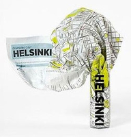
Helsinki Crumpled City Map Stanfords
£10.00
Archived Product
Michelin City Maps Stanfords
£5.99
Vouchers
No voucher codes found.
Do you know a voucher code for this product or supplier? Add it to Insights for others to use.
Do you know a voucher code for this product or supplier? Add it to Insights for others to use.
 Denmark