
 United Kingdom
 France
 Germany
 Netherlands
 Sweden
 USA
USA
 Italy
Italy
 Spain
Spain
More From Contributor

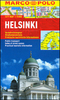


Helsinki F&B
Covers the whole city including the airport, and reaching southern Vantaa. One-way streets are indicated and pedestrian zones, car parks and public transport routes - bus, tram, metro, rail and ferry - are marked. Other details include: churches, police stations, hospitals, schools, post offices, campsites, tourist information offices, monuments, parks, forests, marshes. Legend includes English.There is a diagram of the commuter rail and metro system and a small road map of the Helsinki - Turku region.Street and district index on reverse.

Product Description
Reviews/Comments
Add New
Intelligent Comparison
Archived Product
Helsinki Stanfords
£8.25
Archived Product
Helsinki Stanfords
£17.99
Archived Product
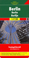
Berlin F&B Stanfords
£9.99
Archived Product

Helsinki Noir Stanfords
£11.99
Vouchers
No voucher codes found.
Do you know a voucher code for this product or supplier? Add it to Insights for others to use.
Do you know a voucher code for this product or supplier? Add it to Insights for others to use.
 Denmark