
 United Kingdom
 France
 Germany
 Netherlands
 Sweden
 USA
USA
 Italy
Italy
 Spain
Spain
More From Contributor


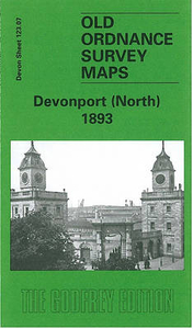
Devonport North 1893
Devonport North in 1893 in a fascinating series of reproductions of old Ordnance Survey plans in the Alan Godfrey Editions, ideal for anyone interested in the history of their neighbourhood or family. The map covers much of the dockyard area of Devonport, extending from the Tamar Quay eastward to Crawford Road, and from St Levan Road southward to Market Street. Features include GWR railway with Devonport station, LSWR railway with Devonport station, Devonport Park, tramways, Morice Town, New Granby Barracks, Royal Albert Hospital, Stoke church, Station Hospital, Royal Naval Hospital, St Peter`s church, Stonehouse Lake, part of Molesworth Ward, Clarence Ward, Tamar Ward, Morice Ward, part of St Aubyn Ward, Royal British Orphan Asylum, St Michael`s church, Old Granby
Barracks, Raglan Barracks. Please note that Gun Wharf and the Dockyard are left blank for security reasons. On the reverse are street directory entries for Albert Road, Benbow Street, Charlotte Street, Cornwall Street, Fore Street, Granby Street, Haddington Road, Keyham Road and Molesworth Road. About the Alan Godfrey Editions of the 25” OS SeriesSelected towns in Great Britain and Ireland are covered by maps showing the extent of urban development in the last decades of the 19th and early 20th century. The plans have been taken from the Ordnance Survey mapping and reprinted at about 15 inches to one mile (1:4, 340). On the reverse most maps have historical notes and many also include extracts from contemporary directories. Most maps cover about one mile (1.6kms) north/south,
one and a half miles (2.4kms) across; adjoining sheets can be combined to provide wider coverage.FOR MORE INFORMATION AND A COMPLETE LIST OF ALL AVAILABLE TITLES PLEASE CLICK ON THE SERIES LINK.

Product Description
Reviews/Comments
Add New
Intelligent Comparison
Archived Product

Deptford North 1894 Stanfords
£3.50
Archived Product

Newport North 1917 Stanfords
£3.50
Archived Product
Derby North 1899 Stanfords
£2.95
Archived Product

Derby North 1899 Stanfords
£3.50
Archived Product

Deptford North 1914 Stanfords
£3.50
Archived Product

Deptford North 1868 Stanfords
£3.50
Vouchers
No voucher codes found.
Do you know a voucher code for this product or supplier? Add it to Insights for others to use.
Do you know a voucher code for this product or supplier? Add it to Insights for others to use.
 Denmark