More From Contributor

£25.00
We are able to source a wide range of courtesy flags. Flags are available in many sizes & can be sewn or printed on 100% Ministry Of Defence Standard Woven & Knitted Polyester. Flags are supplied with rope & toggle. If you would like more information, have a custom size request or cannot find a desired product, please email us at maritime@stanfords.co.uk. We will be glad to help! ...
Archived Product
£13.99
Devon in Footprint’s ‘ With Kids’ series; covering a range of guides dedicated to travelling with children in Britain & Europe & incorporating child-friendly days out, activities, places to stay, accommodation & restaurants. Each of the guides in the series provides a comprehensive survey of the region &

Includes::
a large selection of recommendations for parents planning a trip away with their children. Footprint guides have an established reputation, publishing guides since 1921 & have an unrestrictive editorial style that gives authors the freedom to capture & explore the best of each region for children. All of the With Kids guides are arranged geographically by chapter, allowing readers to identify easily areas of interest. A Family Favourites section at the start of individual titles profile must-see attractions that are suitable for the whole family & a Kids’ Stuff section also

Includes::
ideas for beach & travel games, recommended children’s books, lists of things to spot & 10 things to try on holiday. Each regional section opens by describing the destination & giving a sample of the range of attractions & activities that are available. There is also information on accommodation, restaurants, & notable local towns or villages, all included with children in mind & designed to make planning easier for parents. A Grown-ups’ stuff section at the back of each guide also provides practical guidance on getting there, public transport, recommended maps, online resources, recommendations for accommodation based on children’s ages. Details of baby supplies, camping equipment, doctors & medical centres, hospitals, pharmacies, supermarkets, tourist information centres & toys & beach gear are also included.


...
Archived Product
£10.39
Devon, Cornwall & Southwest England in the Countries & Regions series from Lonely Planet, market-leading comprehensive guides aimed at independent travellers & serving a large range of international destinations. Frank & informal in style, the guides explore an extensive range of sights, activities, accommodation, restaurants & nightlife & are designed for practical use while travelling on the road. Written & researched by a team of experts, each book is independent in its recommendations & suggestions, often offering individual takes on individual destinations. Widely recognised for their reliability, each Lonely Planet country & region guide has the same layout. Introductory sections profile the destination with individual chapters on particular highlights, getting started, (including when to go) itineraries, history, culture, arts, food & drink & the environment. Each guide is organised geographically by region, with individual sections detailing an extensive range of sights, places of interest, attractions, restaurants, nightlife, accommodation & any local activities. The guides have detailed explanations of historical context where relevant. There is also practical guidance on ...
Archived Product
£10.99
Discover Devon, Cornwall & Southwest England
Do like the Romans in Bath's new spa: hot stone therapy anyone?
Replay the

...
Archived Product
£6.99
From the crumbly rhubarb-&-cream-coloured cliffs of the Jurassic Coast in the southeast to the surf-stroked craggy coves in the north, across the wilderness & woodland of Dartmoor & Exmoor, & through the verdant valleys & great green grazing lands of the dairy belt
- Devon is a county of exquisite contrasts & natural wonder. Whether you`re looking for an easy afternoon stroll along the shore, a riverside ramble to an atmospheric country pub or a tor-topping trek on the moors, there`s something to suit every boot in Patrick Kinsella`s inspiring collection of 40 Devon coast & country walks.
...
Archived Product
£11.99
Walking is one of Britain`s favourite leisure activities, & this guide features a variety of mapped walks to suit all abilities. The book features all of the practical detail you need, accompanied by fascinating background reading on the history & wildlife of Devon, & cear mapping for ease of use. Every route has been colour coded according to difficulty. All walks are annotated with local points of interest & places to stop for refreshments. Every walk is given a summary of distance, time, gradient, level of difficulty, type of surface & access, landscape, dog friendliness, parking & public toilets. ...
Archived Product
£2.95
Double-sided, waterproof, leisure & cycle map of Devon at 1:100, 000 from Croyde Cycle, with enlargements of town & city centres at 1:7, 500. Regional & national cycle paths, bridleways, footpaths, & permissive paths are prominently indicated. Road networks are shown, with busy, main, & minor roads differentiated, as well as private roads allowing access on foot/bike. Topography is indicated through spot heights, contour lines (at 30m intervals), & steep hill symbols, with colour used for different terrain types. Points of interest & local facilities such as information points, pubs, camp sites, accommodation & toilets are highlighted. Limited access, geological, & historical information is marked on some parts of the map. Enlargements at 1:7, 500 are included of: Ilfracombe; Bideford; Barnstaple; Torrington; Exeter; Totnes; Torquay; Plymouth city centre. These show one-way streets & local facilities, including parking & cycle hire. There is also an enlargement of Plymouth at 1:60, 000 showing the main & secondary road network. The National Grid is indicated by margin ticks, making the map GPS compatible. ...
Archived Product
£3.50
Devonport North in 1893 in a fascinating series of reproductions of old Ordnance Survey plans in the Alan Godfrey Editions, ideal for anyone interested in the history of their neighbourhood or family. The map covers much of the dockyard area of Devonport, extending from the Tamar Quay eastward to Crawford Road, & from St Levan Road southward to Market Street. Features include GWR railway with Devonport station, LSWR railway with Devonport station, Devonport Park, tramways, Morice Town, New Granby Barracks, Royal Albert Hospital, Stoke church, Station Hospital, Royal Naval Hospital, St Peter`s church, Stonehouse Lake, part of Molesworth Ward, Clarence Ward, Tamar Ward, Morice Ward, part of St Aubyn Ward, Royal British Orphan Asylum, St Michael`s church, Old Granby Barracks, Raglan Barracks. Please note that Gun Wharf & the Dockyard are left blank for security reasons. On the reverse are street directory entries for Albert Road, Benbow Street, Charlotte Street, Cornwall Street, Fore Street, Granby Street, Haddington Road, Keyham Road & Molesworth Road. About the Alan Godfrey Editions of the 25” OS Series Selected towns in Great Britain & Ireland are covered by maps showing the extent of urban development in the last decades of the 19th & early 20th century. The plans have been taken from the Ordnance Survey mapping & reprinted at about 15 inches to one mile (1:4, 340). On the reverse most maps have historical notes & many also include extracts from contemporary directories. Most maps cover about one mile (1.6kms) north/south, one & a half miles (2.4kms) across; adjoining sheets can be combined to provide wider coverage.FOR MORE INFORMATION & A COMPLETE LIST OF ALL AVAILABLE TITLES PLEASE CLICK ON THE SERIES LINK. ...
Archived Product
£3.50
Devonport South & Stonehouse in 1893 in a fascinating series of reproductions of old Ordnance Survey plans in the Alan Godfrey Editions, ideal for anyone interested in the history of their neighbourhood or family. The map covers the southern part of Devonport & the East Stonehouse area of Plymouth. Coverage runs from the dockyard eastward to Hobart Street & from Cumberland Street southward to Cremyll. Features include Royal Marine Barracks, LSWR Stonehouse Pool Branch, Devonport New Quays, tramways, Cremyll, North Quay, Stonehouse Bridge, Mount Wise area, Eastern King area, Garrison Chapel, churches, Mutton Cove, West Quay, Graving Dock, St Paul`s church, The Camber, Town Hall, etc. Please note that the Dockyard, Royal William Victualling Yard & some other areas are left blank for security reasons. On the reverse are street directory entries for Chapel Street, Cumberland Street, Duke Street, Durnford Street, Edgcumbe Street, Emma Place, George Street, James Street, Ker Street & Royal Dockyard. About the Alan Godfrey Editions of the 25” OS Series Selected towns in Great Britain & Ireland are covered by maps showing the extent of urban development in the last decades of the 19th & early 20th century. The plans have been taken from the Ordnance Survey mapping & reprinted at about 15 inches to one mile (1:4, 340). On the reverse most maps have historical notes & many also include extracts from contemporary directories. Most maps cover about one mile (1.6kms) north/south, one & a half miles (2.4kms) across; adjoining sheets can be combined to provide wider coverage.FOR MORE INFORMATION & A COMPLETE LIST OF ALL AVAILABLE TITLES PLEASE CLICK ON THE SERIES LINK. ...
Archived Product
£2.95
Devonshire 1610 Replica Map by the Old Map Company is a reproduction of the map created for the famous atlas of the period by the master map maker John Speede Esq. The Old Map Company has recreated the antique maps of British counties, European cities & World countries originally crafted by master map maker John Speede Esq. whose work had accuracy & quality not surpassed for centuries. Each map is treated & presented on specially crafted paper then h&-treated giving it texture & an aged appearance before being beautifully engraved & detailed. ...
Archived Product

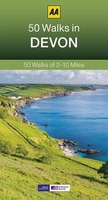
Devon: 50 Walks

Devon in the AA 50 Walks series; comprising an extensive range of walking guides helping you to explore the best walking routes in Great Britain. Each guide covers a total of 50 walks, many of which are circular, between 2-10 miles and also that are suitable for a range of different walking standards.Every walk in the guides has an information box showing clear details of distance, minimum time, level of difficulty, any ascents, the nature of the terrain and landscape, suggested Ordnance Survey map, grid references for starting and finishing points, dog friendliness, parking and any public toilets en route. There are also suggestions of what to look out for and recommended places to eat and drink. Detailed walk descriptions are accompanied by clear mapping of the route ahead, in
addition to colour photographs illustrating the highlights of selected routes.
RIP - This product is no longer available on our network. It was last seen on 25.09.2019

This page now acts as a permanent archive for this product. Add more information using the comments box below to ensure it can still be found by future generations.

Use our search facility to see if it is available from an alternative contributor.
  • Availability: Out Of Stock
  • Supplier: Stanfords
  • SKU: 9780749560492
Availability: In Stock
£9.99

Product Description

Devon in the AA 50 Walks series; comprising an extensive range of walking guides helping you to explore the best walking routes in Great Britain. Each guide covers a total of 50 walks, many of which are circular, between 2-10 miles & also that are suitable for a range of different walking standards. Every walk in the guides has an information box showing clear details of distance, minimum time, level of difficulty, any ascents, the nature of the terrain & landscape, suggested Ordnance Survey map, grid references for starting & finishing points, dog friendliness, parking & any public toilets en route. There are also suggestions of what to look out for & recommended places to eat & drink. Detailed walk descriptions are accompanied by clear mapping of the route ahead, in addition to colour photographs illustrating the highlights of selected routes.

Reviews/Comments

Add New

Price History

Vouchers

No voucher codes found.
Do you know a voucher code for this product or supplier? Add it to Insights for others to use.

Facebook

Jargon Buster

Colour - The categorised spectrum of light visable to humans

Supplier Information

Stanfords
Stanfords was established in 1853 and opened their iconic Covent Garden flagship store in 1901. They have become the top retailer of maps, travel books and accessories in the UK and arguably offer the largest selection of maps and travel books worldwide. Famous names such as Captain Robert Falcon Scott, Ranulph Fiennes and Michael Palin have purchased from Stanfords. They now have a shop in Bristol and both stores together with other venues operate a calendar of events including talks, book signings and exhibitions. As a specialist map retailer, the map selection is comprehensive and includes road maps, street maps and walking maps from worldwide destinations, as well as a selection of world atlases and wall maps. Books include travel guides and travel literature. Stanfords also stock globes, from miniatures made of blue marble to magnificent floor-standing globes. The website features a selection of interesting articles on travel topics.
Page Updated: 2023-11-12 20:15:36

Community Generated Product Tags

Oh No! The productWIKI community hasn't generated any tags for this product yet!
Menu