
 United Kingdom
 France
 Germany
 Netherlands
 Sweden
 USA
USA
 Italy
Italy
 Spain
Spain
More From Contributor
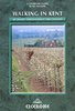


Kent: 50 Walks
Kent in the AA 50 Walks series; comprising an extensive range of walking guides helping you to explore the best walking routes in Great Britain. Each guide covers a total of 50 walks, many of which are circular, between 2-10 miles and also that are suitable for a range of different walking standards.Every walk in the guides has an information box showing clear details of distance, minimum time, level of difficulty, any ascents, the nature of the terrain and landscape, suggested Ordnance Survey map, grid references for starting and finishing points, dog friendliness, parking and any public toilets en route. There are also suggestions of what to look out for and recommended places to eat and drink. Detailed walk descriptions are accompanied by clear mapping of the route ahead, in
addition to colour photographs illustrating the highlights of selected routes.
addition to colour photographs illustrating the highlights of selected routes.
Product Description
Reviews/Comments
Add New
Intelligent Comparison
Archived Product
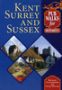
Kent Walks Stanfords
£11.99
Archived Product
Devon: 50 Walks Stanfords
£9.99
Archived Product
Dorset: 50 Walks Stanfords
£9.99
Archived Product

Kent Pub Walks Stanfords
£6.95
Archived Product
Essex: 50 Walks Stanfords
£9.99
Archived Product
Somerset: 50 Walks Stanfords
£9.99
Archived Product
Devon: AA 50 Walks Stanfords
£11.99
Archived Product
Surrey: 50 Walks Stanfords
£9.99
Vouchers
No voucher codes found.
Do you know a voucher code for this product or supplier? Add it to Insights for others to use.
Do you know a voucher code for this product or supplier? Add it to Insights for others to use.
 Denmark