More From Contributor
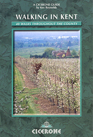
£7.99
Kent
- Pub Walks in the Hills features 20 circular walks in the county, varying in length from 2.5miles to 6.5miles, each incorporating
...
Archived Product
£6.95
Gary Tompsett's mountain biking guide contains 21 well-researched circular routes throughout Kent
- the garden of Engl&. Discover
...
Archived Product
£6.95
A collection of circular walks covering historic & `best kept` villages such as Eynsford & Lamberhurst; Lympne with its cliffs & sweeping vistas; Upnor on the River Medway; the fairy-tale sight of Leeds Castle; Appledore & its ancient port; Georgian Deal with its windy streets & an excellent micropub. The book offers 20 wonderful outings in glorious countryside through the Garden of Engl&. ...
Archived Product
£11.95
Kent Street Atlas in a paperback PVC cover edition at a scale of 3 inches to 1 mile (1:20, 267) in a series of street atlases of English counties from the Geographers' A-Z Map Company. The atlas covers the whole of the western part of the county including the south-eastern boroughs of London & the north side of the Thames, plus selected areas of eastern Kent. Coverage

Includes::
Ashford, Canterbury, Chatham, Dartford, Dover, Folkestone, Maidstone, Margate, Ramsgate, Rochester, Tunbridge Wells, Sevenoaks & Tonbridge. The whole county is also covered at 1 inch to 1 mile (1:63, 360) with maps indicating which areas are covered in greater detail in the main section of the atlas. The atlas has a comprehensive index including separate entries for places of interest such as cultural & sport or recreational facilities, historical sites, nature reserves & gardens. Also provided are lists of hospitals & hospices in the area covered by the atlas, plus diagrams of the Channel Tunnel terminals in Folkestone & Calais. Current edition was published in 2007.

...
Archived Product
£12.95
Accomplished walker Kev Reynolds’ Cicerone guide to Walking in Kent is a comprehensive account of some of the county’s finest walking routes. The guide covers the entirety of the county, from the Eden Valley walk to coastal ramble near Dover & on the Isle of Sheppey. There is an outline of routes such as the North Downs Way & the Wealdway, providing an introduction to Kent’s long distance footpaths
- many of which can be linked up with the walks described in the book. The guide is arranged regionally into three main sections
- West Kent & the Weald, North & East Kent & Longer Walks
- & describes 40 walks ranging from 4 to 9 miles in length that are suitable for both family strollers & determined ramblers. Each walk has an Information Box providing details on distances, relevant maps, starting points, access, parking & refreshments en route, in addition to an overview of the route. Detailed walk descriptions are accompanied by Ordnance Survey extracts mapping the route ahead in addition to colour photographs illustrating some of the highlights of the region.


...
Archived Product
£7.95
A good walk in the countryside is always a pleasure. This book offers 20 circular routes in the Kent countryside which are divided into the four seasons, although each of them offers an excellent walk in any month of the year. The walks are all clearly set out with a numbered route map to help you explore the Garden of Engl&. The what to look out for sections describe seasonal things of interest to note along the way. In the spring there are butterflies & apple orchards filled with blossom; summer brings rare orchids on the chalk Downs & dragonflies darting by rivers. Then come the rich autumnal hues of beech woods & field maple, followed by the winter months with migrating flocks of water birds by the coast & berries in the woods & hedgerows. The book contains walks in the Darent Valley at Otford, there are visits to historic buildings such as St Radigund`s Abbey & the superbly moated house at Ightham Mote. You can enjoy the Weald of Kent at Pembury & timber-framed houses at Wingham & Headcorn. There are also plenty of windmills & oast houses, butterflies & wild flowers to discover. ...
Archived Product
£7.95
This title features forty circular walks covering the three counties, each based on a good local pub. It

Includes::


...
Archived Product
£12.99
Kent, Sussex & Surrey in the Countries, Regions & Cities series from Rough Guides; comprehensively detailed guidebooks specifically designed for independent travellers & serving a range of worldwide destinations. Widely recognised for their free editorial style, Rough Guide authors are allowed to express their personal opinions on a range of subjects. Although sometimes controversial, this editorial stance allows readers to experience more detailed & personal takes on each destination, a feature often more limited in other guidebooks. Cultural & historical nuances are explored in significant depth throughout the text & descriptions on the ambience of individual settings alongside personal recommendations, particularly in cities, are notably prevalent. Each Rough Guide in the Countries, Regions & Cities series has a similar layout. A ...
Archived Product
£9.99
Kent in the AA 50 Walks series; comprising an extensive range of walking guides helping you to explore the best walking routes in Great Britain. Each guide covers a total of 50 walks, many of which are circular, between 2-10 miles & also that are suitable for a range of different walking standards. Every walk in the guides has an information box showing clear details of distance, minimum time, level of difficulty, any ascents, the nature of the terrain & landscape, suggested Ordnance Survey map, grid references for starting & finishing points, dog friendliness, parking & any public toilets en route. There are also suggestions of what to look out for & recommended places to eat & drink. Detailed walk descriptions are accompanied by clear mapping of the route ahead, in addition to colour photographs illustrating the highlights of selected routes. ...
Archived Product
£11.99
Walking is one of Britain`s favourite leisure activities, & this fantastic walking guide to Kent features a variety of mapped walks to suit all abilities. The book features all the practical detail you need, accompanied by fascinating background reading on the history & wildlife of the area, as well as other local points of interest. All walks are annotated with local points of interest & places to stop for refreshments & every walk is given a summary of distance, time, gradient, level of difficulty, type of surface & access, landscape, dog friendliness, parking & public toilets. ...
Archived Product

Kent Walks

Kent in the Pathfinder Guides series, produced in association with Ordnance Survey and published by Crimson; comprising a range of walking guides to popular British destinations. Each Pathfinder guide includes 28 varied walks ranging from easy strolls to exhilarating hikes and is accompanied by 1:25, 000 Ordnance Survey mapping with marked, colour-coded routes. Introductory sections profile the county or region covered, with recommendations on the best time to visit and a brief explanation of GPS. An
RIP - This product is no longer available on our network. It was last seen on 25.09.2019

This page now acts as a permanent archive for this product. Add more information using the comments box below to ensure it can still be found by future generations.

Use our search facility to see if it is available from an alternative contributor.
  • External links may include paid for promotion
  • Availability: Out Of Stock
  • Supplier: Stanfords
  • SKU: 9780711706125
Availability: In Stock
£11.99

Product Description

Kent in the Pathfinder Guides series, produced in association with Ordnance Survey & published by Crimson; comprising a range of walking guides to popular British destinations. Each Pathfinder guide

Includes::
28 varied walks ranging from easy strolls to exhilarating hikes & is accompanied by 1:25, 000 Ordnance Survey mapping with marked, colour-coded routes. Introductory sections profile the county or region covered, with recommendations on the best time to visit & a brief explanation of GPS. An

Reviews/Comments

Add New

Price History

Vouchers

No voucher codes found.
Do you know a voucher code for this product or supplier? Add it to Insights for others to use.

Facebook

Jargon Buster

GPS - Global Positioning System - Global position using satellites
Colour - The categorised spectrum of light visable to humans
Popular - Something that is admired and liked by many people.

Supplier Information

Stanfords
Stanfords was established in 1853 and opened their iconic Covent Garden flagship store in 1901. They have become the top retailer of maps, travel books and accessories in the UK and arguably offer the largest selection of maps and travel books worldwide. Famous names such as Captain Robert Falcon Scott, Ranulph Fiennes and Michael Palin have purchased from Stanfords. They now have a shop in Bristol and both stores together with other venues operate a calendar of events including talks, book signings and exhibitions. As a specialist map retailer, the map selection is comprehensive and includes road maps, street maps and walking maps from worldwide destinations, as well as a selection of world atlases and wall maps. Books include travel guides and travel literature. Stanfords also stock globes, from miniatures made of blue marble to magnificent floor-standing globes. The website features a selection of interesting articles on travel topics.
Page Updated: 2023-11-12 20:15:36

Community Generated Product Tags

Oh No! The productWIKI community hasn't generated any tags for this product yet!
Menu