
 United Kingdom
 France
 Germany
 Netherlands
 Sweden
 USA
USA
 Italy
Italy
 Spain
Spain
More From Contributor

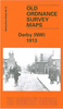


Derby North 1899
Derby North in 1899 in a fascinating series of reproductions of old Ordnance Survey plans in the Alan Godfrey Editions, ideal for anyone interested in the history of their neighbourhood or family. The map covers the northern part of Derby, stretching from Victoria Street northward to West Drive and Old Chester Road, and from Agard Street eastward to Chaddesden Hill. Features include stretch of Midland Railway, North Junction, South Junction, goods depot, GNR Derbyshire Extension line, River Derwent, St Werburgh`s church, Market Place and much of city centre, Exeter Bridge, Cattle Market, Peel Foundry, Derby Canal, County Cricket Ground, Race Course, Grand Stand Hotel, Chaddesden Works, Britannia Foundry, St Mary`s Bridge, tramways, Friary, Strutts Park, Little
Chester, Nottingham Road station, several works alongside river, County Hall, etc. On the reverse are 1891 street directory entries for Albert Street, Bridgegate, Curzon Street, Derwent Street, Iron Gate, Market Place, Nottingham Road, Queen Street, Sadler Gate, St Mary`s Gate, Strand and Victoria Street. About the Alan Godfrey Editions of the 25” OS Series:Selected towns in Great Britain and Ireland are covered by maps showing the extent of urban development in the last decades of the 19th and early 20th century. The plans have been taken from the Ordnance Survey mapping and reprinted at about 15 inches to one mile (1:4, 340). On the reverse most maps have historical notes and many also include extracts from contemporary directories. Most maps cover about one mile (1.6kms)
north/south, one and a half miles (2.4kms) across; adjoining sheets can be combined to provide wider coverage.FOR MORE INFORMATION AND A COMPLETE LIST OF ALL AVAILABLE TITLES PLEASE CLICK ON THE SERIES LINK.

Product Description
Reviews/Comments
Add New
Vouchers
No voucher codes found.
Do you know a voucher code for this product or supplier? Add it to Insights for others to use.
Do you know a voucher code for this product or supplier? Add it to Insights for others to use.
 Denmark