
 United Kingdom
 France
 Germany
 Netherlands
 Sweden
 USA
USA
 Italy
Italy
 Spain
Spain
More From Contributor

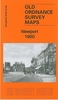


Newport North 1917
Newport North in 1917 in a fascinating series of reproductions of old Ordnance Survey plans in the Alan Godfrey Editions, ideal for anyone interested in the history of their neighbourhood or family. The map covers the northern part of Newport, stretching from Charles Street northward to Stafford Road and from Bishton Street westward to Fields Park Avenue. Features include railway with Newport station, Maindee West, East and North Junctions, Maindee Branch Junction, Monmouthshire Eastern Valleys Line, tramways, Monmouthshire & Brecon Canals, Llanarth Street Junction, River Usk with many wharves, East Usk Oil Works, tramway depot, Dos Nail Works, Newport Athletic Club Grounds, gas works, Baneswell area, Clytha Park area, Isolation Hospital, Barracks, Market, Council
Offices, Bridge Street area, Newport Bridge etc. A selection of street directory entries is on the reverse, including Bridge Street, Clytha Park Road, Commercial Street, Fields Road, High Street and Malpas Road.About the Alan Godfrey Editions of the 25” OS Series:Selected towns in Great Britain and Ireland are covered by maps showing the extent of urban development in the last decades of the 19th and early 20th century. The plans have been taken from the Ordnance Survey mapping and reprinted at about 15 inches to one mile (1:4, 340). On the reverse most maps have historical notes and many also include extracts from contemporary directories. Most maps cover about one mile (1.6kms) north/south, one and a half miles (2.4kms) across; adjoining sheets can be combined to provide wider
coverage.FOR MORE INFORMATION AND A COMPLETE LIST OF ALL AVAILABLE TITLES PLEASE CLICK ON THE SERIES LINK.

Product Description
Reviews/Comments
Add New
Intelligent Comparison
Archived Product

Newport South 1917 Stanfords
£3.50
Archived Product

Deptford North 1914 Stanfords
£3.50
Archived Product
Devonport North 1893 Stanfords
£3.50
Archived Product

Hertford North 1897 Stanfords
£3.50
Archived Product

Deptford North 1894 Stanfords
£3.50
Archived Product

Newhaven North 1937 Stanfords
£3.50
Vouchers
No voucher codes found.
Do you know a voucher code for this product or supplier? Add it to Insights for others to use.
Do you know a voucher code for this product or supplier? Add it to Insights for others to use.
 Denmark