
 United Kingdom
 France
 Germany
 Netherlands
 Sweden
 USA
USA
 Italy
Italy
 Spain
Spain
More From Contributor


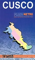
Cusco Tourist Plan
A combined street plan and road map of the Cuzco region, with bilingual notes for tourists. The main map (scale unspecified) is a panoramic oblique-view road map of the wider region around Cusco, including Quillabamba, Abancay, Colcha, Urcos and the Cordillera Vilcanota. Hill shading and spot heights show the general relief and symbols locate ruins, museums, churches and other sites of interest and recreational features eg. trekking and hang-gliding sites. Paved roads, unpaved roads and trails are distinguished, and railways are included. Accompanying historical notes in the margin are in Spanish and English.On the reverse are plans of Cusco (1:28, 000) and Downtown Cusco (1:10, 000). The former covers most of the town, including the airport, but only names major roads. Both
indicate notable buildings, place of interest, hotels etc. These maps are indexed for historical sites, places of interest, lodgings & restaurants, but not for streets. There is also a small plan of the ancient Inca City. Useful addresses are also listed. Legend is in Spanish & English.
indicate notable buildings, place of interest, hotels etc. These maps are indexed for historical sites, places of interest, lodgings & restaurants, but not for streets. There is also a small plan of the ancient Inca City. Useful addresses are also listed. Legend is in Spanish & English.
Product Description
Reviews/Comments
Add New
Intelligent Comparison
Archived Product
Bodrum Tourist Plan Stanfords
£8.99
Archived Product
Barcelona Tourist Plan Stanfords
£6.95
Archived Product
Lima Tourist Plan Stanfords
£9.99
Archived Product
Paris Tourism Plan Stanfords
£2.99
Archived Product

Izmir Tourist Plan Stanfords
£7.95
Archived Product
Arequipa Tourist Plan Stanfords
£9.99
Archived Product
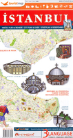
Istanbul Tourist Plan Stanfords
£6.95
Archived Product
Cusco Metro Plan Stanfords
£9.99
Vouchers
No voucher codes found.
Do you know a voucher code for this product or supplier? Add it to Insights for others to use.
Do you know a voucher code for this product or supplier? Add it to Insights for others to use.
 Denmark