
 United Kingdom
 France
 Germany
 Netherlands
 Sweden
 USA
USA
 Italy
Italy
 Spain
Spain
More From Contributor

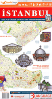
Istanbul Tourist Plan
Istanbul’s central districts on a tourist plan from the locally based publishers Mapmedya Yayinlari, highlighting the city’s numerous sights and providing on the reverse brief descriptions of 24 most popular places, many illustrated with colour photos.The plan covers all the city’s most visited districts on both sides of the Golden Horn and on the Asian side. Coverage extends westwards to the city’s historic walls and north beyond them to include Eyüp. The map extends eastwards to the Bosphorus Bridge and covers the main districts on the Asian side, including the railway station and the Kadiköy piers for ferry connections with the Europeans parts of the city.The tram line linking the city’s historic sites with the new districts across the Galata Bridge is prominently marked
and shown with stops, as are the city’s other tram, metro and railway lines. Ferry routes are included except along the Golden Horn. In the street network only the main traffic routes are named; small connecting streets are shown but not named. Numerous places of interest are highlighted, including many mosques and churches, with the most famous sights indicated by small drawings. The index lists only places of interest, using their official Turkish names. On the reverse are tri-lingual English/Turkish/German notes about 24 of the city’s sights, many illustrated with colour photos.
and shown with stops, as are the city’s other tram, metro and railway lines. Ferry routes are included except along the Golden Horn. In the street network only the main traffic routes are named; small connecting streets are shown but not named. Numerous places of interest are highlighted, including many mosques and churches, with the most famous sights indicated by small drawings. The index lists only places of interest, using their official Turkish names. On the reverse are tri-lingual English/Turkish/German notes about 24 of the city’s sights, many illustrated with colour photos.

Product Description
Reviews/Comments
Add New
Vouchers
No voucher codes found.
Do you know a voucher code for this product or supplier? Add it to Insights for others to use.
Do you know a voucher code for this product or supplier? Add it to Insights for others to use.
 Denmark