
 United Kingdom
 France
 Germany
 Netherlands
 Sweden
 USA
USA
 Italy
Italy
 Spain
Spain
More From Contributor


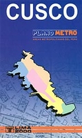
Cusco Metro Plan
Cusco at 1:15, 000 from Editorial Lima 2000 covering the town with its airports and the San Jeronimo district beyond it. An enlargement shows the town centre in greater detail. Colours distinguish the city’s districts, and their estate sub-divisions (urbanizaciones) are identified, with block numbers marked along the streets. Contour lines depict the relief beyond the town’s margin, and parks, agricultural and wooded areas are indicated. Other details include railways, bridges and notable buildings. Small symbols show ruins, police stations, churches, markets, schools, post offices, etc. On the reverse is the index for streets, urbanizaciones, and various locations of interest. Also provided is a black and white road and rail map of the surrounding region including Machu
Picchu. The map legend and all text are in Spanish only.
Picchu. The map legend and all text are in Spanish only.

Product Description
Reviews/Comments
Add New
Vouchers
No voucher codes found.
Do you know a voucher code for this product or supplier? Add it to Insights for others to use.
Do you know a voucher code for this product or supplier? Add it to Insights for others to use.
 Denmark