
 United Kingdom
 France
 Germany
 Netherlands
 Sweden
 USA
USA
 Italy
Italy
 Spain
Spain
More From Contributor


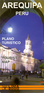
Arequipa Tourist Plan
A combined street plan and road map of the Arequipa region, with bilingual notes for tourists. The main map (scale unspecified) presents an oblique view of Arequipa and surroundings, including the airport, Cono Norte, Nevado Chamina and Volcan Misti. Hill shading shows the general relief, railways are marked and main roads, regions and districts are named. Accompanying historical notes in the margin are in Spanish and English. On the reverse: a detailed plan of the central district at 1:11, 000 and a more generalized 1:60, 000 main road map of the city. These are indexed for historical sites, places of interest, lodgings & restaurants. Useful addresses are also listed. Text is in Spanish & English, but there is no street index.

Product Description
Reviews/Comments
Add New
Intelligent Comparison
Archived Product

Lima Tourist Plan Stanfords
£9.99
Archived Product
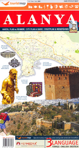
Alanya Tourist Plan Stanfords
£6.95
Archived Product

Bodrum Tourist Plan Stanfords
£8.99
Archived Product
Arequipa Metro Plan Stanfords
£11.95
Archived Product
Barcelona Tourist Plan Stanfords
£6.95
Archived Product
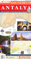
Antalya Tourist Plan Stanfords
£8.99
Archived Product
Paris Tourism Plan Stanfords
£2.99
Archived Product

Izmir Tourist Plan Stanfords
£7.95
Vouchers
No voucher codes found.
Do you know a voucher code for this product or supplier? Add it to Insights for others to use.
Do you know a voucher code for this product or supplier? Add it to Insights for others to use.
 Denmark