More From Contributor

£25.00
This is a spectacular & lavish portrait of China, the world's oldest civilization
- past, present & future. You can take an incredible
...
Archived Product
£7.99
If you are planning a trip to China or if just want to get to know a little more about the Chinese, let ” China A-Z” by writer & journalist Kai Strittmatter be your introduction to this marvellous country & its people. The book is both amusing & informative, giving an understanding of the world’s fastest growing superpower, its ancient tradition & the millions of Chinese who inhabits its lands. All Chinese look the same, some say. Same goes for Europeans. Did you know that our Olympic hosts in 2008 don’t eat soup, they drink it? That their surnames come before their first names? That their good sense is to be found not in their heads but in their hearts? Or that white is their colour of mourning? Kai Strittmatter lived & worked in China for ten years & in this fascinating book he lets in on a few secrets. Introducing us to some telling Chinese symbols
- but not all 57, 000 of them!
- he explains in a wealth of charming, amusing anecdotes & what they reveal of China & its people. On the way we meet pensioners who practice the art of street calligraphy, read the Beijing police’s hilarious English phrasebook & have the dubious pleasure of sampling trendy ‘ Western’ food, as well as a hundred other surprises. With the Beijing Olympics 2008 luring even more travellers to China, this amusing, affectionate & perceptive book provides a fascinating guide to this lively, sociable & friendly people & their complex & often contradictory society. As the author says: ‘ Be prepared for everything when you come to Beijing. It really is unbelievable what can happen here.’‘ Anyone who has spent a night on the same floor of a hotel as a group of Chinese tourists will know that most Chinese love _re nao_: “heat & noise”. They love to go where lots of people are already squeezed together, where all hell has broken loose. _ Re nao_ is a state of being that people strive for because it brings them pleasure & joy. The idea is to dive into as large a mass of people as possible & then, through emitting as many decibels as possible, to reassure each other that you aren’t alone in the world. Some people still suspect that the construction plans for fireworks are encoded in Chinese genes. As a result, they invented them & use them with a mastery & pizzazz unequalled anywhere else in the world. Today _re nao_ is more popular than ever in China, thanks to the increase in happy occasions, which historically have been all too rare for this long-suffering people. The mother of all _re nao_’s was the day when it was announced that Beijing would host the Olympic Games. All that night you couldn’t understand a word the television reporters were saying. _ Re nao_ fits the Olympic spirit: the character _re_ once represented a torch-holder. The opposite of _re nao_ is _tai ping_, “the highest peace”. Here’s a tip: _tai ping_ can be found in Beijing in only one way
- you’ll have to be alone in a swimming pool, with both ears underwater.’`...this is a delightfully witty & insightful guide to todays China.` _ The Guardian_`A humourous & insightful study of life in China’ _WANDERLUST_


...
Archived Product
£9.99
An administrative map of China at 1:6, 500, 000 from Gizi Map showing the division of the country into provinces. All place names are given in both Chinese & Latin alphabet. Hong Kong & the Pearl River Delta are presented in a greater detail on an inset. China’s provinces are shown in bright contrasting colours. Town symbols indicate the size of the population. Main airports & ports are marked, as well as coastal & international shipping routes, Topographic information is limited to the network of rivers. Latitude & longitude lines are at 5° intervals. The map is not indexed. Multilingual map legend

Includes::
English. An inset shows Hong Kong & the Pearl River Delta region at 1:1, 000, 000.* This title is also available as a wall map.

...
Archived Product
£13.50
An administrative wall map of China at 1:6, 500, 000, size 96 x 68cm (38 x 27 approx), from Gizi Map showing the division of the country into provinces. All place names are given in both Chinese & Latin alphabet. Hong Kong & the Pearl River Delta are presented in a greater detail on an inset. China ...
Archived Product
£9.99
China at 1:4, 500, 000 on a large administrative wall map, size 135cm x 95cm (53” x 37.5” approx), from Global Mapping showing provinces in different colours. An additional panel provides more information about each province. Names of the provinces & of the provincial capitals are shown in both Chinese & Latin alphabet; all other place names are given only transliterated. Towns are graded according to their population. The map shows the network of principal road & railway connections & indicates domestic airports. Topography is shown by subtle relief shading with names of main geographical

Features:
mountain ranges, peaks, deserts, etc. Latitude & longitude lines are drawn at 5° intervals. Additional panel lists the administrative units indicating their status (province, autonomous region, etc), population (in 2010) & the capital.

...
Archived Product
£10.95
The first part of book gives useful information regarding planning a trip, buying & outfitting a bicycle, survival skills, & getting yourself & the bicycle into China. The main part of the book is given over to the nine tours. The trips cover various areas including Taiwan, Hong Kong, Shanghai, Beijing, & the part of the Great Wall. Each trip is then described with the practical information first, eg distance, estimated completion time, best time to go, & terrain etc. This is followed by a comprehensive guide of the route. Accommodation & eating suggestions are also given at each stage of the route. Illustrated throughout with many b/w photographs & various simple maps. The book ends with a comprehensive phrase guide. ...
Archived Product
£20.00
Cloth-backed small size version of A New Map of Irel&, originally published by William Faden around 1797 & dedicated to ” His Majesty King George the Third, The Patron & Promoter of every useful science”. Counties are in different colours, with the divisions into Ulster, Connaught, Leinster & Munster also marked. A pretty vignette of a rural scene with cupids decorates the title. This reproduction was taken from what used to be called a “cloth-dissected” map, made when the map itself was cut into sections & each section then individually pasted onto an overall cloth backing for the whole map. In this version the whole map is backed onto cloth in one piece but the gaps between the sections have been reproduced in the printing to preserve the style & the feeling of the original. Each individual map is presented folded in a colourful case covered with a unique design marbled paper – no two cases are identical.PLEASE NOTE: this title is also available in a larger size reproduction. To see the list of all the titles in this series from Old Folding Maps please click on the series link. ...
Archived Product
£45.00
Cloth-backed small size version of A New Map of Irel&, originally published by William Faden around 1797 & dedicated to ” His Majesty King George the Third, The Patron & Promoter of every useful science”. Counties are in different colours, with the divisions into Ulster, Connaught, Leinster & Munster also marked. A pretty vignette of a rural scene with cupids decorates the title. This reproduction was taken from what used to be called a “cloth-dissected” map, made when the map itself was cut into sections & each section then individually pasted onto an overall cloth backing for the whole map. In this version the whole map is backed onto cloth in one piece but the gaps between the sections have been reproduced in the printing to preserve the style & the feeling of the original. Each individual map is presented folded in a colourful case covered with a unique design marbled paper – no two cases are identical.PLEASE NOTE: this title is also available in a larger size reproduction. To see the list of all the titles in this series from Old Folding Maps please click on the series link. ...
Archived Product
£7.95
Central China at 1:1, 500, 000 in a series of four double-sided maps from Nelles, each in a convenient format for use when travelling. The maps include street plans of main cities and/or enlargements of their environs or other popular tourist areas. The maps present road & rail networks on a base with topography indicated by relief shading with names of mountain ranges & peaks plus additional spot heights. Local airports are marked & the maps also show internal administrative boundaries with names of the provinces. Places of interest, including historical sights, beaches, national parks or protected area, etc. are highlighted both on the main map & on the accompanying street plans or enlargements. All place names are shown in Latin alphabet only. The maps are not indexed. Map legend

Includes::
English. In this title: a street plan of central Shanghai, plan of the Hangzhou West Lake area, plus an enlargement of the environs of Shanghai.

...
Archived Product
£9.99
Central China in a series of five indexed maps at 1:2, 000, 000 from Gizi Map with attractive presentation of the country`s varied topography. Bold altitude colouring, with spot heights & names of mountain ranges & other geographical features, provides an excellent picture of the terrain. The maps in this series show various categories of roads including selected tracks, with intermediate driving distances marked on many routes. Railways, shipping & ferry lines, & local airports are also shown. Province boundaries are indicated & national parks are highlighted. Symbols marks landmarks & features such as tombs, monasteries, churches, temples, ruins, UNESCO sites including the Great Wall, & other places of interest. Names of main towns are also given in Chinese script & within Tibet alternative versions are provided. Latitude & longitude lines are drawn at 1° intervals. Each title has an index on the reverse. Multilingual legend

Includes::
English.IN THIS TITLE: central & eastern China, extending from Shenyang in the north-east to Chongqing in the south & Yiayuguan in the west, including the Great Wall.

...
Archived Product

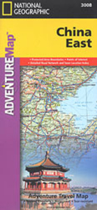
China Adventure Map

China at 1:4, 375, 000 in a series of Adventure maps from the National Geographic Society with cartography provided by Reise Know-How. The map is double-sided and printed on light waterproof and tear-resistant synthetic paper. All place names are in both Chinese and Latin alphabet.Cartographic information provided by Reise Know-How has been adjusted to follow the house style of the NGS Adventure series with greater emphasis on the country’s topography. Altitude colouring in broader bands has been replaced here by contours at 500m intervals and relief shading. Coverage includes the whole of Mongolia where boundaries of national parks and other protected areas are very prominently highlighted.Road network is graded into five types and shows distances are on main and selected secondary
routes. Railway lines are included and domestic airports are marked. Internal administrative boundaries are shown with names of the provinces. Symbols indicate numerous places of interest, including the Great Wall and UNESCO world heritage sites, archaeological remains, etc. The map has a latitude and longitude grid at intervals of 4° and is indexed.Overall, the NGS map presents a more vivid picture of the country’s topography, whilst the original RK-H version provides clearer information for touring the country by road or rail.PLEASE NOTE: to ensure faster delivery to our customers we keep this title in regular stock in the Reise Know-How version. The NGS versions can be ordered on request.
RIP - This product is no longer available on our network. It was last seen on 25.09.2019

This page now acts as a permanent archive for this product. Add more information using the comments box below to ensure it can still be found by future generations.

Use our search facility to see if it is available from an alternative contributor.
  • Availability: Out Of Stock
  • Supplier: Stanfords
  • SKU: 9781566955928
Availability: In Stock
£9.99

Product Description

China at 1:4, 375, 000 in a series of Adventure maps from the National Geographic Society with cartography provided by Reise Know-How. The map is double-sided & printed on light waterproof & tear-resistant synthetic paper. All place names are in both Chinese & Latin alphabet. Cartographic information provided by Reise Know-How has been adjusted to follow the house style of the NGS Adventure series with greater emphasis on the country’s topography. Altitude colouring in broader bands has been replaced here by contours at 500m intervals & relief shading. Coverage

Includes::
the whole of Mongolia where boundaries of national parks & other protected areas are very prominently highlighted. Road network is graded into five types & shows distances are on main & selected secondary routes. Railway lines are included & domestic airports are marked. Internal administrative boundaries are shown with names of the provinces. Symbols indicate numerous places of interest, including the Great Wall & UNESCO world heritage sites, archaeological remains, etc. The map has a latitude & longitude grid at intervals of 4° & is indexed. Overall, the NGS map presents a more vivid picture of the country’s topography, whilst the original RK-H version provides clearer information for touring the country by road or rail.PLEASE NOTE: to ensure faster delivery to our customers we keep this title in regular stock in the Reise Know-How version. The NGS versions can be ordered on request.

Reviews/Comments

Add New

Price History

Vouchers

No voucher codes found.
Do you know a voucher code for this product or supplier? Add it to Insights for others to use.

Facebook

Jargon Buster

Paper - A thin sheet mainly used for writing. Available in a variety of colours. Made mainly from wood pulp.
delivery - The method by which something is delivered from one location to another
Waterproof - Resistant to water, usualy specified by depth in metres
Wall - A physical barrier between two areas
World - A physical grouping, commonly used to describe earth and everything associated with ti
Network - A link and communication between things. Often computers or people.
Adventure - an undertaking of an exciting challenge or experience.
Road - a manmade lane or a path that is used to speed up travel.
Resistant - Something that can repel against something.
Altitude - Something that can be quite high in relation to sea or ground level.

Supplier Information

Stanfords
Stanfords was established in 1853 and opened their iconic Covent Garden flagship store in 1901. They have become the top retailer of maps, travel books and accessories in the UK and arguably offer the largest selection of maps and travel books worldwide. Famous names such as Captain Robert Falcon Scott, Ranulph Fiennes and Michael Palin have purchased from Stanfords. They now have a shop in Bristol and both stores together with other venues operate a calendar of events including talks, book signings and exhibitions. As a specialist map retailer, the map selection is comprehensive and includes road maps, street maps and walking maps from worldwide destinations, as well as a selection of world atlases and wall maps. Books include travel guides and travel literature. Stanfords also stock globes, from miniatures made of blue marble to magnificent floor-standing globes. The website features a selection of interesting articles on travel topics.
Page Updated: 2023-11-12 20:15:36

Community Generated Product Tags

Oh No! The productWIKI community hasn't generated any tags for this product yet!
Menu