
 United Kingdom
 France
 Germany
 Netherlands
 Sweden
 USA
USA
 Italy
Italy
 Spain
Spain
More From Contributor


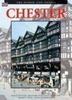

Chester 1908
Chester in 1908 in a fascinating series of reproductions of old Ordnance Survey plans in the Alan Godfrey Editions, ideal for anyone interested in the history of their neighbourhood or family. The map covers the centre of Chester, stretching from Sealand Road eastward to Boughton House, and from Brook Lane southward to Lower Park Road. Features include Cathedral, railways with main station, Northgate station, carriage & wagon works, engine shed, goods sheds; Grosvenor Park, City Walls, Town Hall, Eastgate Street, Foregate Street, Bridge Street, Northgate Street, Linen Hall, General Infirmary, Watergate House, northern tip of racecourse, Dee Basin, Garden Lane area, Diocesan Training College, St Thomas church, cattle market, tramways, St John`s College, Earl`s Eye,
Lead Works, Hoole area, Hoole Park, Chester Workhouse, Flookersbrook, Dee Hills Park, Newtown area, etc. On the reverse are street directory entries for Boughton, Frodsham Street, Grosvenor Place, Lower Bridge Street, Pepper Street, Upper Northgate Street and Watergate Street. About the Alan Godfrey Editions of the 25” OS Series:Selected towns in Great Britain and Ireland are covered by maps showing the extent of urban development in the last decades of the 19th and early 20th century. The plans have been taken from the Ordnance Survey mapping and reprinted at about 15 inches to one mile (1:4, 340). On the reverse most maps have historical notes and many also include extracts from contemporary directories. Most maps cover about one mile (1.6kms) north/south, one and a half
miles (2.4kms) across; adjoining sheets can be combined to provide wider coverage.FOR MORE INFORMATION AND A COMPLETE LIST OF ALL AVAILABLE TITLES PLEASE CLICK ON THE SERIES LINK.

Product Description
Reviews/Comments
Add New
Intelligent Comparison
Archived Product

Colchester 1898 Stanfords
£9.99
Archived Product
Ilchester 1928 Stanfords
£2.95
Archived Product

Ilchester 1928 Stanfords
£3.50
Archived Product
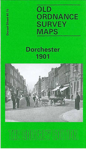
Dorchester 1901 Stanfords
£3.50
Archived Product

Colchester 1896 Stanfords
£3.50
Archived Product
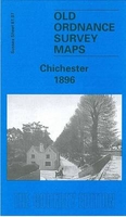
Chichester 1896 Stanfords
£3.50
Archived Product
Colchester 1805 Stanfords
£7.99
Archived Product
Manchester 1903 Stanfords
£7.99
Vouchers
No voucher codes found.
Do you know a voucher code for this product or supplier? Add it to Insights for others to use.
Do you know a voucher code for this product or supplier? Add it to Insights for others to use.
 Denmark