More From Contributor
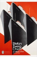
£12.99
This brand new title in Bradt`s acclaimed UK regional Slow series is the only full guide to Cheshire, a county known for its abundance of black-&-white timbered buildings & which was put firmly on the map in the 1980s thanks to then-resident stars Posh & Becks. Cheshire is a county that confounds expectations, from the Cheshire Plain to the hills & moors of the Pennines & Peak District in the east & surprisingly dramatic sandstone ridges in the west, not to mention the Wirral Peninsula, flanked by the major estuaries of the Rivers Mersey & Dee flowing into the Irish Sea. Home to premier league footballers it may be, but it is also a largely rural landscape & an area of farm shops, forests & falconries; meres, marinas & marshes. There is industrial & scientific heritage, too, ranging from Bronze-Age mining sites to the internationally important astronomical observatory & mighty Lovell Telescope at Jodrell Bank. With this new Bradt guide, discover all of this & more: the county town of Chester with its fascinating Roman history, unique double-decker medieval shopping arcades & the most complete city walls in Britain; ruins of ancient castles; & reminders of the salt & silk industries that have been so important in the past. For a truly slow experience, Cheshire also offers a network of canals, perfect for waterside strolls or pootling along in a narrowboat, while Bradt`s Slow Cheshire details information for walkers & cyclists, too. Also included in this guide are gardens & parks, grand stately homes & structural legacies of the past (such as Port Sunlight), engaging museums, attractions & events. Local food & drink is covered, along with all types of accommodation, from farm stays & self-catering cottages to guesthouses & hotels. ...
Archived Product
£25.00
Chesire Pevsner Architectural Guide Pevsner Architectural Guide, in a series of publications begun with the express aim of providing up-to-date guides to the most significant buildings in every part of the country, suitable for both general reader & specialist. Each volume provides an introductory overview of the architecture of the area, followed by a descriptive gazetteer arranged alphabetically by place. Whilst cathedrals & their furnishings, great country houses & their parks form the grand set pieces, the books demonstrate the enjoyable diversity of architecture in the British Isles in accounts of rural churches & farmsteads, Victorian public buildings & industrial monuments. A continuing programme of publication keeps the series up-to-date with new information on older buildings & recent architecture while maintaining the tradition of Pevsner's own succinct accounts. Each book has over 100 photographs, mostly specially commissioned, numerous maps & plans, a glossary & indexes. ...
Archived Product
£4.95
Chesire Ring map (running through Macclesfield, Kidsgrove, Middlewich, Preston Brook, Sale, Manchester & Ashton-under-Lyne) by GEOproject shows details of navigation & facilities available to the boat user with details of boatyard & boat trip operators, as well as useful snippets of visitor information for places of interest not far from the water ...
Archived Product
£3.50
Cheslyn Hay in 1882 in a fascinating series of reproductions of old Ordnance Survey plans in the Alan Godfrey Editions, ideal for anyone interested in the history of their neighbourhood or family. About the Alan Godfrey Editions of the 25” OS Series: Selected towns in Great Britain & Ireland are covered by maps showing the extent of urban development in the last decades of the 19th & early 20th century. The plans have been taken from the Ordnance Survey mapping & reprinted at about 15 inches to one mile (1:4, 340). On the reverse most maps have historical notes & many also include extracts from contemporary directories. Most maps cover about one mile (1.6kms) north/south, one & a half miles (2.4kms) across; adjoining sheets can be combined to provide wider coverage.FOR MORE INFORMATION & A COMPLETE LIST OF ALL AVAILABLE TITLES PLEASE CLICK ON THE SERIES LINK. ...
Archived Product
£12.99
` Supreme Quality` chess & draughts board games set with instructions. We enjoy nothing better after dinner than a game of chess or draughts. But beware; due to the challenging nature of the game tempers may run high. The set
Includes:: 1 x Smart green checker board, 32 x round wooden chess/draughts pieces in red & cream with gold relief, 1 x cotton carry bag for the counters, & a full set of instructions-

Material:
Wood/ Cardboard- For playing chess & draughts- Contains a full set of instructions


...
Archived Product
£6.95
Topographic coverage of mainland Spain at 1:50, 000 in the MTN50 (Mapa Topográfico Nacional) series from the Centro Nacional de Información Geografica, the country’s civilian survey organization. The maps have contours at 20m intervals, enhanced by relief shading, plus colouring and/or graphics to show different types of terrain, vegetation or land use. Boundaries of national parks & other protected areas are marked. In addition to all the usual information featured on topographic mapping at this scale, detailed presentation of the road & rail networks, rural tracks & paths, etc, the maps also show campsites & mountain refuges. On more recent editions some GRs, the official long-distance hiking routes, are also marked (although not as clearly as on hiking maps from other publishers). Each map covers 29.5x 18.5 km (with adjustments in the border or coastal areas). The maps have a 1-km UTM grid, plus margin ticks for latitude & longitude at 1` intervals. Map legend is in Spanish only.HOW TO CHOOSE THE RIGHT 50K MAP: all the titles in CNIG’s 200K Provincial Road Maps series at 1:200, 000 are overprinted with the grid for the 1:50, 000 maps & can be used to see the area covered by each 50K title. TO SEE THE LIST OF TITLES IN THIS SERIES PLEASE CLICK ON THE SERIES LINK.PLEASE NOTE
- MAP TITLES: the grids shown on our website serve both the civilian & the military 1:50, 000 topographic series. Although the areas covered by maps in both series are identical (apart from some border or coastal sheets), occasionally map titles differ – only one title is shown on the grid, usually the military one. In Galicia, the Basque country & in the Catalan speaking areas the tendency now is to use local place names rather than the often better known Castilian ones. Where possible, both versions are included in our titles. Map titles listed on our website are based on information received by us at the time of publication, but sometimes maps arrive showing a completely different title! As long as the map number is as ordered, the correct map has been supplied.
...
Archived Product
£5.00
The ancient city of Chester stands on the River Dee, & has attracted visitors since the Roman occupation of Britain. The medieval walls encompass not oly the city itself but also nearly 2, 000 years of history. This sense of history, combined with the unique covered walkways of the Rows & the peace of the cathedral & the riverside walks, ensures that any visit to Chester will be an unforgettable experience. ...
Archived Product
£3.99
Street by Street Chester Midi has been fully updated with a stylish new cover design, in a handy glovebox size. Quick to navigate & easy-to-use, the maps clearly show AA recommended restaurants, pubs, hotels, one-way streets & car parks. Featuring a clever use of colour to ensure it can be read under street lighting, & National Grid referencing, Street by Street Chester Midi is all you need to keep you on the move. ...
Archived Product
£3.50
Chester in 1908 in a fascinating series of reproductions of old Ordnance Survey plans in the Alan Godfrey Editions, ideal for anyone interested in the history of their neighbourhood or family. The map covers the centre of Chester, stretching from Sealand Road eastward to Boughton House, & from Brook Lane southward to Lower Park Road. Features include Cathedral, railways with main station, Northgate station, carriage & wagon works, engine shed, goods sheds; Grosvenor Park, City Walls, Town Hall, Eastgate Street, Foregate Street, Bridge Street, Northgate Street, Linen Hall, General Infirmary, Watergate House, northern tip of racecourse, Dee Basin, Garden Lane area, Diocesan Training College, St Thomas church, cattle market, tramways, St John`s College, Earl`s Eye, Lead Works, Hoole area, Hoole Park, Chester Workhouse, Flookersbrook, Dee Hills Park, Newtown area, etc. On the reverse are street directory entries for Boughton, Frodsham Street, Grosvenor Place, Lower Bridge Street, Pepper Street, Upper Northgate Street & Watergate Street. About the Alan Godfrey Editions of the 25” OS Series: Selected towns in Great Britain & Ireland are covered by maps showing the extent of urban development in the last decades of the 19th & early 20th century. The plans have been taken from the Ordnance Survey mapping & reprinted at about 15 inches to one mile (1:4, 340). On the reverse most maps have historical notes & many also include extracts from contemporary directories. Most maps cover about one mile (1.6kms) north/south, one & a half miles (2.4kms) across; adjoining sheets can be combined to provide wider coverage.FOR MORE INFORMATION & A COMPLETE LIST OF ALL AVAILABLE TITLES PLEASE CLICK ON THE SERIES LINK. ...
Archived Product
£8.99
Chester & Ellesmere Port in the Cassini Past & Present map series which covers town & cities of England & Wales & offers a unique way of tracing their history & expansion by showing four different periods of their development using Ordnance Survey mapping from the mid-19th century, the late 19th century, the 1920s & the present day. Coverage

Includes::
Broughton, Connah

...
Archived Product

Chess: A Novel

`... a human being, an intellectual human being who constantly bends the entire force of his mind on the ridiculous task of forcing a wooden king into the corner of a wooden board, and does it without going mad!`A group of passengers on a cruise ship challenge the world chess champion to a match. At first, they crumble, until they are helped by whispered advice from a stranger in the crowd - a man who will risk everything to win. Stefan Zweig`s acclaimed novella Chess is a disturbing, intensely dramatic depiction of obsession and the price of genius.
RIP - This product is no longer available on our network. It was last seen on 25.09.2019

This page now acts as a permanent archive for this product. Add more information using the comments box below to ensure it can still be found by future generations.

Use our search facility to see if it is available from an alternative contributor.
  • Availability: Out Of Stock
  • Supplier: Stanfords
  • SKU: 9780241305164
Availability: In Stock
£4.99

Product Description

`... a human being, an intellectual human being who constantly bends the entire force of his mind on the ridiculous task of forcing a wooden king into the corner of a wooden board, & does it without going mad!`A group of passengers on a cruise ship challenge the world chess champion to a match. At first, they crumble, until they are helped by whispered advice from a stranger in the crowd
- a man who will risk everything to win. Stefan Zweig`s acclaimed novella Chess is a disturbing, intensely dramatic depiction of obsession & the price of genius.

Reviews/Comments

Add New

Intelligent Comparison

Oooops!
We couldn't find anything!
Perhaps this product's unique.... Or perhaps we are still looking for comparisons!
Click to bump this page and we'll hurry up.

Price History

Vouchers

No voucher codes found.
Do you know a voucher code for this product or supplier? Add it to Insights for others to use.

Facebook

Jargon Buster

Wooden - Something that is made from wood, from trees
Human - A highly developed and adapted mamal and deminant species on earth
World - A physical grouping, commonly used to describe earth and everything associated with ti
King - The figure head of a monarch

Supplier Information

Stanfords
Stanfords was established in 1853 and opened their iconic Covent Garden flagship store in 1901. They have become the top retailer of maps, travel books and accessories in the UK and arguably offer the largest selection of maps and travel books worldwide. Famous names such as Captain Robert Falcon Scott, Ranulph Fiennes and Michael Palin have purchased from Stanfords. They now have a shop in Bristol and both stores together with other venues operate a calendar of events including talks, book signings and exhibitions. As a specialist map retailer, the map selection is comprehensive and includes road maps, street maps and walking maps from worldwide destinations, as well as a selection of world atlases and wall maps. Books include travel guides and travel literature. Stanfords also stock globes, from miniatures made of blue marble to magnificent floor-standing globes. The website features a selection of interesting articles on travel topics.
Page Updated: 2023-11-12 20:15:36

Community Generated Product Tags

Oh No! The productWIKI community hasn't generated any tags for this product yet!
Menu