
 United Kingdom
 France
 Germany
 Netherlands
 Sweden
 USA
USA
 Italy
Italy
 Spain
Spain
More From Contributor


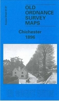
Chichester 1896
Chichester in 1896 in a fascinating series of reproductions of old Ordnance Survey plans in the Alan Godfrey Editions, ideal for anyone interested in the history of their neighbourhood or family. The map covers the centre, east and north of Chichester. The city centre is in the south-western quarter of the map, and coverage stretches from the West Gate eastward to the eastern edge of the parish; coverage also extends from South Gate northward to the Infirmary, Otter Memorial College and Oaklands. Features include the Cathedral, West Street, East Street, South Street, North Street, Priory Park, cattle market, Chichester workhouse, St Paul`s church, Somerstown, Eastgate Square; while further east the map includes Portfield, the northern part of Whyke, Oving Road, Stane
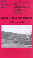
Street, cemetery, All Saints church Oving. In the top right corner is West Hampnett Union Workhouse, converted out of a partly Elizabethan mansion and sadly burnt down in 1899. On the reverse is the Private Residents entry from a 1905 directory.About the Alan Godfrey Editions of the 25” OS SeriesSelected towns in Great Britain and Ireland are covered by maps showing the extent of urban development in the last decades of the 19th and early 20th century. The plans have been taken from the Ordnance Survey mapping and reprinted at about 15 inches to one mile (1:4, 340). On the reverse most maps have historical notes and many also include extracts from contemporary directories. Most maps cover about one mile (1.6kms) north/south, one and a half miles (2.4kms) across; adjoining sheets can
be combined to provide wider coverage.FOR MORE INFORMATION AND A COMPLETE LIST OF ALL AVAILABLE TITLES PLEASE CLICK ON THE SERIES LINK.

Product Description
Reviews/Comments
Add New
Intelligent Comparison
Archived Product

Colchester 1896 Stanfords
£3.50
Archived Product

Winchester 1895 Stanfords
£3.50
Archived Product

Colchester 1898 Stanfords
£9.99
Archived Product

Colchester East 1896 Stanfords
£3.50
Archived Product

Chester 1908 Stanfords
£3.50
Archived Product
Lanchester 1895 Stanfords
£3.50
Archived Product
Colchester 1805 Stanfords
£7.99
Archived Product

Colchester North 1896 Stanfords
£3.50
Vouchers
No voucher codes found.
Do you know a voucher code for this product or supplier? Add it to Insights for others to use.
Do you know a voucher code for this product or supplier? Add it to Insights for others to use.
 Denmark