
 United Kingdom
 France
 Germany
 Netherlands
 Sweden
 USA
USA
 Italy
Italy
 Spain
Spain
More From Contributor


Colchester North 1896
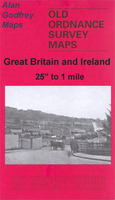
Colchester North in 1896 in a fascinating series of reproductions of old Ordnance Survey plans in the Alan Godfrey Editions, ideal for anyone interested in the history of their neighbourhood or family. Colchester is covered by three maps. This title is centred on the main station (North station); North Station Road runs from this to the town, with North Bridge and the Cattle Market near the foot of the map. Other features include St Paul`s church, Eastern Counties Asylum, and (north of the station) Bergholt Road and Mile End Road. Braiswick House is in the top north-western corner. A contemporary street directory is on the reverse.About the Alan Godfrey Editions of the 25” OS SeriesSelected towns in Great Britain and Ireland are covered by maps showing the extent of urban development
in the last decades of the 19th and early 20th century. The plans have been taken from the Ordnance Survey mapping and reprinted at about 15 inches to one mile (1:4, 340). On the reverse most maps have historical notes and many also include extracts from contemporary directories. Most maps cover about one mile (1.6kms) north/south, one and a half miles (2.4kms) across; adjoining sheets can be combined to provide wider coverage.FOR MORE INFORMATION AND A COMPLETE LIST OF ALL AVAILABLE TITLES PLEASE CLICK ON THE SERIES LINK.
in the last decades of the 19th and early 20th century. The plans have been taken from the Ordnance Survey mapping and reprinted at about 15 inches to one mile (1:4, 340). On the reverse most maps have historical notes and many also include extracts from contemporary directories. Most maps cover about one mile (1.6kms) north/south, one and a half miles (2.4kms) across; adjoining sheets can be combined to provide wider coverage.FOR MORE INFORMATION AND A COMPLETE LIST OF ALL AVAILABLE TITLES PLEASE CLICK ON THE SERIES LINK.

Product Description
Reviews/Comments
Add New
Intelligent Comparison
Archived Product

Colchester 1896 Stanfords
£3.50
Archived Product

Colchester East 1896 Stanfords
£3.50
Archived Product

Colchester 1898 Stanfords
£9.99
Archived Product

Doncaster North 1903 Stanfords
£3.50
Archived Product

Doncaster North 1929 Stanfords
£3.50
Archived Product
Manchester North East 1891 Stanfords
£3.50
Archived Product
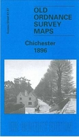
Chichester 1896 Stanfords
£3.50
Archived Product
Colchester 1805 Stanfords
£7.99
Vouchers
No voucher codes found.
Do you know a voucher code for this product or supplier? Add it to Insights for others to use.
Do you know a voucher code for this product or supplier? Add it to Insights for others to use.
 Denmark