
 United Kingdom
 France
 Germany
 Netherlands
 Sweden
 USA
USA
 Italy
Italy
 Spain
Spain
More From Contributor


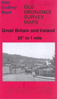
Ilchester 1928
Ilchester in 1928 in a fascinating series of reproductions of old Ordnance Survey plans in the Alan Godfrey Editions, ideal for anyone interested in the history of their neighbourhood or family. Selected towns in Great Britain and Ireland are covered by maps showing the extent of urban development in the last decades of the 19th and early 20th century.In this title: this detailed map covers the tiny town of Ilchester. In 1901 this had a population of just 433, but it was once a major town which, in the Middle Ages, boasted 7 churches. Until 1832 it sent two MPs to Parliament. However it was already in serious decline by the late Middle Ages and in 1542 Leland describes it as one of the ancientest townes...yn wonderful decay. The map covers most of the town, including Northover, and
features include Hainbury House, Hainbury Flour Mill, Northover Flour Mill, St Andrew's church, St Mary's church, Kingshams House, Town Hall and all houses neatly shown. Also included are directories for the town in 1902 and 1927. About the Alan Godfrey Editions of the 25
features include Hainbury House, Hainbury Flour Mill, Northover Flour Mill, St Andrew's church, St Mary's church, Kingshams House, Town Hall and all houses neatly shown. Also included are directories for the town in 1902 and 1927. About the Alan Godfrey Editions of the 25
Product Description
Reviews/Comments
Add New
Intelligent Comparison
Archived Product

Ilchester 1928 Stanfords
£3.50
Archived Product

Colchester 1898 Stanfords
£9.99
Archived Product
Chester 1908 Stanfords
£3.50
Archived Product

Colchester 1896 Stanfords
£3.50
Archived Product
Colchester 1805 Stanfords
£7.99
Archived Product

Colchester 1921-1922 Stanfords
£9.99
Vouchers
No voucher codes found.
Do you know a voucher code for this product or supplier? Add it to Insights for others to use.
Do you know a voucher code for this product or supplier? Add it to Insights for others to use.
 Denmark